How to Calculate NDWI using Landsat 8 in Google Earth Engine
Автор: GIS Madras
Загружено: 2025-05-16
Просмотров: 618
Описание:
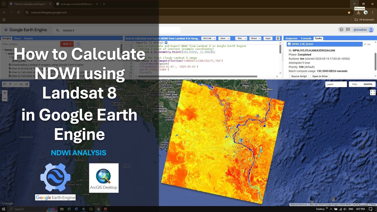
In this tutorial you will how to calculate NDWI using Landsat 8 in Google Earth Engine. In addition you will also learn how to download NDWI and view in ArcGIS. Google Earth Engine is a Cloud based platform for planetary scale analysis, code with both in Java and Python script for large analyses in short time.
The Normalized Difference Water Index (NDWI) is used to detect water bodies in satellite images. As water bodies strongly absorb light in visible to infrared electromagnetic spectrum, NDWI uses green and near infrared bands to highlight water bodies. The NDWI is also used to monitor changes related to water content in water bodies. The formula is:
NDWI=(Green-NIR) / (Green+NIR)
Landsat 8 NDWI = (B03 - B05) / (B03 + B05)
Sentinel-2 NDWI = (B03 - B08) / (B03 + B08)
Landsat 1-5 MSS NDWI = (B01 - B04) / (B01 + B04)
Landsat 4-5 TM NDWI = (B03 - B05) / (B03 + B05)
Landsat 7 ETM+ NDWI = (B02 - B04) / (B02 + B04)
MODIS NDWI = (B04 - B02) / (B04 + B02)
Values description: Index values greater than 0.5 usually correspond to water bodies. Vegetation usually corresponds to much smaller values and built-up areas to values between zero and 0.2.
(Source: sentinelhub, https://custom-scripts.sentinel-hub.c...)
Bands in Landsat 8 (OLI)
Band 1 Coastal Aerosol (0.43 - 0.45 µm) 30 m
Band 2 Blue (0.450 - 0.51 µm) 30 m
Band 3 Green (0.53 - 0.59 µm) 30 m
Band 4 Red (0.64 - 0.67 µm) 30 m
Band 5 Near-Infrared (0.85 - 0.88 µm) 30 m
Band 6 SWIR 1(1.57 - 1.65 µm) 30 m
Band 7 SWIR 2 (2.11 - 2.29 µm) 30 m
Band 8 Panchromatic (PAN) (0.50 - 0.68 µm) 15 m
Band 9 Cirrus (1.36 - 1.38 µm) 30 m
Band 10 TIRS 1 (10.6 - 11.19 µm) 100 m
Band 11 TIRS 2 (11.5 - 12.51 µm) 100 m
(Source: USGS, https://www.usgs.gov/landsat-missions...)
Google Earth Engine Playlist:
• Google Earth Engine
Code Link:
https://drive.google.com/file/d/1rx0j...
Join this channel to get access to perks:
/ @gismadras
00:00 Introduction
02:22 Selecting Area of Interest
03:05 Accessing & Filtering image (Landsat 8)
05:19 Print & NDWI Calculation
07:19 Display / Color
08:55 Defining Boundary
10:17 Run Script & Export NDWI
14:22 Download & View in ArcGIS
#NDWI #googleearthengine #waterdetection #NormalizedDifferenceWaterIndex #earthenginetutorial #downloadndwi #arcgis
Повторяем попытку...
Доступные форматы для скачивания:
Скачать видео
-
Информация по загрузке:


![COMO CALCULAR NDWI E EXTRAIR UMA MÁSCARA DE ÁGUA NO GOOGLE EARTH ENGINE [AULA 10]](https://image.4k-video.ru/id-video/QwPE4aw-h58)


