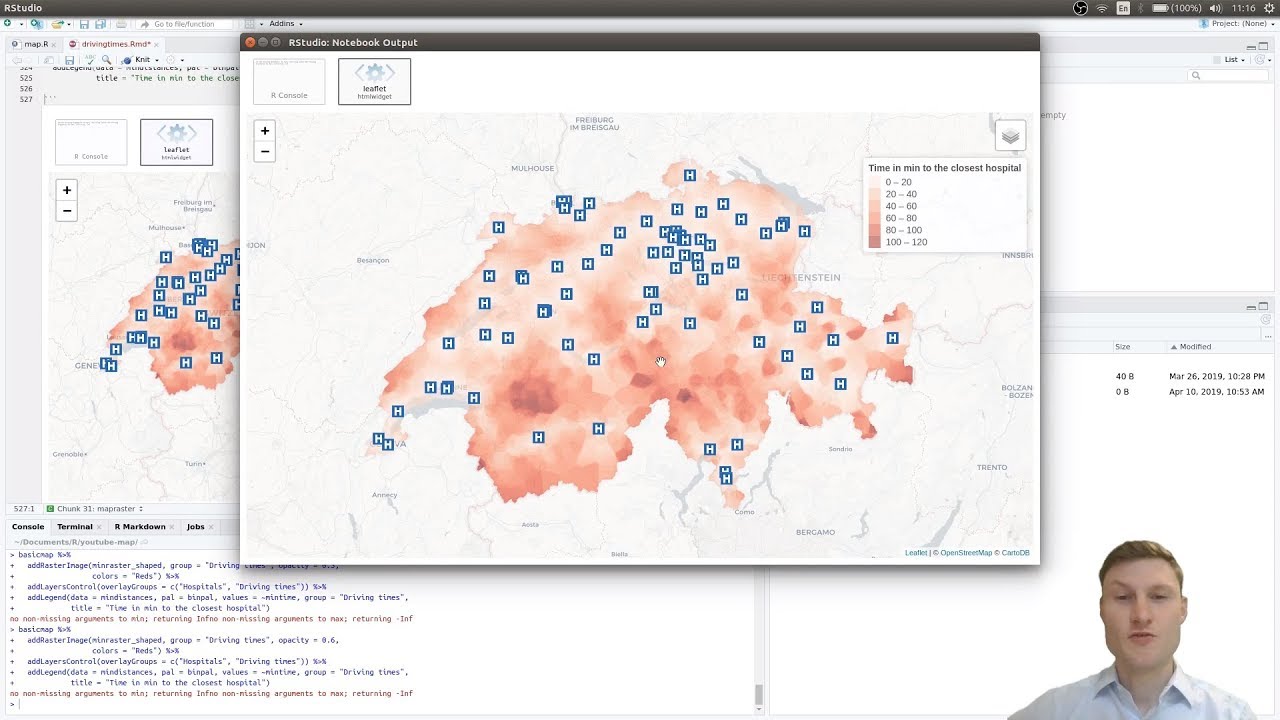
Driving time interpolation map in R (using OSRM, leaflet, raster, ggmap)
Автор: Martin Geissmann
Загружено: 2019-04-10
Просмотров: 8449
Описание:
We create a map that shows the driving time to the closest emergency hospital. We use the following:
a public list of Swiss hospitals
our own OSRM server (Docker) to estimate driving times
2D interpolation and mapping functions in R (gstat, ggmap, raster, sp etc.)
leaflet to create an interactive map
Written tutorial for this video: http://rpubs.com/mgei/drivingtimes
OSRM package for R: https://github.com/rCarto/osrm
Docker image: https://hub.docker.com/r/osrm/osrm-ba...
Download map for OSRM from here: http://download.geofabrik.de/
Swiss hospital data: https://www.bag.admin.ch/bag/de/home/...
How to ggmap::geocode with a Google API key: • Geocode in R with ggmap (and a free Google...
My github: https://github.com/mgei/map-related
My business: https://www.econovo.ch/en/
Повторяем попытку...
Доступные форматы для скачивания:
Скачать видео
-
Информация по загрузке: