Cadence GIS Desire Lines
Автор: Cadence
Загружено: 2025-04-14
Просмотров: 38
Описание:
Cadence GIS makes designing, building and sharing interactive maps easy. Cadence’s intuitive interface lets you seamlessly import, clean and structure your data - no matter the format - so you can build rich data sets fast. Use automated workflows and powerful analytics built for every skill level. Bring data to life with stunning maps and rich visual tools like isochrones, desire lines, interactive map stories and much more.
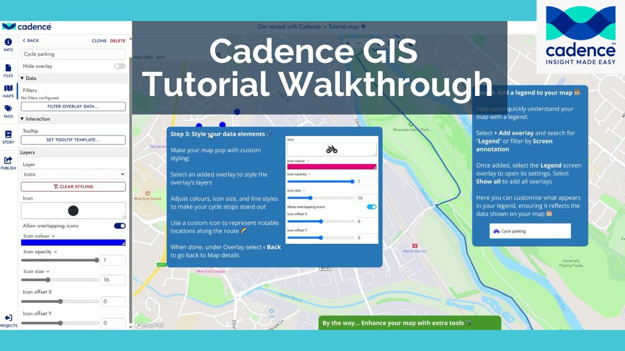
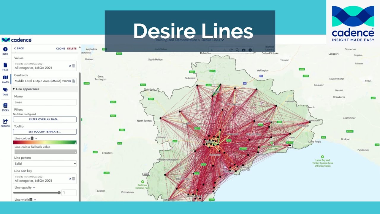
Visualising travel patterns or movement data couldn't be easier with Cadence's built in Desire Lines tool. Just click add overlay, search for demand visualisation in the visualisation folder and select it. Next, choose your data source. Cadence has preloaded datasets, or you can upload your own.
In this example, we use 2021 census data on commuting patterns. You can then pick centroids to define the points of origin and destination. To enhance clarity, adjust the line appearance. Colour can represent the number of travellers, and sorting ensures the busiest routes appear on top. Finally, set line width based on travel volume for a clear, impactful map. You can also filter out low traffic routes or style centroids for better visibility.
Get more information and a free trial: https://https://cadence.cityscience.com
Source: Office for National Statistics licensed under the Open Government Licence v.3.0. Contains OS data © Crown copyright and database rights 2025.
Повторяем попытку...
Доступные форматы для скачивания:
Скачать видео
-
Информация по загрузке: