Getting Started with Cadence GIS Geospatial Mapping
Автор: Cadence
Загружено: 2025-04-14
Просмотров: 81
Описание:
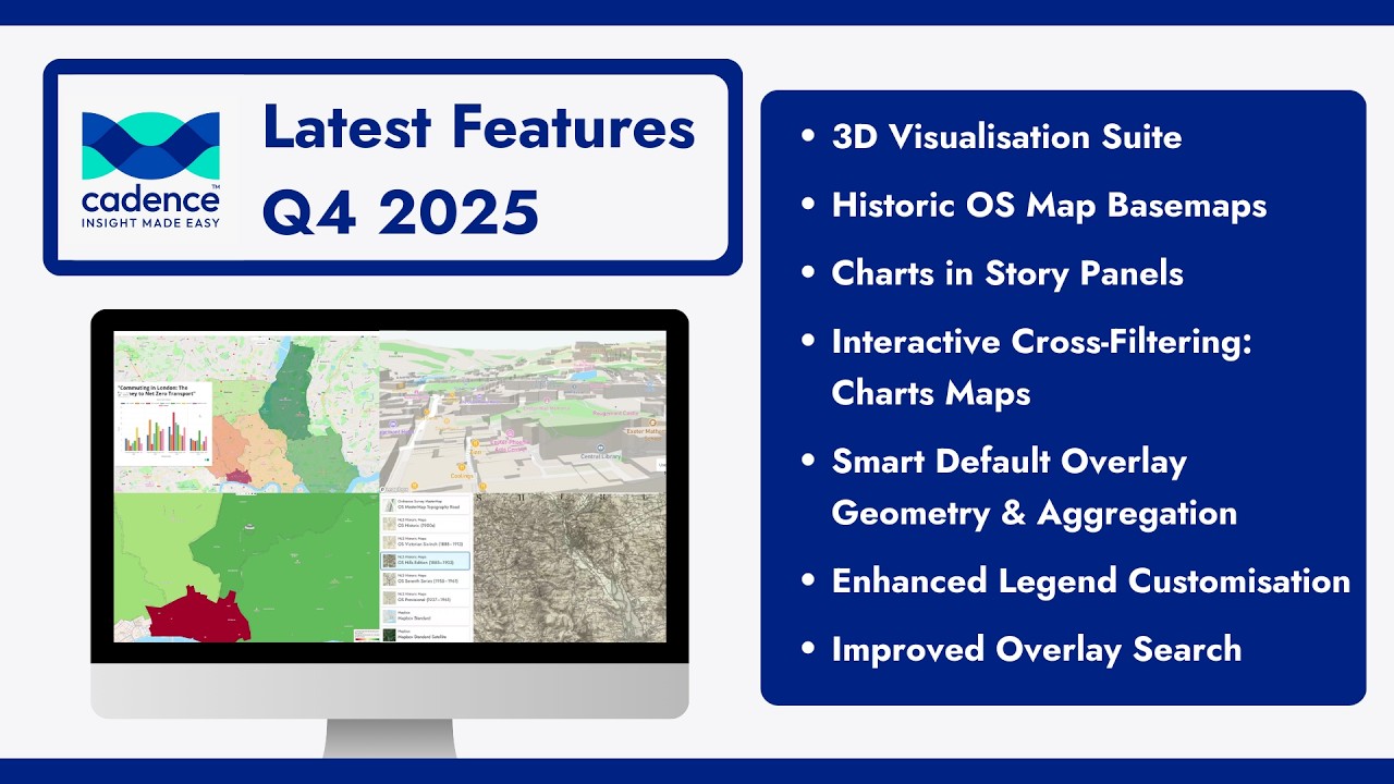
Cadence GIS makes designing, building and sharing interactive maps easy. Cadence’s intuitive interface lets you seamlessly import, clean and structure your data - no matter the format - so you can build rich data sets fast. Use automated workflows and powerful analytics built for every skill level. Bring data to life with stunning maps and rich visual tools like isochrones, desire lines, interactive map stories and much more.
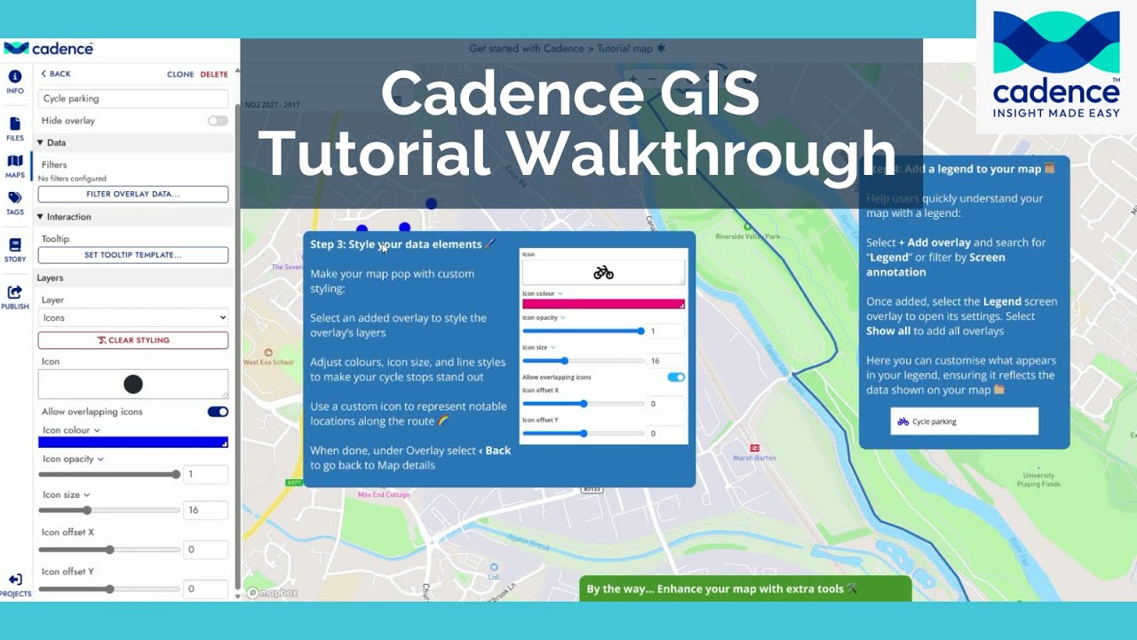
Getting started with Cadence couldn't be easier. Once logged in, you'll find example projects and links to resources. You can personalise the basemap, adding built in datasets and styling layers. You can then add legends, tooltips and overlays like a compass or scale bar. Publishing options allow you to share maps via links, embedding or interactive story slides.
Get more information and a free trial: https://https://cadence.cityscience.com
Source: Office for National Statistics licensed under the Open Government Licence v.3.0. Contains OS data © Crown copyright and database rights 2025.
Повторяем попытку...
Доступные форматы для скачивания:
Скачать видео
-
Информация по загрузке: