Active thunderstorm with anvil crawlers on UK's hottest day on record - Herne Bay, Kent - 19/07/2022
Автор: Jamie M
Загружено: 2022-07-20
Просмотров: 5977
Описание:
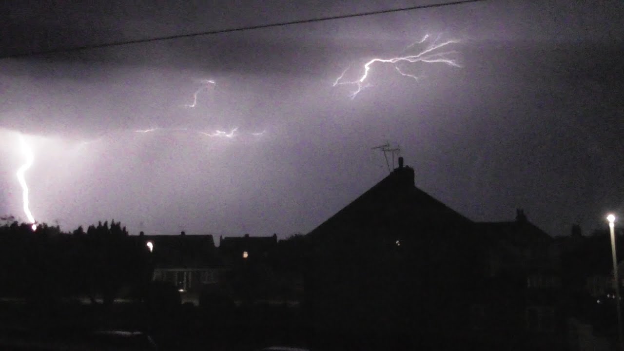
An incredibly active elevated thunderstorm developed just offshore and began to move north towards my location. The UK recorded a maximum temperature of 40.3°C at RAF Coningsby and this meant some extremely hot air was set in place across the UK and incredibly dry air too therefore little rainfall was recorded (0.4 mm) due to most of it evaporating before hitting the surface. It also gave some apt opportunity to see anvil crawlers by their dozens within the storm, something I hadn't seen from one of these imports in a long time. Activity seemed to be similar to that of daytime imports of 25th July 2019 which was also the previous hottest day on record for the UK in which I saw lots of anvil crawlers due to the rain largely evaporating and activity skewing east which gave a perfect view from the garden. The storm was also associated with a cold front moving through so the temperature drop behind the storm going from 27.4°C to 23.2°C was staggering but also well accepted considering the suffocating feel to the air! The day was also the first day that the UK had hit 40°C anywhere so ending off the heat with a bang was a necessity and it kicked off big time although being largely unmodeled; the AROME run I looked at in the morning had all rain dying out before hitting here! A thunderstorm occurring on the 19th of July seemed to also continue the strange frequency of storms occurring on said date such as 2014, 2016 and 2017. I will attach the Convective Weather forecast for the date as it gives greater detail for what occurred!
Convective Outlook
VALID 06:00 UTC Tue 19 Jul 2022 - 05:59 UTC Wed 20 Jul 2022
ISSUED 06:12 UTC Tue 19 Jul 2022
ISSUED BY: Dan
An incredibly hot, dry airmass continues to cover Britain on Tuesday associated with a deep well-mixed layer generally suppressing surface-based convection. Above this mixed layer scattered elevated showers and thunderstorms are possible in the morning over SW England and into Wales and perhaps SE Ireland along a NW-SE aligned instability axis drifting gradually eastwards through the day on the forward side of an upper low over Biscay. Most model guidance suggests activity along this zone will wane by the afternoon hours, however the instability axis remains as it tracks eastwards across England through the afternoon and evening and any subtle forcing/moistening may be sufficient for additional elevated showers/thunderstorms to develop. However, confidence is rather low on exactly when and where - a blend of guidance suggests there may be an uptick in activity across SE England, East Anglia and the E Midlands during the evening hours. Meanwhile, ahead of this feature the UKV (and to a lesser extent the ECMWF) continues to flag the potential for a few scattered showers/thunderstorms over Cen N and NE England and SE Scotland during the afternoon and early evening hours, exiting to the North Sea. In the model world these have a surface-based look to them forming within the surface trough axis, but in reality their bases would be incredibly high (same level as elevated convection essentially) and given the incredibly deep hot, dry layer such surface-based convection would likely struggle for moisture. Therefore this scenario is deemed rather unlikely, with elevated convection probably the more favoured mode (if anything does indeed develop). Any strong, isolated elevated convection that does develop at any point during this forecast period poses the risk of starting a fire given potential for dry thunderstorms and tinder dry vegetation, and perhaps also some heat bursts. Thunderstorms could produce quite frequent lightning given the magnitude of instability above the EML.
Perhaps better consensus is for an active complex of thunderstorms to quickly develop over parts of northern Scotland and the Moray Firth during the late afternoon and early evening hours, on the leading edge of the approaching cold front as PVA arrives from the southwest. This may become messy given a mixture of convective and dynamic precipitation, but could be rather active for a few hours before weakening on approach to Shetland. Overnight, there may also be an increase in elevated shower/thunderstorm activity in the vicinity of the Celtic Sea and portions of Wales/SW England (perhaps W Midlands/W Country) on the northern periphery of the approaching Biscay upper low.
Повторяем попытку...
Доступные форматы для скачивания:
Скачать видео
-
Информация по загрузке:


