20 Years of Earthquakes in Chile: 2000 - 2019
Автор: PacificTWC
Загружено: 2020-02-21
Просмотров: 14473
Описание:
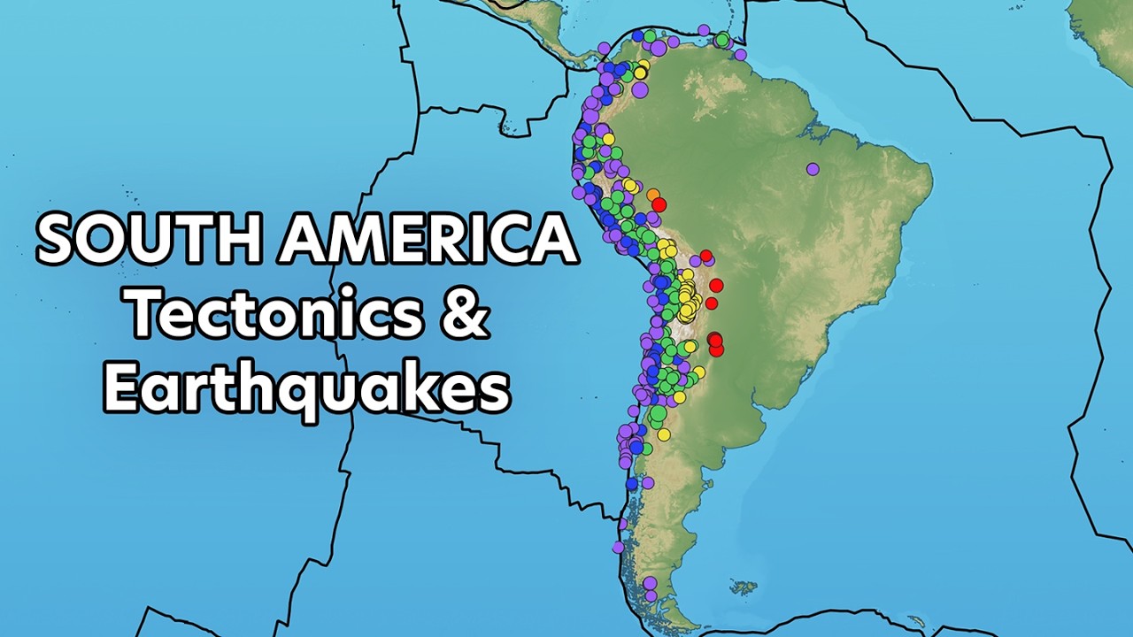
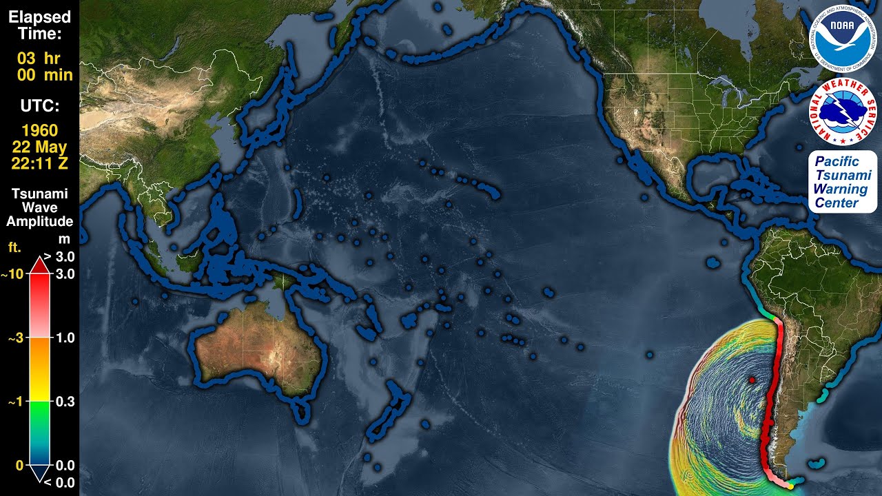
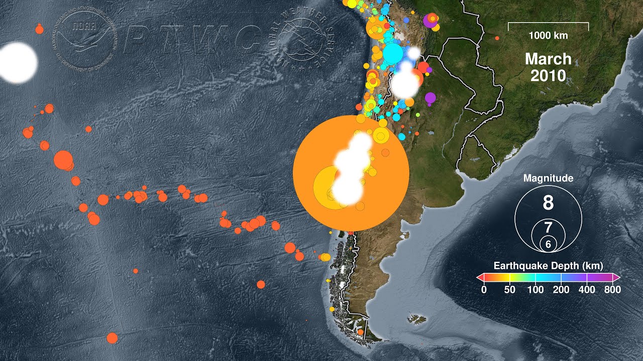
The nation of Chile lies above a tectonic plate boundary called a “subduction zone” where the Nazca and Antarctic Plates grind beneath the South American Plate. This type of plate boundary can create mountain belts and volcanoes, such as those that make up the Andes that stretch the entire length of the South American continent. Subduction zones can also generate megathrust earthquakes beneath the seafloor that cause devastating tsunamis. Many such earthquakes and tsunamis have struck Chile including the 8.8 magnitude earthquake that caused a devastating tsunami on 27 January 2010. This earthquake, the largest to strike Chile in 50 years, produced three minutes of intense shaking at 3:34 in the morning, killing over 400 people. The tsunami that followed caused the greatest devastation and 124 deaths on the Chilean mainland, where waves reached as high as 29 m (95 ft.). On Chile’s Juan Fernandez Islands the waves grew to over 18 m (60 ft.), killing at least 4, and over 4 m (14 ft.) at Rapa Nui (Isla de Pascua/Easter Island). Outside of Chile the tsunami wave heights exceeded 1 m or 3 ft. in the Marquesas Islands (French Polynesia), New Zealand, the Kuril Islands (Russia), and in the United States in California and Hawaii. It caused an estimated $30 billion in damage in Chile, and minor damage in San Diego, California and in Tohoku, Japan.
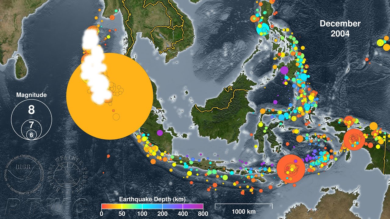
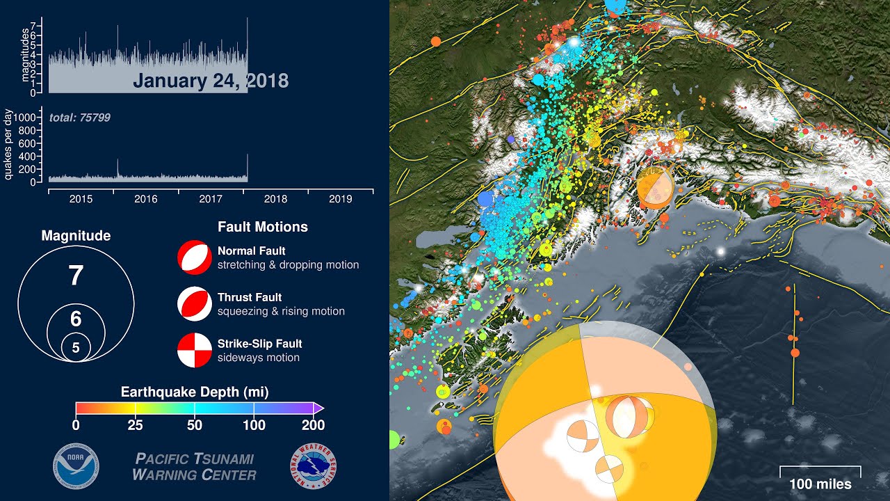
This animation begins with a map of plate boundaries including the subduction zone between the South American plate and the Nazca and Antarctic Plates. It will then show the earthquakes in sequence as they occur for 20 years beginning in the year 2000, about 10 years before the 2010 earthquake, and continues through the end of 2019, showing the nearly ten years of activity since then. It will then conclude with a summary map showing all of the earthquakes in the animation. Several tsunami-generating earthquakes occurred during this period and are visible in this animation:
23 June 2001 -- M8.4 -- southern Peru
27 February 2010 -- M8.8 -- Maule, Chile
1 April 2014 -- M8.2 -- Iquique, Chile
16 September 2015 -- M8.3 -- Illapel, Chile
The U.S. Pacific Tsunami Warning Center (PTWC) will issue tsunami alerts for any potentially tsunami-causing earthquake in the Chile region. These alerts will be posted to:
https://tsunami.gov
-----
To see an animation of the 2010 Chile tsunami, please watch:
• Tsunami Forecast Model Animation: Chile 2010
To see how subduction zones make tsunamis, please watch:
• How to Make a Tsunami
To see a comparison of the relative sizes of some historic earthquakes, please watch:
• Perspective: a graphical comparison of ear...
-----
Tsunami data from NOAA’s Global Historical Tsunami Database:
https://www.ngdc.noaa.gov/hazard/tsu_...
Earthquake Data Source: United States Geological Survey (USGS)/National Earthquake Information Center (NEIC) searchable catalog:
https://earthquake.usgs.gov/earthquak...
Plate boundaries from UTIG’s PLATES project:
https://ig.utexas.edu/marine-and-tect...
Повторяем попытку...
Доступные форматы для скачивания:
Скачать видео
-
Информация по загрузке: