GeoPard Satellite Imagery & Vegetation analysis Raw satellite image vs Upsampled vs Contrast Stret
Автор: GeoPard Agriculture
Загружено: 2024-08-19
Просмотров: 349
Описание:
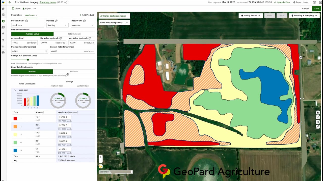
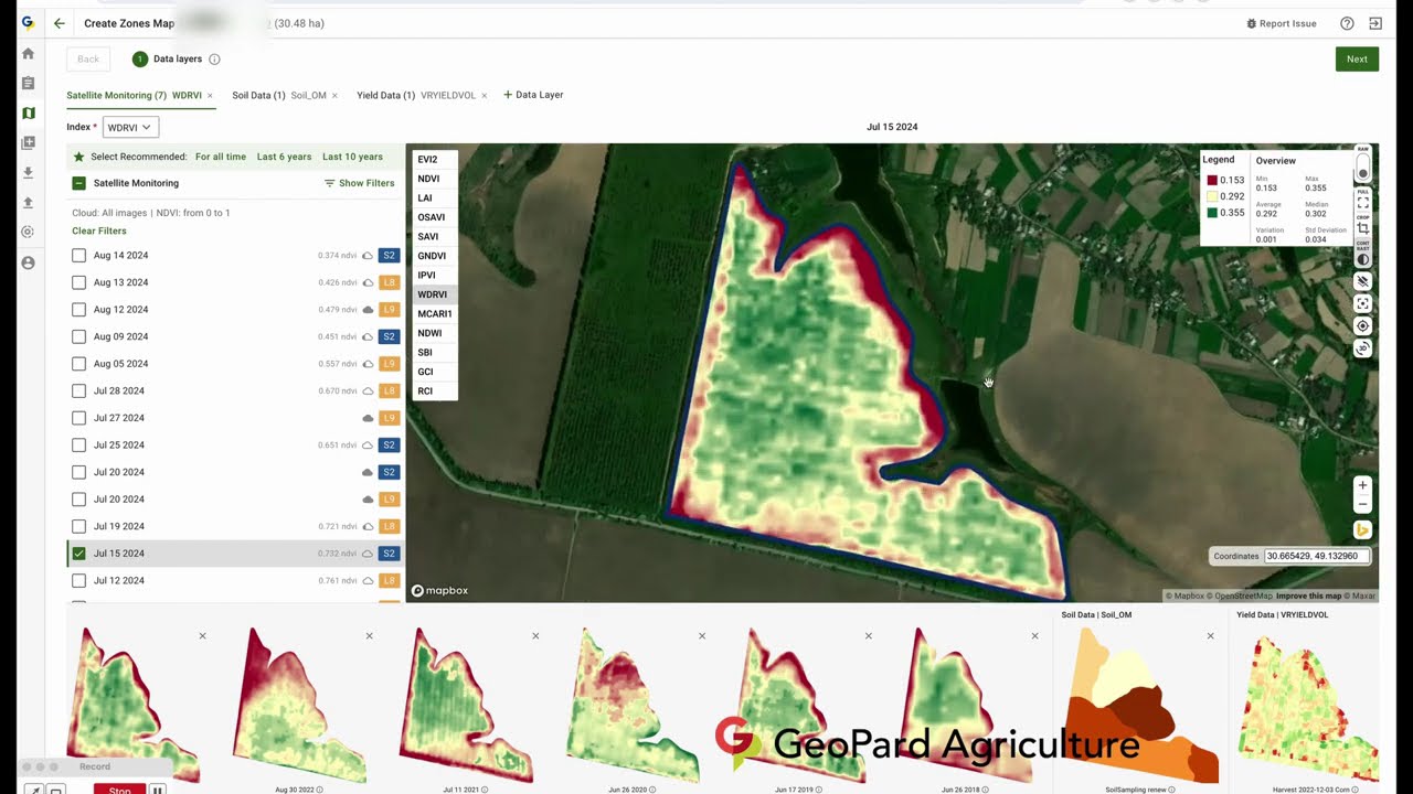
Earth Observation starts with solid data preparation, including obstacle detection (clouds, shadows) and advanced imagery processing.
We compared and implemented raw Sentinel-2 imagery with an upsampled version (1m resolution) enhanced through contrast stretching across 20 satellite imagery indices.
All are available in the GeoPard basic monitoring package.
It could be utilized for:
Accurate change detection and anomalies early detection
Crop monitoring
Damage assessment (flood, hail, lodging)
Yield prediction
Variable rate application maps based on multi-layer zoning or agronomic Equations/Formulas
Deforestation detection
Повторяем попытку...
Доступные форматы для скачивания:
Скачать видео
-
Информация по загрузке:


![[4K FULL HD] Relaxing Water Background | 1 HOUR | Calm Water Wallpaper (No Sound)](https://imager.clipsaver.ru/y9PTNTSpGJs/max.jpg)