ycliper

Популярное

Музыка Кино и Анимация Автомобили Животные Спорт Путешествия Игры Юмор

Интересные видео

2025 Сериалы Трейлеры Новости Как сделать Видеоуроки Diy своими руками

Топ запросов

смотреть а4 schoolboy runaway турецкий сериал смотреть мультфильмы эдисон
Скачать

Download Vegetation Health Products (VCI, TCI, VHI) derived from Satellite Remote Sensing data

Автор: OpenGeo Lab

Загружено: 2021-07-16

Просмотров: 4859

Описание: 
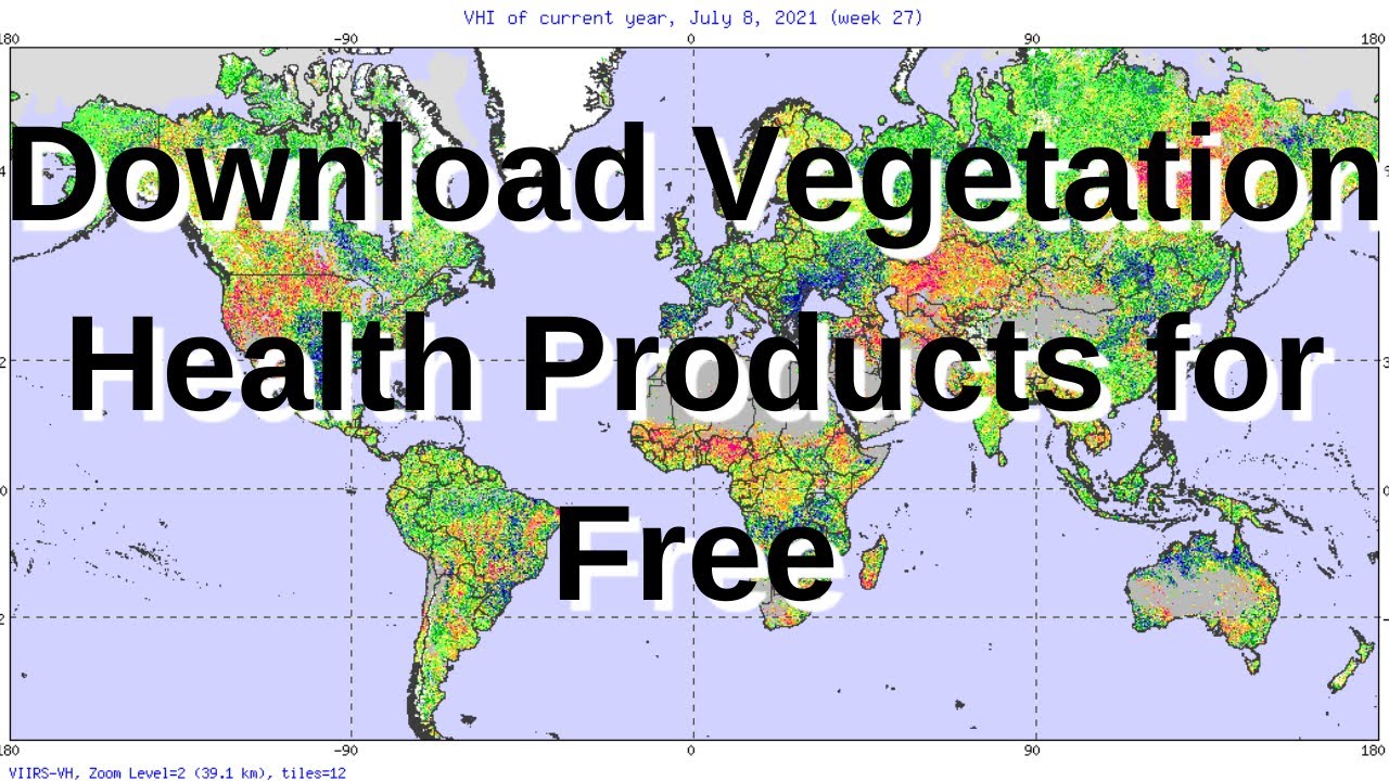
This video will help you in downloading the vegetation health products i.e Vegetation Condition Index (VCI), Temperature Condition Index (TCI) and Vegetation Health Index (VHI) from the NOAASTAR Portal. These products have been generated using long term satellite remote sensing data. In this video mathematics behind the VCI, TCI and VHI calculation is also explained.

Link for NOAA STAR Web page:
https://www.star.nesdis.noaa.gov/smcd...

Не удается загрузить Youtube-плеер. Проверьте блокировку Youtube в вашей сети.
Повторяем попытку...
Download Vegetation Health Products (VCI, TCI, VHI) derived from Satellite Remote Sensing data

Поделиться в:

Доступные форматы для скачивания:

Скачать видео

  • Информация по загрузке:

Скачать аудио

Похожие видео

Order and Download VIIRS Data from NOAA's CLASS

Order and Download VIIRS Data from NOAA's CLASS

Google Data Studio - Build interactive/dynamic Dashboard from Excel data

Google Data Studio - Build interactive/dynamic Dashboard from Excel data

How to extract NDVI from Landsat 8 Satellite Imagery Data in ArcGIS?

How to extract NDVI from Landsat 8 Satellite Imagery Data in ArcGIS?

Google Earth Engine - Browse, Visualize and Download Landsat 9 data

Google Earth Engine - Browse, Visualize and Download Landsat 9 data

Google Earth Engine -Time Series NDVI Extraction from MODIS and Sentinel-2 Data

Google Earth Engine -Time Series NDVI Extraction from MODIS and Sentinel-2 Data

Почему река Лена - самая ЖУТКАЯ Река в Мире

Почему река Лена - самая ЖУТКАЯ Река в Мире

Monitoring Drought Using Vegetation Health Index (VHI) in Google Earth Engine | Step-by-Step Guide

Monitoring Drought Using Vegetation Health Index (VHI) in Google Earth Engine | Step-by-Step Guide

КАК УСТРОЕН TCP/IP?

КАК УСТРОЕН TCP/IP?

Python for Geospatial Analysis: Install Python, GeoPandas, GDAL and Rasterio library[using pip]

Python for Geospatial Analysis: Install Python, GeoPandas, GDAL and Rasterio library[using pip]

Как Сделать Настольный ЭЛЕКТРОЭРОЗИОННЫЙ Станок?

Как Сделать Настольный ЭЛЕКТРОЭРОЗИОННЫЙ Станок?

Map and Calculate Multiple Urban Green Space Area with Earth Engine

Map and Calculate Multiple Urban Green Space Area with Earth Engine

WebGIS development using Node.js and Openlayers

WebGIS development using Node.js and Openlayers

Двигатель Стирлинга: обогнать паровой век и покорить космос

Двигатель Стирлинга: обогнать паровой век и покорить космос

Парадокс ригеля и стропил

Парадокс ригеля и стропил

Drought Mapping with VCI in Google Earth Engine: A Step-by-Step Tutorial

Drought Mapping with VCI in Google Earth Engine: A Step-by-Step Tutorial

LST, Urban Heat Island Effect, and UTFVI Analysis using Google Earth Engine and Landsat dataset

LST, Urban Heat Island Effect, and UTFVI Analysis using Google Earth Engine and Landsat dataset

Calculate VHI,VCI,TCI,SMI,PDSI,SPI vegetation drought monitoring using Google Earth Engine (GEE).

Calculate VHI,VCI,TCI,SMI,PDSI,SPI vegetation drought monitoring using Google Earth Engine (GEE).

Google Earth Engine: Estimate and map Crop sown area using Sentinel-2 Multi-Temporal data

Google Earth Engine: Estimate and map Crop sown area using Sentinel-2 Multi-Temporal data

Как начать работать с Obsidian ПРАВИЛЬНО (Гайд для новичков)

Как начать работать с Obsidian ПРАВИЛЬНО (Гайд для новичков)

Lecture 41: NDVI and other indices

Lecture 41: NDVI and other indices

© 2025 ycliper. Все права защищены.


  • Контакты
  • О нас
  • Политика конфиденциальности


Контакты для правообладателей: [email protected]