45 Ishiyakushi Ishiyakushi Temple
Автор: tokaido53
Загружено: 2026-02-28
Просмотров: 4
Описание:
https://axera.org/to53/
For more information, please click here.
Ukiyoe of the Fifty-three Stages of the Tokaido drawn by Hiroshige Utagawa, I researched the view from where it was seen and actually went there. The route to the places depicted together with explanations of the history and topography of the area are also included in the book.
Click here to view the 100 Famous Places Edo.
Japanese version
https://www.axera.co.jp/edo100/index....
English version
https://www.axera.co.jp/edo100views/i...
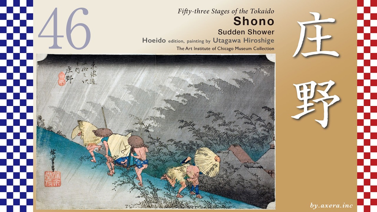
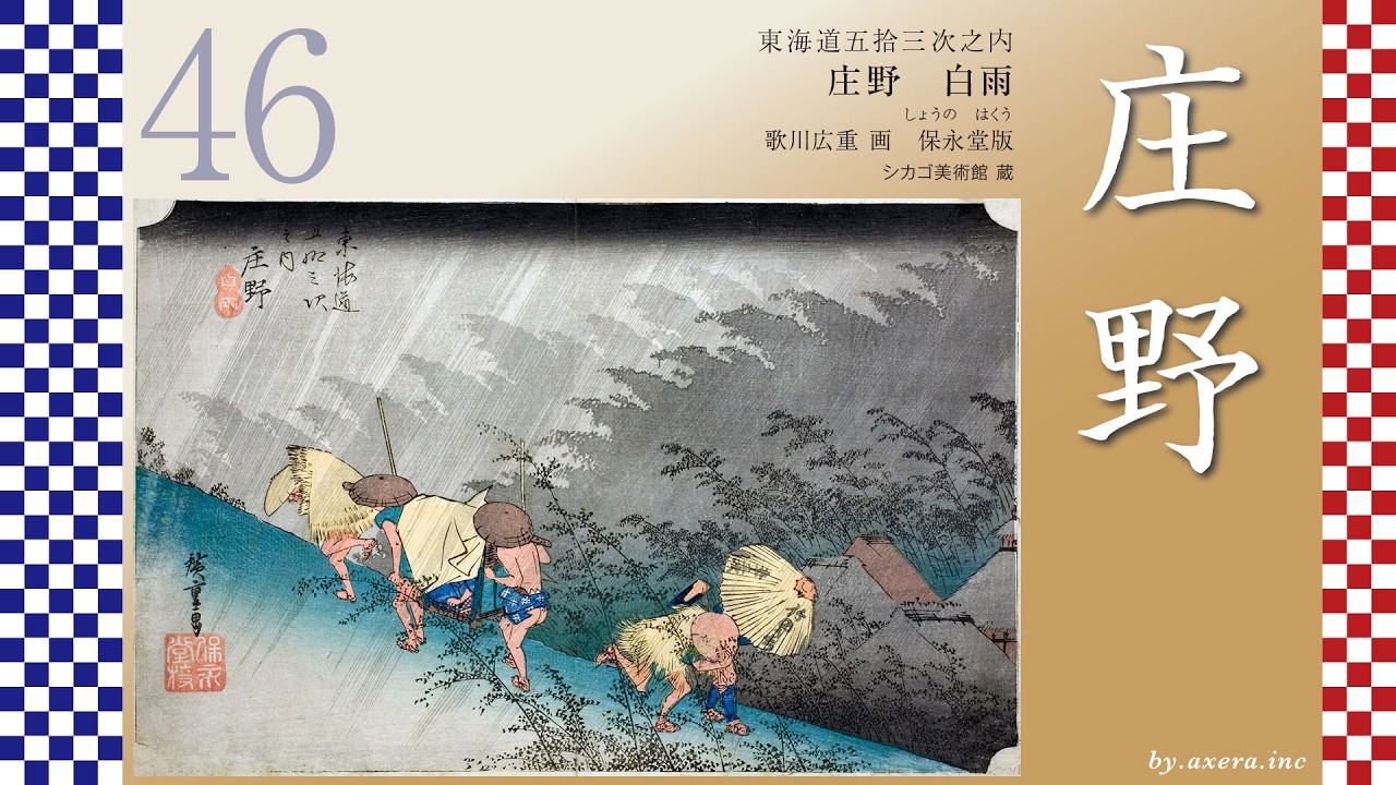
Fifty-three Stages of the Tokaido
Ishiyakushi
Ishiyakushi Temple
Hoeido edition, painting by Utagawa Hiroshige
The British Museum Collection
What you are looking at here is a scene depicting the precincts of Ishiyakushi Temple, from which Ishiyakushi-juku took its name, viewed across distant rice fields.Beyond this quiet rural landscape, the stage of history quietly reveals itself.
Let us begin by looking at a wider map.After leaving Yokkaichi-juku, the Tokaido runs about 10.8 kilometers to Ishiyakushi-juku.
Along the way, at the Hinaga crossroads, it separates from the Ise-kaido Road.
After passing this junction and walking about 6.5 kilometers, travelers reached Ishiyakushi-juku.
Continuing about halfway farther, they would already arrive at Shono-juku.
Ishiyakushi-juku officially became a relay station in 1616.
Because the distance between Yokkaichi-juku and Kameyama-juku was too long, a new relay station was established in Takatomi Village, which had developed as a temple town around Ishiyakushi Temple.
However, only eight years later, another relay station was built nearby at Shono, resulting in a concentration of small relay stations in this area.
At the time, the Tokaido near Hinaga was about nine meters wide.
Its sides were slightly elevated, and rows of pine trees welcomed travelers.
Today, only a single pine tree remains as a quiet reminder of those days.
Before long, travelers reached the junction where the Tokaido and the Ise-kaido Road diverged.
Here stood a torii gate for worshipping Ise Grand Shrine from afar, serving as a landmark for those on the road.
This is also the spot where the mochi shop was depicted in the clerical-script edition shown in the previous episode.
Farther along, travelers encountered Tsue-tsuki-zaka, a steep slope associated with the legendary hero Yamato Takeru.
Its sharp incline still conveys the hardships of travel in earlier times.
Eventually, the road merges with a national highway and then branches left again before entering Suzuka City.
After passing the honjin of Ishiyakushi-juku, travelers crossed National Route 25 and gently descended to the gate of Ishiyakushi Temple, which gave the relay station its name.
Because the Tokaido ran along the eastern edge of the temple grounds, Hiroshige is thought to have painted this scene from a slightly more easterly farm path.
On the map, Hiroshige’s viewpoint is indicated with a red gradient.
From his perspective, the scenery would have looked something like this.
On the left stands the temple gate, before which travelers and a monk head toward Shono.
On the right, a gentle slope leads toward Ishiyakushi-juku.
Along the paths, farmers carry loads, while others work in the rice fields.
It is a quiet autumn countryside, where the sounds of birds seem almost audible.
Though modest in appearance, it reflects a life sustained by steady labor.
The temple’s full name is Shingon-sect Takatomizan Rurikoin Ishiyakushi Temple.
Its principal image is a 190-centimeter-tall Yakushi Nyorai carved shallowly into natural granite, said to have been engraved overnight by Kobo Daishi Kukai.
During the Edo period, feudal lords traveling on sankin-kotai journeys prayed here for safe passage, and stone steps built for their use still remain today.
Повторяем попытку...

Доступные форматы для скачивания:
Скачать видео
-
Информация по загрузке: