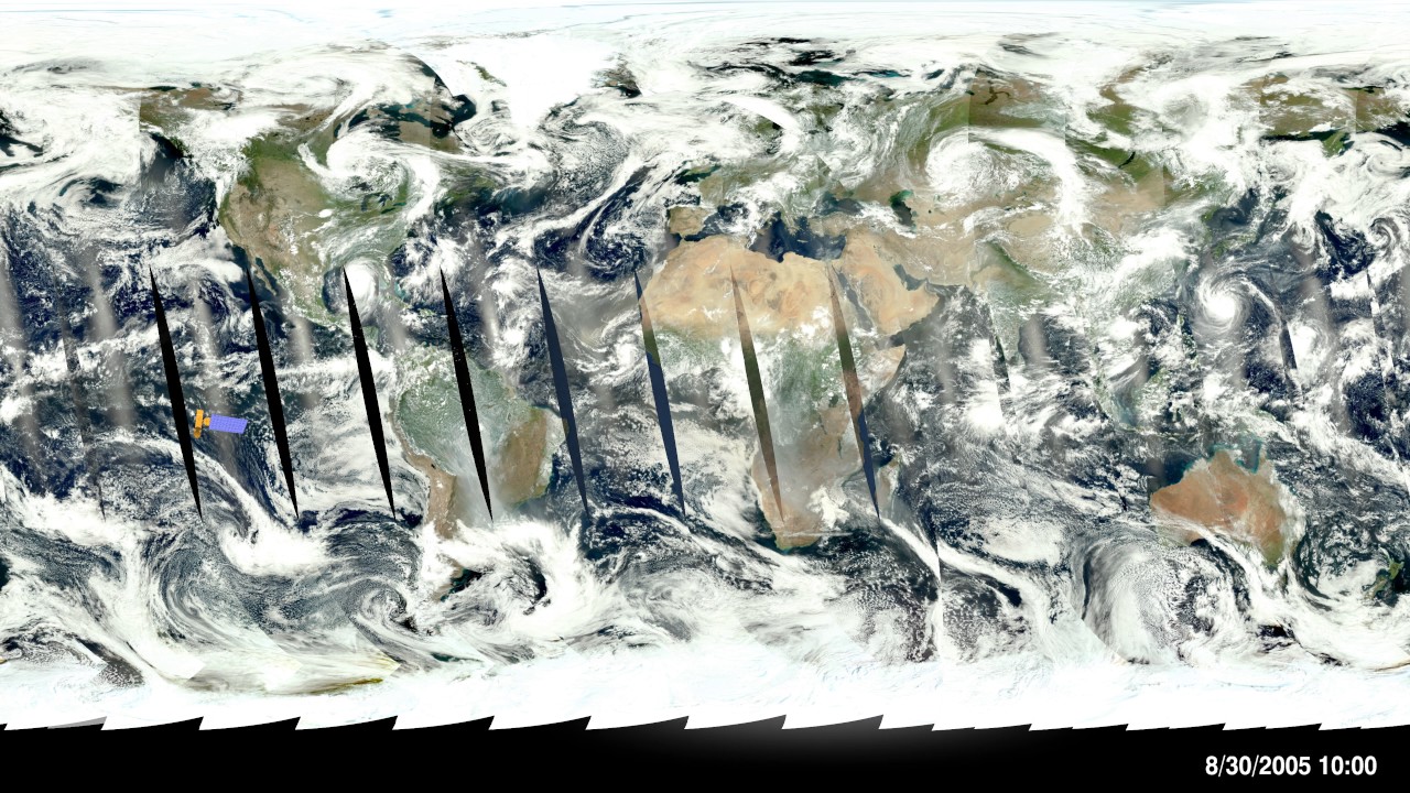
Aqua Satellite and MODIS Swath
Автор: NASA Scientific Visualization Studio
Загружено: 2016-12-11
Просмотров: 5122
Описание:
This visualization shows the Aqua satellite orbiting for four days, August 28-31, 2005, showing a set of MODIS measurements taken those days day that have been processed to look like a a true-color image of the Earth. Notice that the MODIS sensor only takes data during the dayside part of the orbit because it measures reflected light from the Sun, and that there is a bright band of reflected sunlight in the center of swaths over the ocean. Also visible in this visualization are Hurricane Katrina, just to the west of Florida in the Gulf of Mexico, and Typhoon Talim, in the western Pacific between Japan and New Guinea.
Visualizer: Horace Mitchell (lead)
For more information or to download this public domain video, go to https://svs.gsfc.nasa.gov/3348#9565.
Повторяем попытку...
Доступные форматы для скачивания:
Скачать видео
-
Информация по загрузке: