Look at this Survey-Grade Data from an Affordable 3-in-1 Mapping LiDAR | ROCK R3 V2
Автор: ROCK Robotic
Загружено: 2025-12-11
Просмотров: 242
Описание:
ROCK R3 V2 — Affordable LiDAR. Professional Results.
See the ROCK R3 V2 in action with real dataset fly-throughs across Aerial, Handheld (SLAM), and Mobile Mapping.
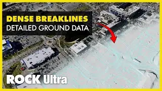
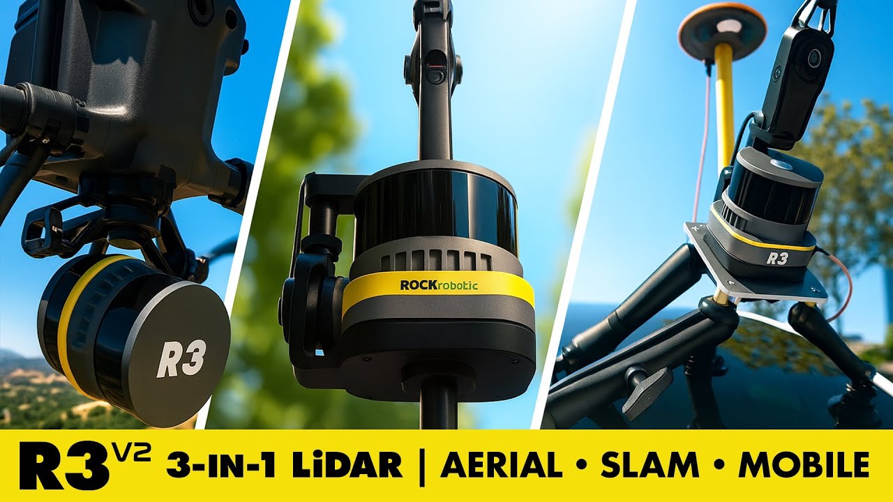
It’s a compact, 3-in-1 LiDAR system that delivers survey-grade accuracy (2–3 cm) and a seamless field-to-finish workflow through ROCK Cloud and ROCK Desktop.
✓ 3-in-1 versatility for Aerial, Handheld (SLAM), and Mobile Mapping
✓ 2–3 cm survey-grade accuracy across terrains and environments
✓ 26 MP RGB camera for vivid colorized point clouds
✓ Compact 1.26 kg design ideal for drones, vehicles & handheld operation
✓ Direct integration with ROCK Cloud, ROCK Desktop & ROCK Pilot
✓ Optional SLAM Dock V2 and ROCK Mobile Mount for true multi-environment mapping
Learn more about the ROCK R3 V2 and start your LiDAR journey today. 👇
🔎 Explore the data & read the case study:
https://www.rockrobotic.com/blog/rock...
ℹ️ Learn more about the ROCK R3 V2 LiDAR system:
https://rockrobotic.com/hardware/rock-r3
💬 Talk to a ROCK LiDAR expert & get a personalized quote:
https://rockrobotic.com/talk-to-sales
#ROCKRobotic #ROCKR3V2 #DroneLiDAR #LiDARMapping #Surveying #3DMapping #Geospatial #MobileMapping #SLAMMapping #DroneSurvey #SurveyGradeLiDAR #AffordableLiDAR #AerialMapping #PointCloudData #LiDARTechnology #ROCKEcosystem #ConstructionMapping #EngineeringSurvey
Повторяем попытку...
Доступные форматы для скачивания:
Скачать видео
-
Информация по загрузке: