2.25.26-2.26.26 trades for one more day before fading by the weekend
Автор: Auntie Jen Jen Kidcasters; HNN Chief Meteorologist
Загружено: 2026-02-26
Просмотров: 6
Описание:
2.25-2.26.26 Island Weather Overview:
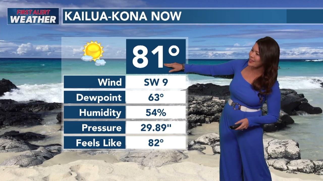
Today a pretty typical trade wind pattern - last day of traditional trades for now. High pressure far north of the state is keeping moderate trades in place, and that means a familiar setup — clouds and a few light showers focused mainly over windward and mauka areas, while leeward spots stay mostly dry.
As we head into Friday and Saturday, those trades will start to ease and even shift more southeasterly as a weakening front approaches from the west. That’ll mean lighter winds for many areas and even the chance for some localized land and sea breeze action over the weekend. Overall though, it still looks fairly dry through Saturday, since the deeper moisture with that front should stay just west and northwest of the islands.
Now looking ahead to Sunday and Monday, that’s where we’re watching things a bit more closely. The forecast models — including the GFS and ECMWF — aren’t in perfect agreement. About half of the guidance keeps the deeper moisture west of the state, while the other half brings some of it into at least the western islands. So for now, we’re going with a blended approach, increasing rain chances mainly for Kauai and possibly Oahu late Sunday into Monday. The rest of the state could see some uptick in clouds and showers, but nothing widespread at this point.
By Tuesday into the middle of next week, a more typical and breezy trade wind pattern looks to return.
For mariners, fresh to strong trades continue through tonight, so rough conditions remain in place. A Small Craft Advisory stays up through this evening for the typically windier waters and channels. Winds ease and turn more southeasterly over the weekend as the front approaches.
In the surf, we still have a High Surf Advisory in effect through 6 PM today for many east-facing shores, thanks to a lingering north-northeast swell combined with strong onshore winds. Surf along north and west shores will trend up again starting Saturday as a new west-northwest swell moves in, peaking early next week. East shore surf lowers a bit into the weekend as the trades back off, but another north-northeast swell arriving over the weekend will help keep some energy in the water.
South shores stay near seasonal averages for now, but we’ll keep an eye on a potential long-range boost into early March. #hiwx #hawaiiweather #hawaii #hawaiiforecast #meteorology #meteorologist #hawaiinews #weather #weatherreport
Повторяем попытку...
Доступные форматы для скачивания:
Скачать видео
-
Информация по загрузке: