Скачать
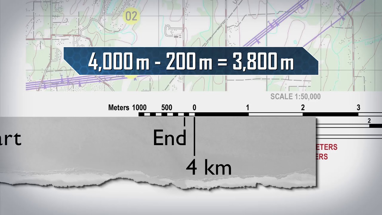
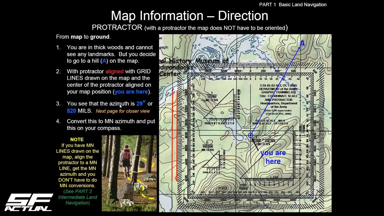
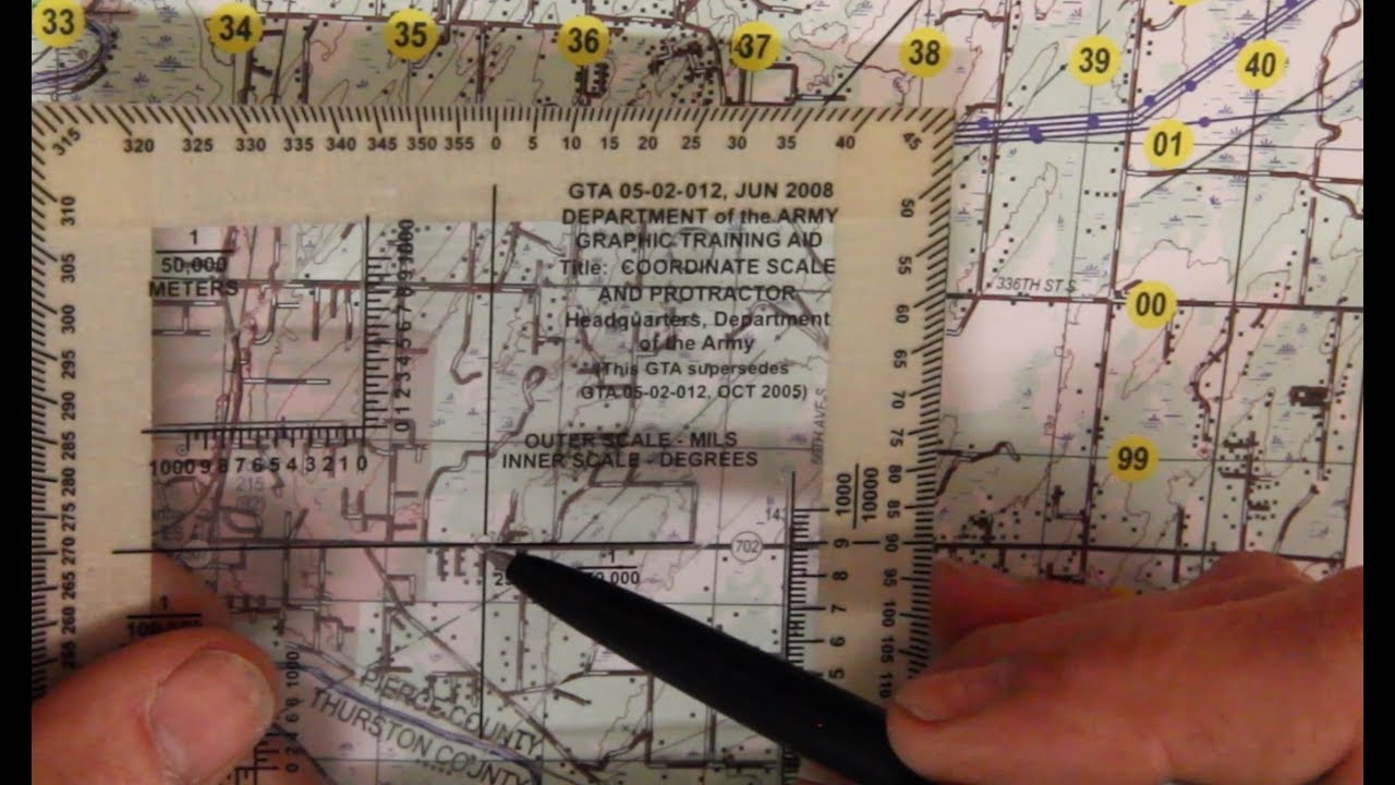
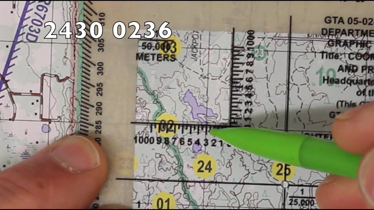
SMCT: Determine Grid Azimuths Using a Protractor
Автор: T2COM G-2 OE Enterprise G&V
Загружено: 2019-12-17
Просмотров: 46696
Описание:
A visualization depicting the Soldier’s Manual of Common Tasks (STP 21-1-SMCT) task Determine Grid Azimuths Using a Protractor (071-COM-0018). This was developed for the Center for Initial Military Training, FT Eustis, Va. This visualization has been approved for public release.
Storyboard developed from the STP 21-1 Soldier's Manual of Common Tasks Warrior Skills Level 1, September 2017
Approved by the Center for Initial Military Training (CIMT) G-3/5/7, Initial Entry Training, Fort Eustis Virginia.
Не удается загрузить Youtube-плеер. Проверьте блокировку Youtube в вашей сети.
Повторяем попытку...
Повторяем попытку...

Доступные форматы для скачивания:
Скачать видео
-
Информация по загрузке: