ycliper

Популярное

Музыка Кино и Анимация Автомобили Животные Спорт Путешествия Игры Юмор

Интересные видео

2025 Сериалы Трейлеры Новости Как сделать Видеоуроки Diy своими руками

Топ запросов

смотреть а4 schoolboy runaway турецкий сериал смотреть мультфильмы эдисон
Скачать

How to use a Military Protractor for Land Navigation

Автор: STOKERMATIC

Загружено: 2019-04-13

Просмотров: 42687

Описание: 
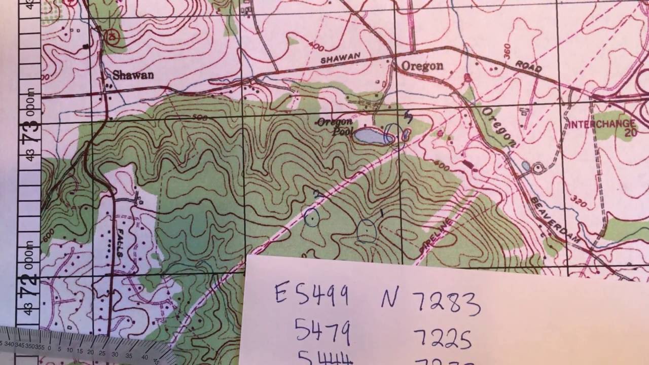
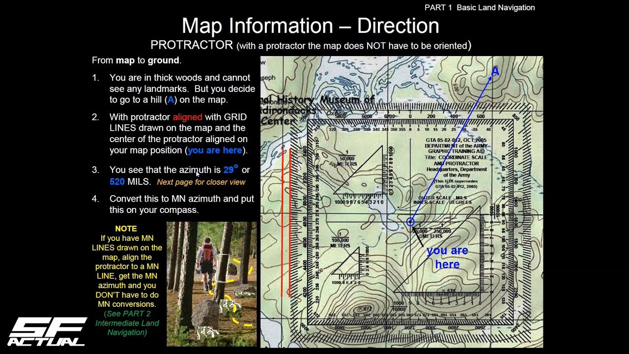
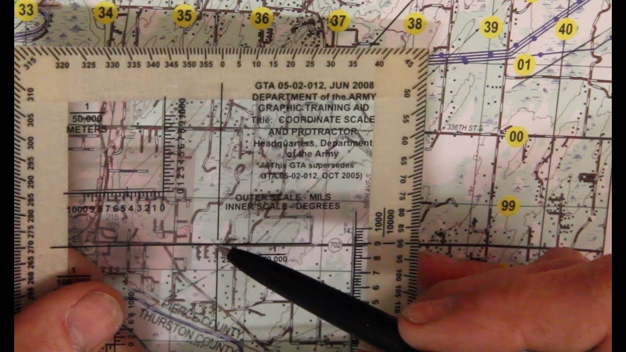
In this video I'll provide a description of a military protractor; how I set one up; how to use it to plot a grid coordinate; determine an azimuth as well as distance from one point to another.

If you need a protractor - here's one I recommend https://amzn.to/2VM1UpP
As an Amazon associate I may earn a small commission for my endorsement, recommendation, testimonial.

You can find me on Instagram at   / stokermatic1976  

If you enjoyed the content, please like and subscribe to stay up to date on all videos. I look forward to hearing your comments.

To view all land navigation video's check out this playlist:
   • FieldCraft  

Land navigation
Military protractor
Land nav
Landnav

Не удается загрузить Youtube-плеер. Проверьте блокировку Youtube в вашей сети.
Повторяем попытку...
How to use a Military Protractor for Land Navigation

Поделиться в:

Доступные форматы для скачивания:

Скачать видео

  • Информация по загрузке:

Скачать аудио

Похожие видео

How to use a compass at night - Land Nav Tips

How to use a compass at night - Land Nav Tips

Master How to Plot 6, 8, and 10 Grid Coordinates on a Topographical Map

Master How to Plot 6, 8, and 10 Grid Coordinates on a Topographical Map

8-Digit Grid Coordinate Military Protractor

8-Digit Grid Coordinate Military Protractor

Наземная навигация

Наземная навигация

Use a Lensatic Compass with a map & without

Use a Lensatic Compass with a map & without

Plotting UTM coordinates, Calculating bearing, and measuring distance

Plotting UTM coordinates, Calculating bearing, and measuring distance

Plotting UTM Coordinates with a Grid Tool

Plotting UTM Coordinates with a Grid Tool

Как устроен парусный военный корабль XVIII века (HMS Victory)

Как устроен парусный военный корабль XVIII века (HMS Victory)

US Military Basic Land Navigation (Part 1.2) - Topographical Maps and Land/Map Association

US Military Basic Land Navigation (Part 1.2) - Topographical Maps and Land/Map Association

Упрощенные подшипники транспортира

Упрощенные подшипники транспортира

ЗАЧЕМ ОН ЛИЛ ВОДУ В МОРОЗ? ГЕНИАЛЬНАЯ ЛОВУШКА СОЛДАТА

ЗАЧЕМ ОН ЛИЛ ВОДУ В МОРОЗ? ГЕНИАЛЬНАЯ ЛОВУШКА СОЛДАТА

That Was Really Filmed on Camera

That Was Really Filmed on Camera

SMCT: Determine the Grid Coordinates of a Point on a Military Map

SMCT: Determine the Grid Coordinates of a Point on a Military Map

ADVANCED LANDNAV: NEGOTIATE OBSTACLES

ADVANCED LANDNAV: NEGOTIATE OBSTACLES

#1 Reason People Get Lost In The Woods - They Can’t Read A Map

#1 Reason People Get Lost In The Woods - They Can’t Read A Map

Мы стоим на пороге нового конфликта! Что нас ждет дальше? Андрей Безруков про США, Россию и кризис

Мы стоим на пороге нового конфликта! Что нас ждет дальше? Андрей Безруков про США, Россию и кризис

Self Mapping Using The PAUL Method

Self Mapping Using The PAUL Method

Why Rivers Move

Why Rivers Move

BLC - CIT how to determine grid coordinates on a military map

BLC - CIT how to determine grid coordinates on a military map

Wilderness Navigation #11 - UTM coordinates

Wilderness Navigation #11 - UTM coordinates

© 2025 ycliper. Все права защищены.


  • Контакты
  • О нас
  • Политика конфиденциальности


Контакты для правообладателей: [email protected]