Mt. Agassiz Summit Route – West Approach Full Hike
Автор: Adrian of the West
Загружено: 2025-08-21
Просмотров: 108
Описание:
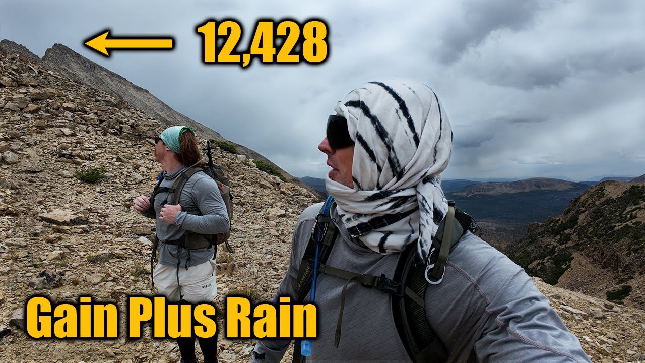
This video shows the full hike to the summit of Mt. Agassiz in the High Uintas Wilderness of Utah. Mt. Agassiz offers an amazing view of the Middle Basin lakes and surrounding areas. The west ascent requires some off-trail navigation but is overall very doable. This guide covers the full route to the summit of Mt. Agassiz from the Highline, showing the scenery, elevation gain, and challenges along the way. If you’re planning a High Uintas adventure, this hike is a great route worth exploring, and the footage here will give you a comprehensive look at what to expect before you go.
If you have any questions, drop a comment and I'll reply.
VIDEO CHAPTERS
00:00 Start
01:34 High Uintas Wilderness
02:04 Burned area
04:43 Exiting burned area
06:03 The meadow
07:05 First class 2 ascent
11:43 Ridgeline
13:07 Middle Basin overlook
14:05 Ridgeline and cliffs
20:23 Another great view
21:28 Summit
23:52 Descent
26:19 Storm front
29:33 Mountain goblin spotted
29:46 Lower descent
31:52 Reentering burned area
32:12 Flood meadow
33:20 More burned area
34:01 Highline trail
35:09 Looking back
35:53 Final thoughts
USEFUL COORDINATES
40.72133, -110.86575 Parking area
40.70250, -110.84975 Exit Highline trail
40.70815, -110.84285 Flood meadow
40.71293, -110.83657 Entering valley
40.71430, -110.83225 Alcove spot 1
40.71394, -110.83196 Alcove spot 2
40.71726, -110.83129 Ridgeline
40.71742, -110.83046 Middle Basin overlook
40.71115, -110.82430 Summit
#MtAgassiz #HighUintas #UtahHiking #SummitHike #HikingAdventures
Повторяем попытку...
Доступные форматы для скачивания:
Скачать видео
-
Информация по загрузке: