How to Add Real-World Geo location in Civil 3D | Complete Guide
Автор: Civil Skills Academy
Загружено: 2026-02-08
Просмотров: 124
Описание:
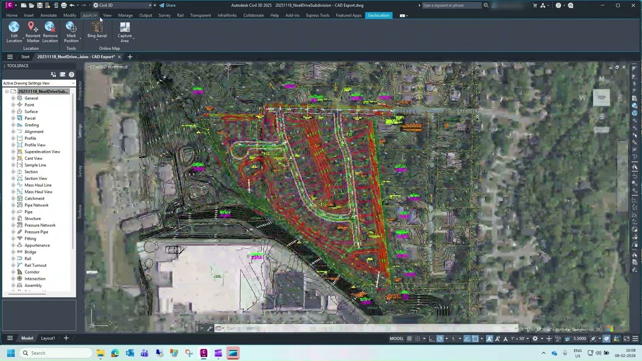
Learn how to add real-world geolocation to your Civil 3D project step by step in this complete guide. In this video, you’ll understand how to correctly set coordinate systems, apply geolocation, and bring aerial imagery into your Civil 3D drawings for accurate site context and visualization.
What you’ll learn:
✔ How to set coordinate systems in Civil 3D
✔ Add geolocation to any Civil 3D project
✔ Insert aerial imagery & map data
✔ Fix common geolocation issues
📌 Use this workflow for subdivision layouts, road projects, and site development drawings.
If you find this helpful, like, share, and subscribe for more Civil 3D tutorials, tips, and real-world workflows.
Hashtags
#Civil3D #Geolocation #AerialView #AutoCADCivil3D #CivilEngineering #LandDevelopment #Surveying #CADTutorial #Civil3DTips
Повторяем попытку...
Доступные форматы для скачивания:
Скачать видео
-
Информация по загрузке:


![Divine Music - The Year Mix Vol.10 [Chill & Ethnic Deep 2025]](https://imager.clipsaver.ru/Q3XBH_FhuKY/max.jpg)