AR Sandbox at NDSU: Learning Tool
Автор: NDSU OTL
Загружено: 2017-01-17
Просмотров: 156
Описание:
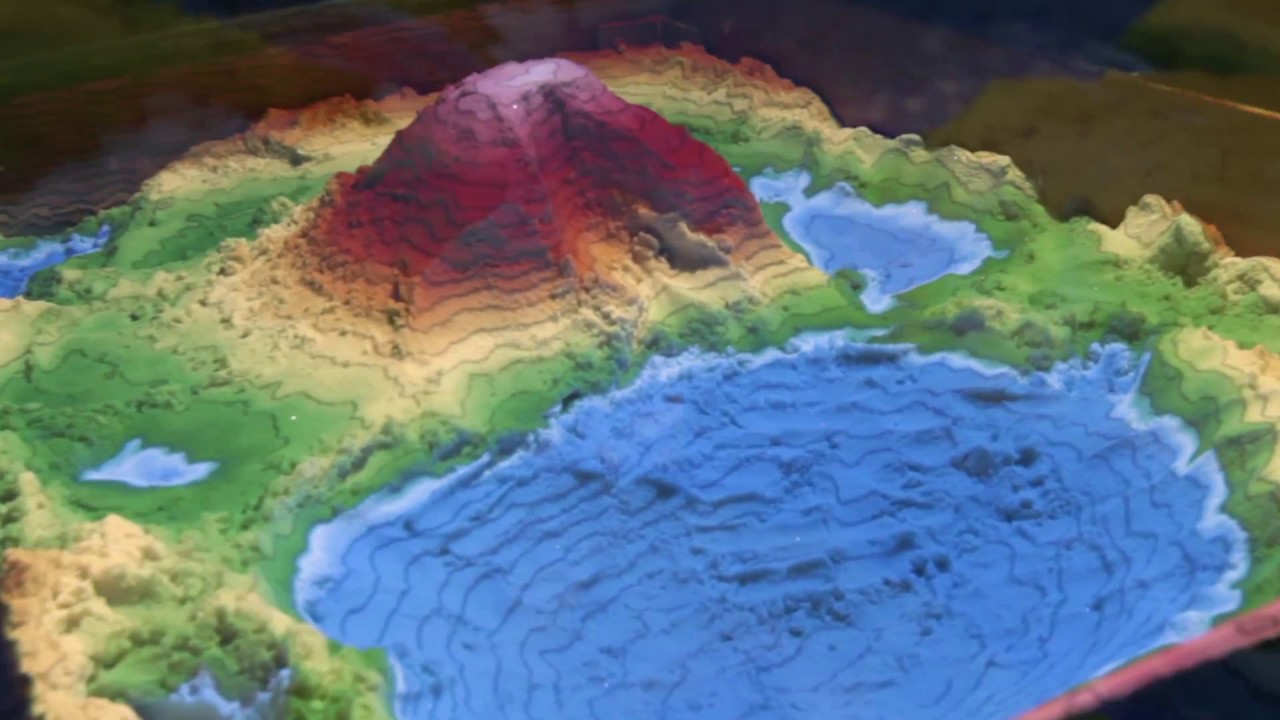
Reading and understanding topographic maps helps students better understand landscapes, develops a better understanding of spatial reasoning, and improve their problem solving skills.These skills are important to all fields, but are often difficult to teach. Students sometimes struggle to understand a 2D representation of a 3D space. For that reason NDSU has begun incorporating the Augmented Reality Sand Table in a number of their Geoscience and Architecture courses.
In this video, NDSU's Geoscience Department instructors Jessie Rock and Stephanie Day discuss this new teaching tool and how it is used in their classrooms. Ben Bernard, an instructor from NDSU's Department of Architecture and Landscape Architecture, touches on how the skills learned through the augmented reality sand box will be useful to students in their future careers.
Resources:
Geosciences Department
https://www.ndsu.edu/geoscie/
Architecture and Landscape Architecture
https://www.ndsu.edu/ala/
Office of Teaching and Learning:
https://www.ndsu.edu/otl
We Learn Together
#studentfocused
#welearntogether
NDSU is a student-focused, land-grant, research university.
Повторяем попытку...
Доступные форматы для скачивания:
Скачать видео
-
Информация по загрузке: