QGIS 4 Arch - Working with Raster Data
Автор: ArchaeoSquatch
Загружено: 2020-06-18
Просмотров: 3728
Описание:
QGIS4Arch is a free online course for learning QGIS, an open source geographic information system (GIS) software package. This course is for those who works with cultural heritage resources, including archaeologists, architectural historians, and historians. The course is designed to take you from beginner to expert. This video uses QGIS Latest Release version 3.12.
Timestamps
0:10 - Topics for this lesson.
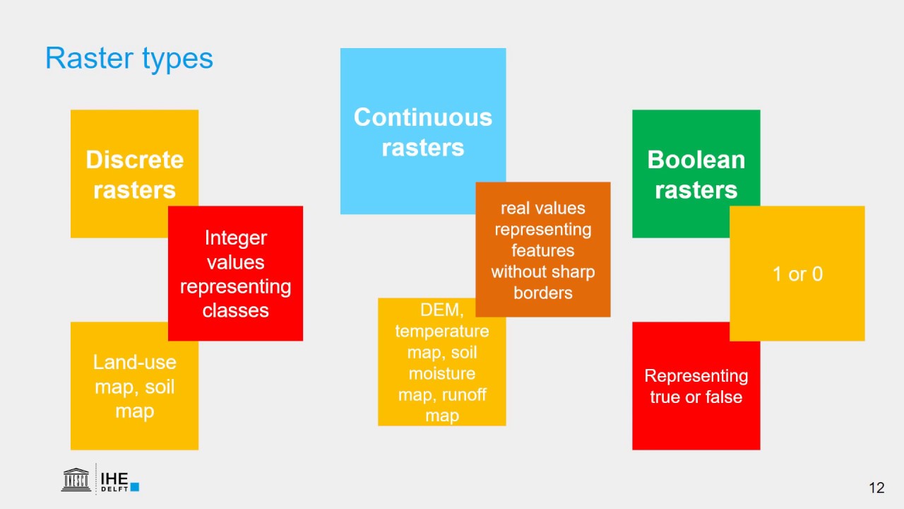
0:48 - Types of raster data.
1:08 - Downloading data from USGS National Map website.
4:25 - Symbolizing raster data.
6:04 - Merging multiple rasters into a single file.
8:05 - Using a polygon to clip a portion of a raster file.
10:18 - Creating, symbolizing, and labeling contour lines.
Data used in this lesson.
USGS National Map Viewer - https://apps.nationalmap.gov/viewer/ (may appear different given date of this tutorial)
Data for this lesson - https://www.anthroyeti.net/QGIS4Arch/...
Повторяем попытку...

Доступные форматы для скачивания:
Скачать видео
-
Информация по загрузке: