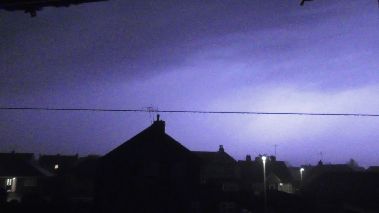
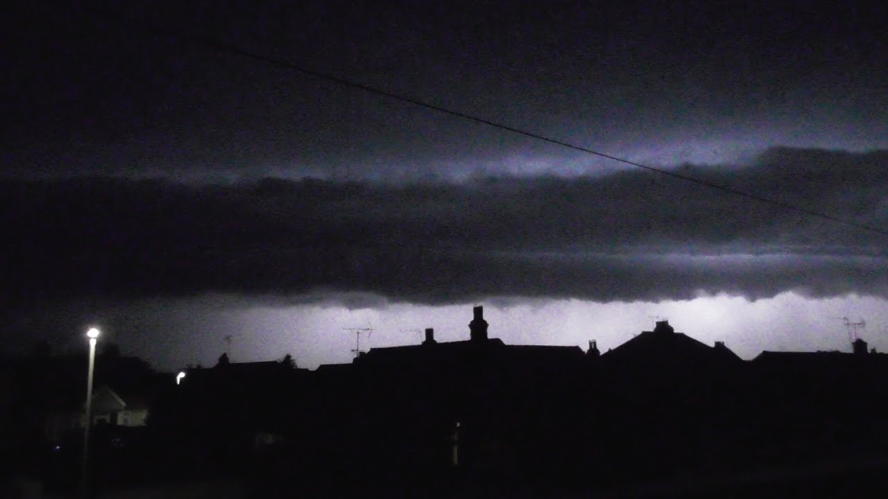
Severe elevated thunderstorms - Herne Bay, Kent - 18th and 19th May 2022
Автор: Jamie M
Загружено: 2022-05-20
Просмотров: 2491
Описание:
An unstable Theta-W airmass moved over SE England and therefore made for an impressive show of sparks during the night of the 18th/19th with elevated supercells being reported into France and interesting cloud structures that could be seen as 'similar' in the SE. Incredibly active storms made landfall around the Brighton area and moved NNE and split right through London with an eastern extent hitting near to my location around Sheerness whilst the other branched out west of London. Various other locations had cells develop which became active. The entire thing as it made landfall in Brighton was an MCS.
Forecast from Convective Weather giving more background on the day:
Convective Outlook
VALID 06:00 UTC Wed 18 May 2022 - 05:59 UTC Thu 19 May 2022
ISSUED 07:25 UTC Wed 18 May 2022
ISSUED BY: Dan
A large upper low dominates over the North Atlantic on Wednesday, while an upper ridge covers much of mainland Europe. This places a southwesterly flow aloft across the British Isles throughout this forecast period, with a series of shortwaves embedded in the flow running northeastwards. The first pronounced trough axis will clear northern Scotland during Wednesday morning, linked to a surface low and wrap-around precipitation.
Meanwhile, a cold front will approach SW Ireland late morning, pushing cloud and rain across Ireland and Northern Ireland during the afternoon. The front will be strongly forced on the forward side of the next approaching, increasingly negatively-tilted, upper trough and the orientation of the front suggests the potential for embedded linear convection in an environment with fairly strong low-level wind shear. Squally winds of 60-70mph may be possible, and a SVR has been introduced to highlight this risk. While this may be somewhat shallow in height, a few lightning strikes may be possible from the strongest/deepest convection. CAPE appears rather meagre, but some squally gusts of wind will be possible. Showers will follow into W / SW Ireland later in the afternoon, and these may also produce a few lightning strikes - a low-end SLGT has been issued as a result.
Elsewhere, a cold front - having cleared to the North Sea on Tuesday night - will linger over France and BeNeLux on Wednesday before lifting back northwards as a warm front wave during Wednesday night. As surface pressure falls over western France on Wednesday afternoon, low-level winds will back across SE Britain allowing advection of a relatively high Theta-W airmass (14-16C at 850hPa) to advect into the area. This will lead to differential temperature advection as cooling aloft occurs as the upper trough over Ireland grazes the western edge of the Theta-W plume. Forecast soundings and cross sections are strongly indicative of mid-level instability atop a cooler, more stable surface layer, with scope for elevated convection rooted from the 850-900mb layer (cloud bases typically 4,000-5,000ft). Forecast profiles suggest that, despite a very warm and deeply mixed boundary layer, capping will be too strong in France for much in the way of surface-based convection - at least until late afternoon/evening hours. However, a rapid uptick in primarily elevated convection seems likely over western and northern France later in the day, and this should migrate/expand northeastwards to affect central/eastern portions of the English Channel and Cen S / SE England during the mid-late evening period onwards.
Cloud tops could potentially push beyond 40,000ft, and given the magnitude of instability (MUCAPE exceeding 1,000 J/kg in places) and strong shear (including some backing of the lower cloud layer winds), lightning could be very frequent and should a couple of supercells evolve then this may be potentially accompanied by marginally-severe hail. PWAT in the mid 30s mm suggests the risk of local flash flooding, especially if multiple cells train over similar areas (risk of 20-30mm accumulations) - however, the fairly fast storm motion (very approximately 30mph) may reduce this risk somewhat. CAM guidance has been consistent in suggesting bowing structures with gusts of 50-60mph in localised spots. This would likely cause some portions of the line of thunderstorms to accelerate more quickly to the northeast than others, and may also cause some weakening of cells in places too. Attempting to pinpoint specifically where these features will occur is difficult, if not impossible, due to storm-scale interactions.
Повторяем попытку...
Доступные форматы для скачивания:
Скачать видео
-
Информация по загрузке: