Earth's Features Unit Pack: Topography, Erosion & Modeling | 4th Grade Science
Автор: Breaking Printers
Загружено: 2026-01-31
Просмотров: 1
Описание:
Are your students struggling to understand how flat lines on a map represent tall 3D mountains? 🏔️ In this video, we break down a complete 3-day lesson plan that turns your 4th graders into expert Cartographers using clay models, satellite data, and hands-on graphing!
✅ Purchase and print this NO-PREP activity pack with lesson plans, worksheets, graphics, and more NOW!! ✅ https://www.teacherspayteachers.com/P...
In this video, we cover:
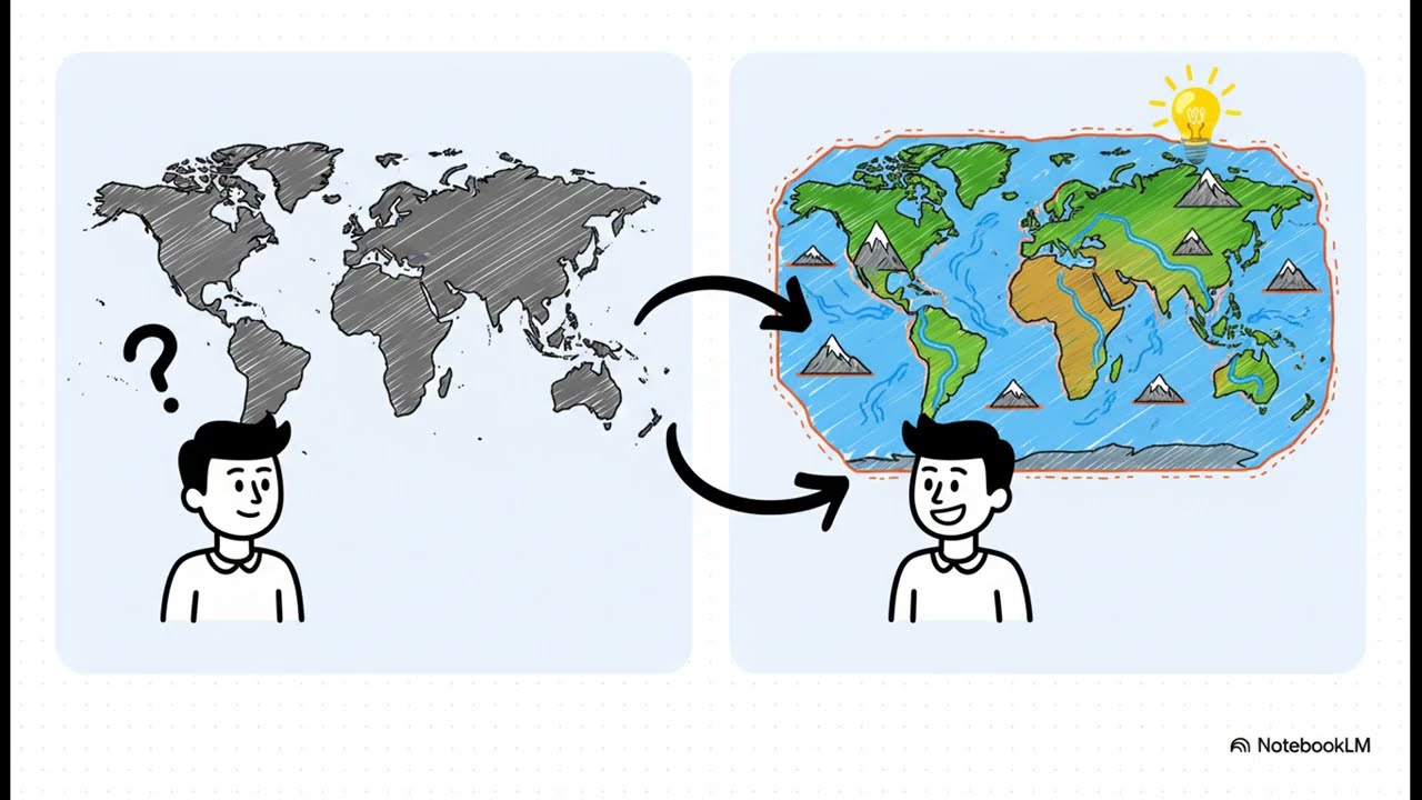
Day 1: Perspectives & Patterns We start by comparing "Two Perspectives" of Earth. You’ll learn how to help students distinguish between Topographic Maps (which use lines/flat colors) and Satellite Images (which show real textures like snow and rock). We also tackle the "Bird's-Eye View" concept, helping students visualize what features look like from space.
Day 2: Measuring Data & Earth’s Forces Stop using straight rulers for winding rivers! 🚫 We demonstrate the "String Method" to measure curved river paths accurately. Then, we dive into the science behind the scenery. We use Claim-Evidence-Reasoning (CER) to explain how Plate Tectonics "buckle" the land to form mountains and how Erosion acts as a transport system for sediment.
Day 3: The Clay Model Challenge This is the student favorite! 🌟 We use modeling clay to build 3D landscapes with mountains, rivers, and plains. Students then stand up to sketch their own "Bird's-Eye View" map, translating their 3D build into a 2D drawing.
💡 TEACHER TIPS INCLUDED:
• Visual Anchors: Use hand motions to teach the difference between Weathering (breaking), Erosion (sweeping/taking away), and Deposition (patting down/dropping off).
• Differentiation: How to use sentence stems for students who struggle with scientific arguments about landforms.
• The "Snake" Analogy: Why we treat rivers like snakes when measuring distance.
❓ QUESTION OF THE DAY: Do you find students struggle more with the math of maps (scale/graphing) or the visualization (2D vs 3D)? Let me know in the comments! 👇
🔔 SUBSCRIBE for more hands-on Science & Earth Space lessons
Повторяем попытку...
Доступные форматы для скачивания:
Скачать видео
-
Информация по загрузке: