ROW of Kathmandu Metro
Автор: Pragnyan Ghimire
Загружено: 2025-07-05
Просмотров: 133
Описание:
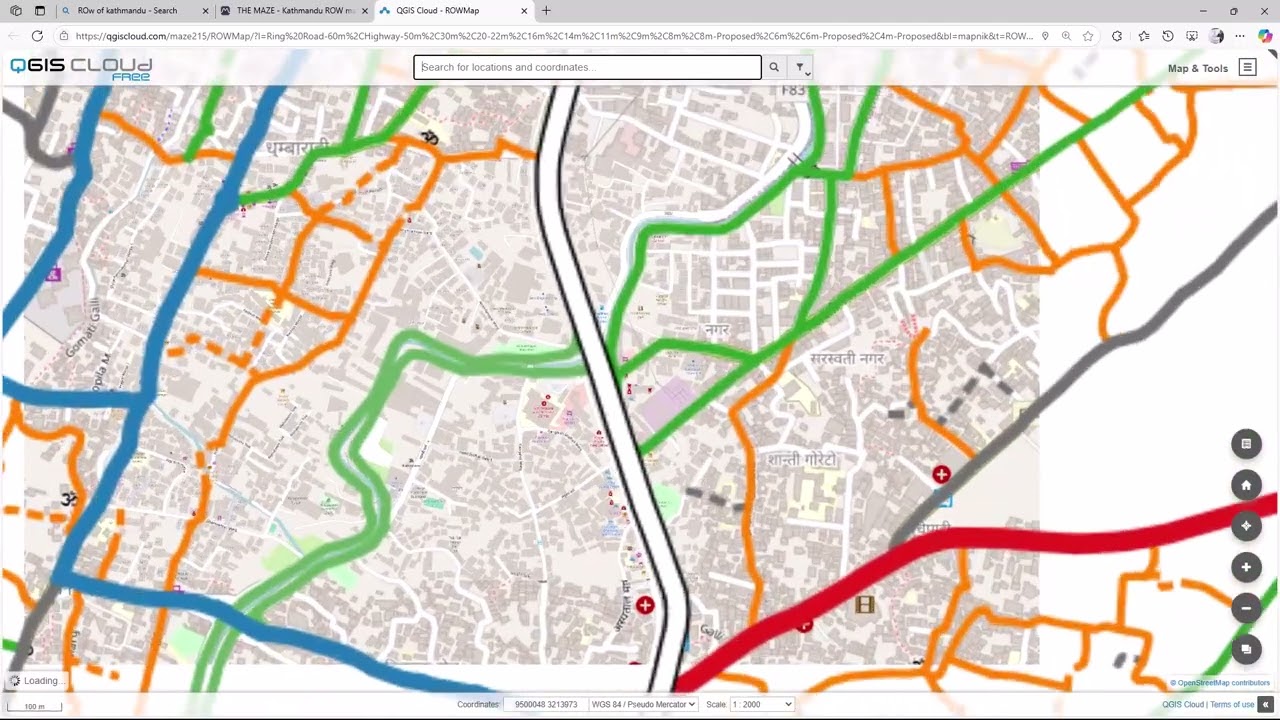
🚇 ROW & GLD Overview
ROW (Right of Way) in Kathmandu Metropolitan City refers to the designated width of roads, which influences building setbacks and land use. For example, dead-end roads longer than 50m typically require a 4-meter ROW.
GLD (Guided Land Development) is a planning approach used to structure urban growth. Kathmandu’s GLD map is based on GLD-2073, and it’s subject to updates based on local needs.
These maps are crucial for land transactions, building design, and urban planning, especially when verifying plot proximity to proposed ROWs.
🗺️ Visualization Tools
OpenStreetMap (OSM) provides the base map, offering crowd-sourced geospatial data. It’s integrated into platforms like QGIS and The Maze for enhanced visualization.
QGIS is used to style and analyze the data. You can apply custom color combinations to distinguish ROWs, GLD zones,
ROWs: shaded corridors or dashed outlines
GLD zones: pastel fills or hatch patterns
The Maze platform hosts an interactive map of Kathmandu’s ROW and GLD, allowing users to explore proposed roads and verify land use boundaries.
📍 Where to Explore
You can view the Kathmandu ROW and GLD map on The Maze’s official map portal, and for broader metro planning details, check the Kathmandu Metro feasibility report.
Would you like help creating a custom QGIS style or map layout for your own project? I’d be glad to assist.
www.maze.com.np
Повторяем попытку...
Доступные форматы для скачивания:
Скачать видео
-
Информация по загрузке:


