UAV LiDAR Survey in Action | High-Accuracy Topographical Mapping from the Air
Автор: Flydar Uk
Загружено: 2026-01-23
Просмотров: 2
Описание:
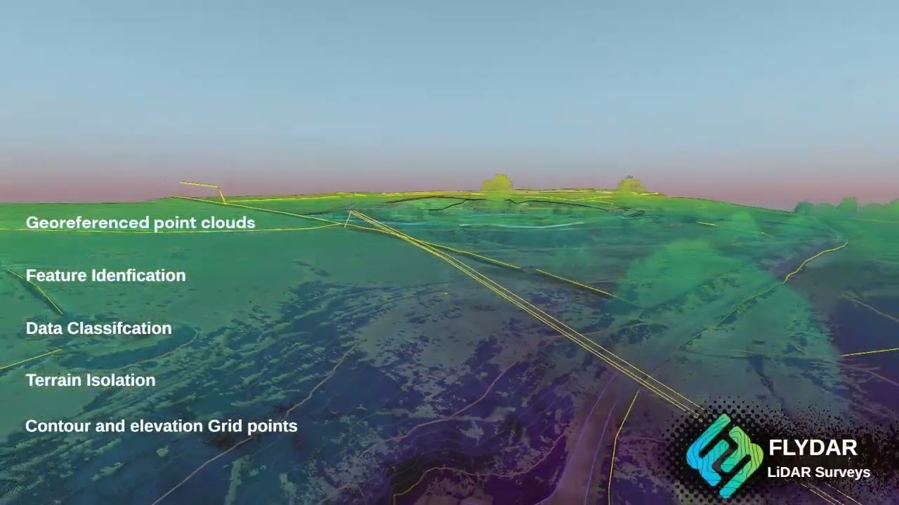
In this video, we showcase a UAV LiDAR survey capturing a site with survey-grade accuracy in a single flight. Using laser scanning technology, we’re able to measure true ground levels, even through vegetation, producing reliable data for planning, design, and construction.
Unlike standard drone mapping that relies purely on photographs, LiDAR records millions of precise ground points, creating highly accurate 3D models and topographical information you can trust.
From this single survey, we deliver:
Classified point clouds
Accurate topographical plans
Digital Terrain Models (DTM)
3D surfaces and site models
All data is tied into RTK ground control, referenced to the national grid, and typically achieves centimetre-level accuracy. This makes it suitable for planning applications, engineering design, drainage strategies, earthworks calculations, and construction projects.
If you need reliable, survey-grade site data rather than just visuals, UAV LiDAR is the difference.
Повторяем попытку...
Доступные форматы для скачивания:
Скачать видео
-
Информация по загрузке: