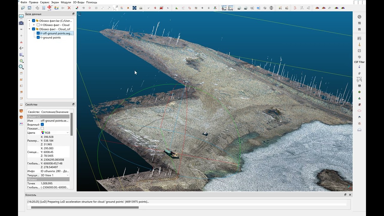
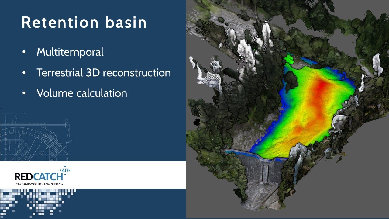
Retention Basin - terrestrial Photogrammetry and Volume calculation
Автор: REDcatch GmbH
Загружено: 2022-08-03
Просмотров: 2031
Описание:
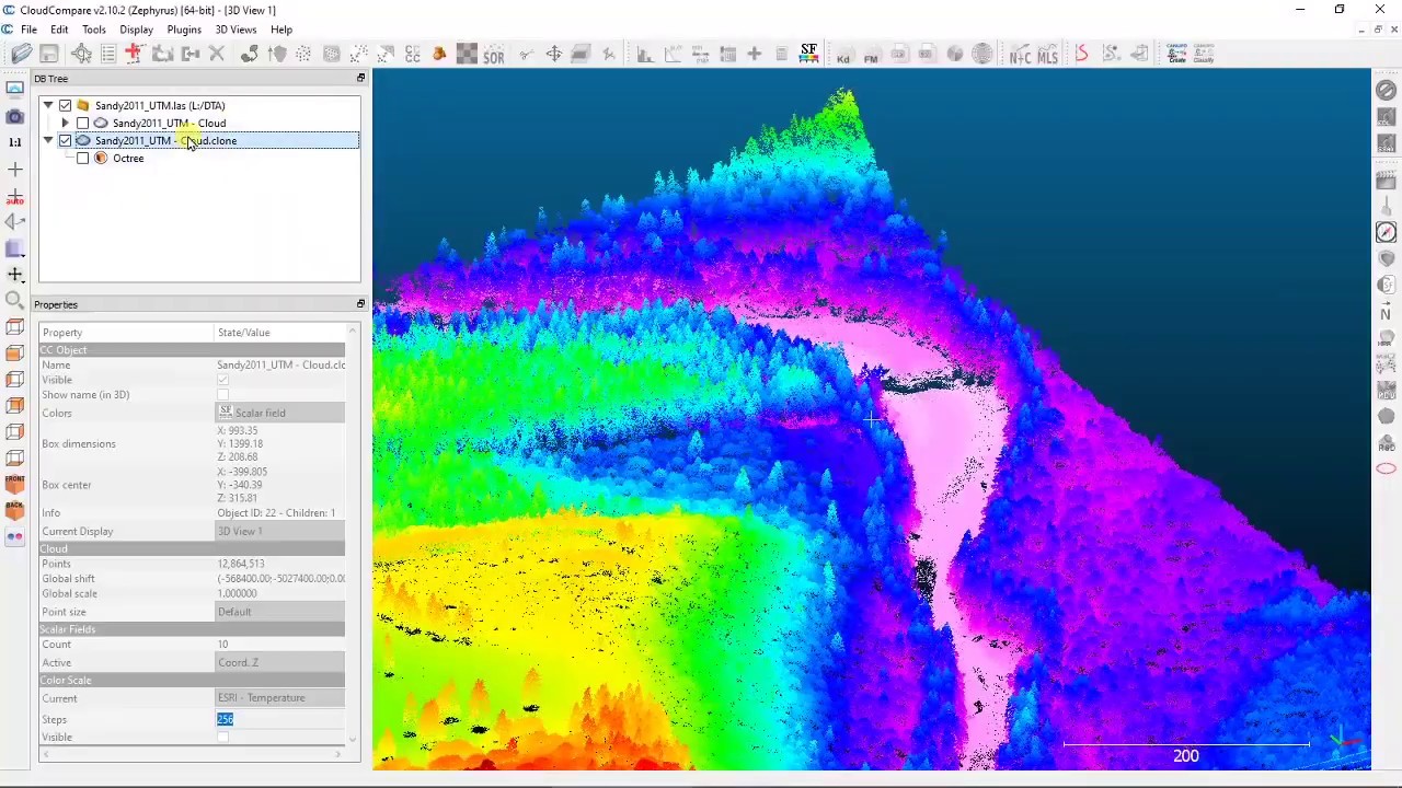
After heavy rainfalls and a mudflow, the retention basin above a settlement needs to be analysed regarding volume and deposit height.
Using terrestrial RTK camera devices from @REDcatchGmbH and@agisoftmetashape3247 for multitemporal 3D reconstruction. Analysis were performed in CloudCompare.
Links:
RTK for 360° camera: https://www.redcatch.at/rtk_360camera/
3D ImageVector, RTK for digital camera: https://www.redcatch.at/3dimagevector/
CloudCompare software: https://www.danielgm.net/cc/
Metashape: https://www.agisoft.com/
What you will see in this video:
o Intro multi-temporal terrestrial survey (0:00)
o The location: (0:30)
o 3D ImageVector survey in 2020 (0:40)
o RTK for 360° camera (1:00)
o The Workflow explained (1:28)
o Processing in Agisoft 2020 (1:43)
o Processing spherical camera in Agisoft 2022-07 (2:29)
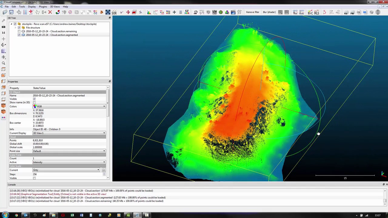
o Import in CloudCompare and resample, clean point cloud (2:49)
o Perform cross section of multi temporal point clouds (4:15)
o Volume measurement (5:09)
o Visualize deposit height in 3d (5:51)
o Render view in CloudCompare to JPG (6:22)
o Get more from REDcatch GmbH (6:44)
Повторяем попытку...
Доступные форматы для скачивания:
Скачать видео
-
Информация по загрузке: