Скачать
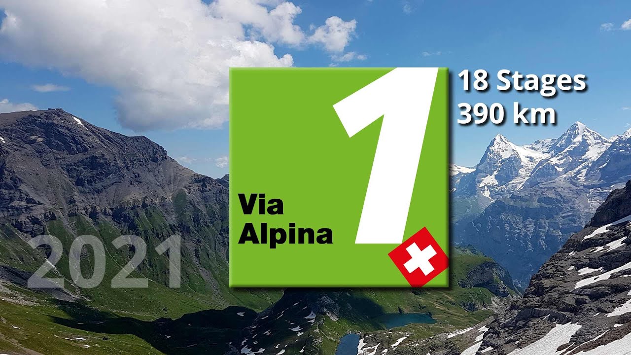
Via Alpina in 10 minutes - a virtual flight
Автор: maxoptikum
Загружено: 2022-03-13
Просмотров: 8332
Описание:
We fly with GoogleEarth along the "Via Alpina" - the swiss national hiking route No. 1. From Montreux to Sargans, with elevation profile and pictures from the way.
Data on the entire route:
Metres in altitude ascending: 24'800 m
Metres of altitude descending: 23'600 m
Distance: 390 km
Number of stages: 20 (according to Schweizmobil), 18 (according to video)
For more information visit:
https://www.schweizmobil.ch/en/wander...
or
https://www.myswitzerland.com/en-ch/e...
Helpful apps:
"Schweizmobil" - for planning and tracking the route.
"Bänkli" - to find benches, fountains, etc.
Не удается загрузить Youtube-плеер. Проверьте блокировку Youtube в вашей сети.
Повторяем попытку...
Повторяем попытку...
Доступные форматы для скачивания:
Скачать видео
-
Информация по загрузке:


![Hiking alone 85 km, Swiss Alps [5 days ] Via alpina | silent hiking film (4K)](https://imager.clipsaver.ru/lOibLgP9Gmg/max.jpg)