Скачать
Using contours to identify landforms
Автор: Edukite Learning
Загружено: 2020-10-26
Просмотров: 42845
Описание:
Grade 11 Geography:
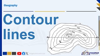
Contour lines are imaginary lines drawn on a topographic map that join places that with the same altitude. These lines show us the height, size, shape and steepness of landscape features.
Subscribe to Edukite Learning:
/ @edukitelearning
#Geography #Grade11 #topographic
#maps #contours #EdukiteLearning #edukite #SouthAfrica #CAPS #FET
#concave #slope #Convexslopes
Не удается загрузить Youtube-плеер. Проверьте блокировку Youtube в вашей сети.
Повторяем попытку...
Повторяем попытку...

Доступные форматы для скачивания:
Скачать видео
-
Информация по загрузке: