Visual Waypoint Drone Flight: AI-Powered Navigation Without GPS | Python OpenCV
Автор: Twitch Lord
Загружено: 2025-11-10
Просмотров: 2695
Описание:
Designed to be lightweight, portable, and easy to integrate.
Want to see how it works in practice? Watch the full video above — and subscribe if you want to follow this into a full-on defense tech project!
Built by: @Twitch-Lord
Curious about autonomous drones and AI? Don’t miss this!
watch this video too: • DIY Variable Pitch Kamikaze Drone | Python...
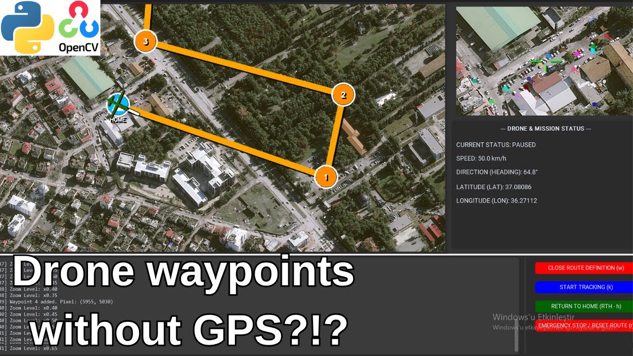
Most consumer drones rely on GPS coordinates for autonomous waypoint navigation. But what happens when your drone doesn’t have a GPS module? In this demo, we showcase an image-based navigation system that allows a drone to fly from point to point using only its onboard camera feed. No GPS signals are required.
Our approach uses computer vision and AI to estimate the drone’s position and orientation (6 DoF) from the video stream. By analyzing the visual environment and comparing it with preloaded maps, the drone can autonomously navigate to selected waypoints with a simple point-and-click interface.
This project explores the potential of GPS-independent flight and highlights the challenges of visual pose estimation. Using learned image transformations, the system matches real-time camera input with map data to guide the drone accurately.
Whether you’re into Python, OpenCV, computer vision, or drone technology, this demo is a peek into the future of autonomous navigation without GPS.
#python #opencv #computervision #artificialintelligence #machinelearning #deeplearning #drone #drones #droneai #dronetechnology #dronedevelopment #autonomousdrone #waypointnavigation #gpsfree #gpsless #gpsindependent #visualnavigation #aerialrobotics #robotics #aitechnology #diydrone #uav #droneproject #cvdrone #visionbasedcontrol
Повторяем попытку...
Доступные форматы для скачивания:
Скачать видео
-
Информация по загрузке: