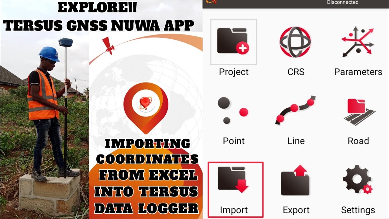
How i import Coordinates from Excel into Tersus
Автор: Eazy Geospatialz🌍
Загружено: 2023-10-15
Просмотров: 2661
Описание:
#gnss is used by Geomatic engineers primarily for geodetic control networks, Mapping and GIS applications.
The Tersus #gnss is one of the topnotch equipment tracking over 500 satellites in Real Time for high Precision measurements.
This video shows one among the many functions the Tersus GNSS nuwa app can do for staking out operation.
Tutorial on how to extract coordinates from Layout plans below
• Extract Multiple Coordinates on AutoCAD Dr...
if you're in need of this equipment in Nigeria contact
https://sacredion.com
If Outside Nigeria visit
http://www.tersus-gnss.com/?gad_sourc...
Don't forget to subscribe and share if you find this video helpful
Join me on Social media
👥Public Facebook Group: https://www.facebook.com/profile.php?...
👷LinkedIn: https://www.linkedin.com/in/victor-nw...
📩Email: [email protected]
#settingout
#geomatics
Thank you❤️
Повторяем попытку...
Доступные форматы для скачивания:
Скачать видео
-
Информация по загрузке: