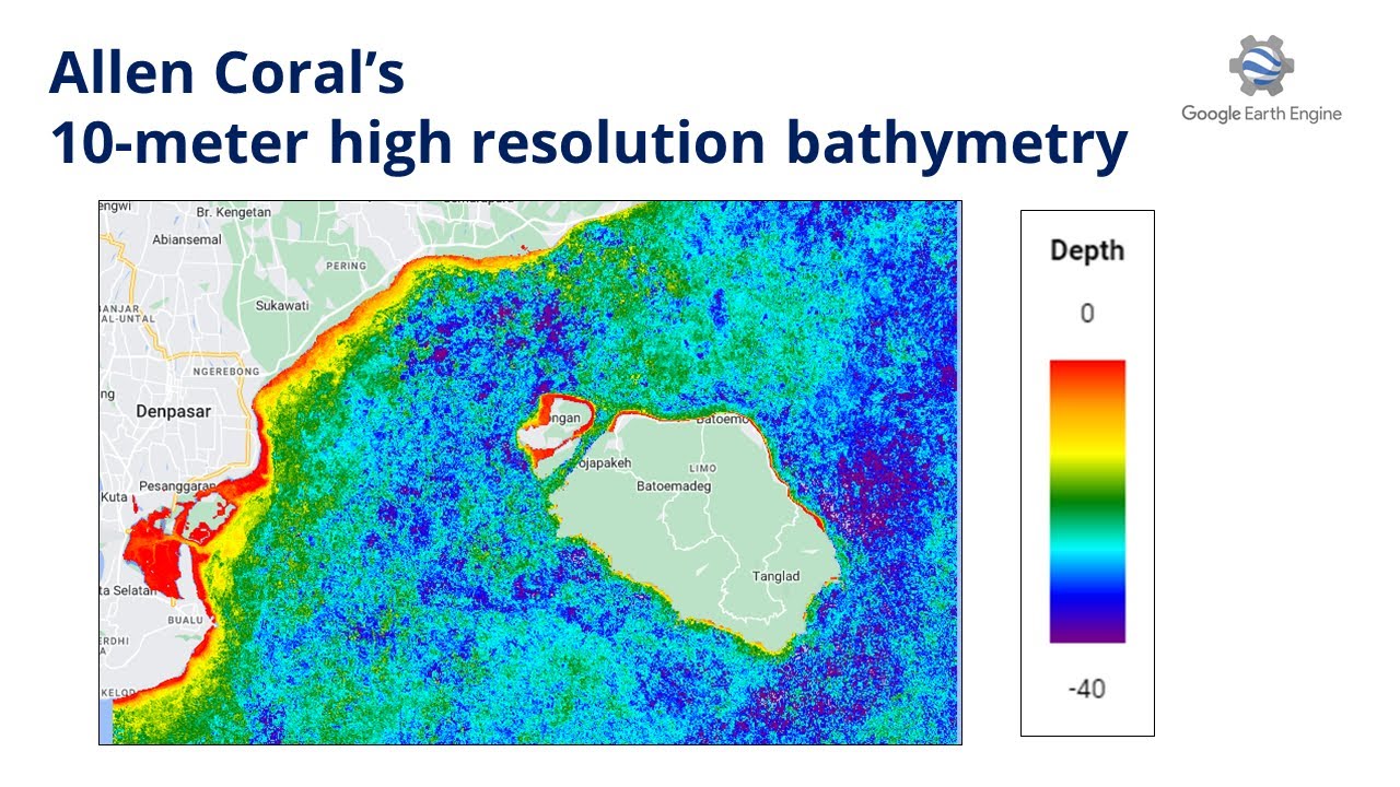
Create Allen Coral's 10-meter High-Resolution Bathymetry with Sentinel-2 in Earth Engine
Автор: Ramadhan
Загружено: 2023-06-26
Просмотров: 4954
Описание:
Do you think that your country's current bathymetry data resolution is too low? Don't worry you can make your own with better resolution.
Check the script here: https://code.earthengine.google.com/0...
In this video, I am following Allen Coral Atlas to create bathymetry, read more here: https://allencoralatlas.org/methods/#...
Basically, what I do is create a cloud-free composite of the coastal area and then mask it with a Normalized Difference Water Index above 0.1 to get the water area only. After that, the imagery is applied with sunglint correction. Before calculating the end, the sunglint corrected imagery is corrected to below surface reflectance for better depth. After that, the depth calculation is done.
I hope this video helps with your coastal and ocean project/research.
Email: [email protected]
Linkedin: / ramiqcom
GitHub: https://github.com/ramiqcom
Повторяем попытку...
Доступные форматы для скачивания:
Скачать видео
-
Информация по загрузке:


