LiDAR to Design to Survey Layout - Riegl VZ600i
Автор: The 3rd Dimension
Загружено: 2024-06-22
Просмотров: 3850
Описание:
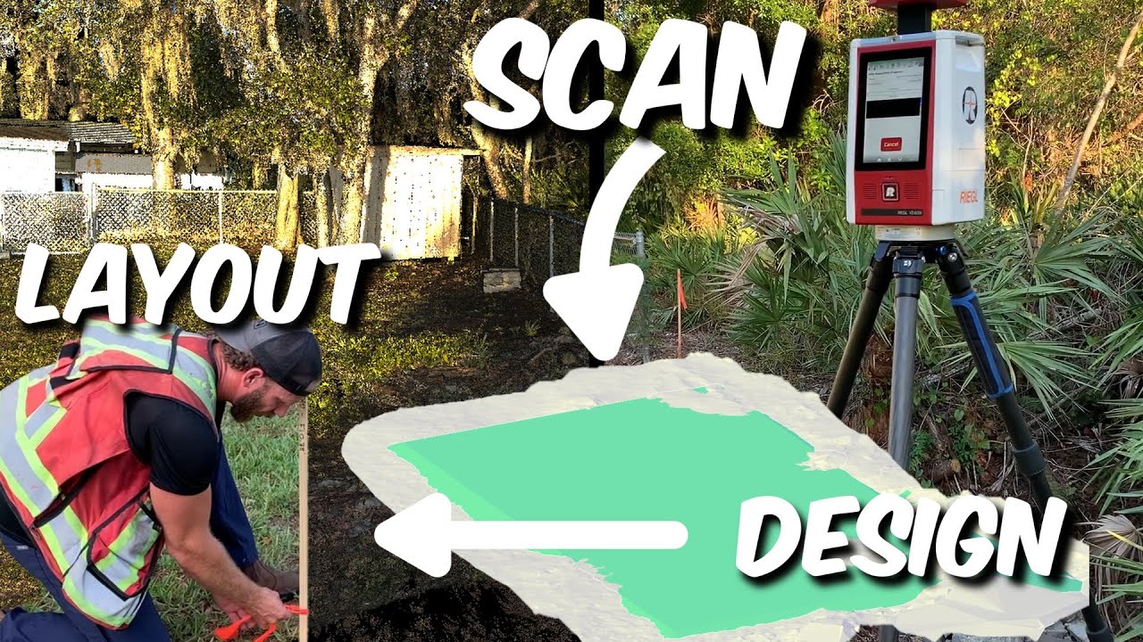
In today’s video we’re going to try something a bit different. I’m going to bring you along from start to finish how I went from scanning a site, turning raw data into a point cloud, cleaning that point cloud & removing off ground points, creating a surface, creating a design surface off the measured surface, calcing volumes between the two and finally staking out the design in the field.
00:00 - Intro
01:39 - Where & What?
03:19 - RiSCAN PRO
07:33 - Lets Talk About Accuracy
10:16 - Cleaning & aligning the cloud in CloudCompare
13:36 - Scanning Vs Traditional Surveying
16:05 - Earthworks Design & Volumes
19:53 - Septic Design
23:04 - Field Layout
27:01 - Final Thoughts
Повторяем попытку...
Доступные форматы для скачивания:
Скачать видео
-
Информация по загрузке: