Contouring by DGPS (Part - 1)
Автор: Learn Surveying
Загружено: 2025-06-28
Просмотров: 218
Описание:
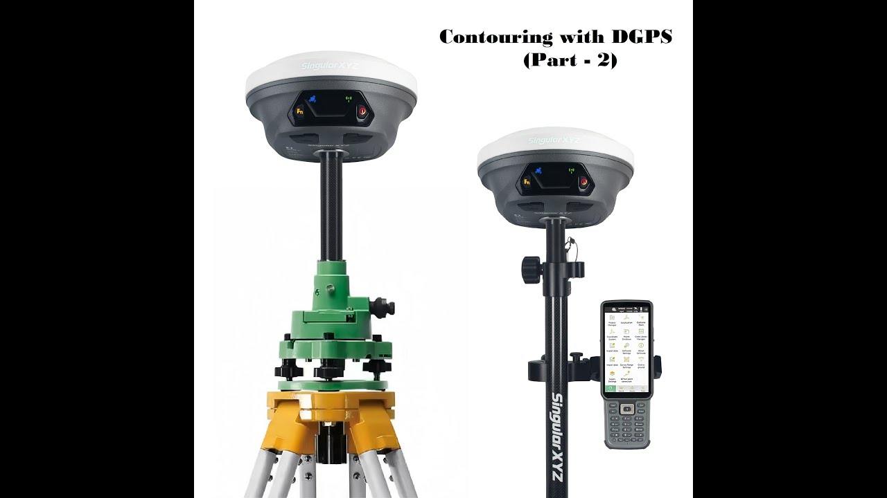
Differential Global Positioning System or DGPS is the latest equipment used in topography, acquiring coordinates or preparing a contour map. In recent times, almost in all infrastructure development projects, this equipment is a must choice.
In this video, G1 Galaxy model of South Precision Instrument is used and all preliminary setting videos are also shown. This video is intended to educate the aspirant engineers and surveyors with this device.
To see my earlier videos, please click on the following link -
1) Closed Traversing with Total Station (Part - 1) - • Closed Traversing using Total Station (Par...
2) Closed Traversing with Total Station (Part - 2) - • Closed Traversing with Total Station (Part...
Повторяем попытку...

Доступные форматы для скачивания:
Скачать видео
-
Информация по загрузке: