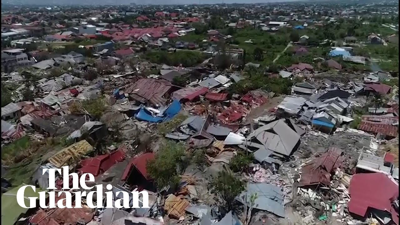
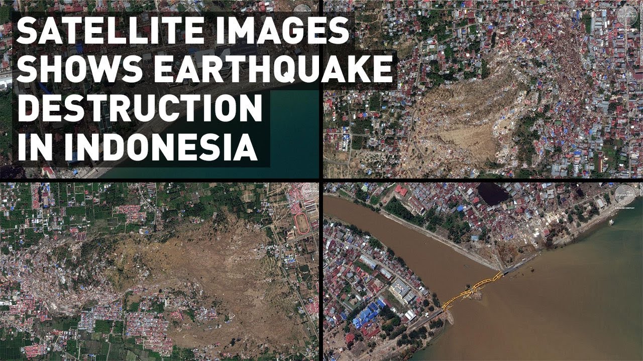
Satellite images shows massive destruction from the Indonesia earthquake and tsunami
Автор: Geospatial World
Загружено: 2018-10-04
Просмотров: 41165
Описание:
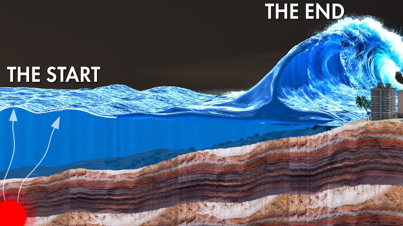
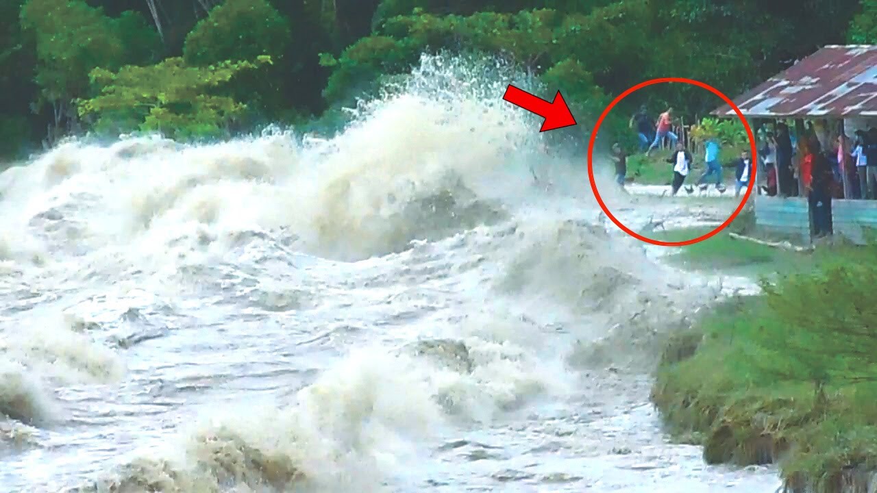
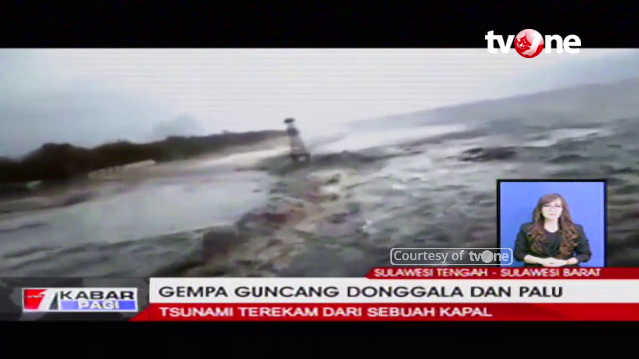
The powerful, 7.5 magnitude earthquake that rattled the northern coast of Sulawesi island on September 28, 2018, caused tremendous damage. Homes throughout Palu, Indonesia, have been flattened. A series of tsunami waves decimated the coastline. Destructive flows of mud and soil destroyed several inland areas in the city of 300,000 people.
As part of Open Data Program, DigitalGlobe publicly released data of the affected areas to support disaster response. Relief workers are using these freely available satellite imagery to navigate destruction.
These satellite images reveal three large inland flows of mud that caused severe damage in densely populated areas, connecting roadway to the bridge also washed away. Large chunks of the coastline are missing.
#IndonesiaTsunami #IndonesiaEarthquake #SatelliteImages
Повторяем попытку...
Доступные форматы для скачивания:
Скачать видео
-
Информация по загрузке: