Urban Expansion Mapping with NDBI: Track Growth with Google Earth Engine
Автор: Erni Saurmalinda Butar Butar
Загружено: 2025-06-14
Просмотров: 842
Описание:
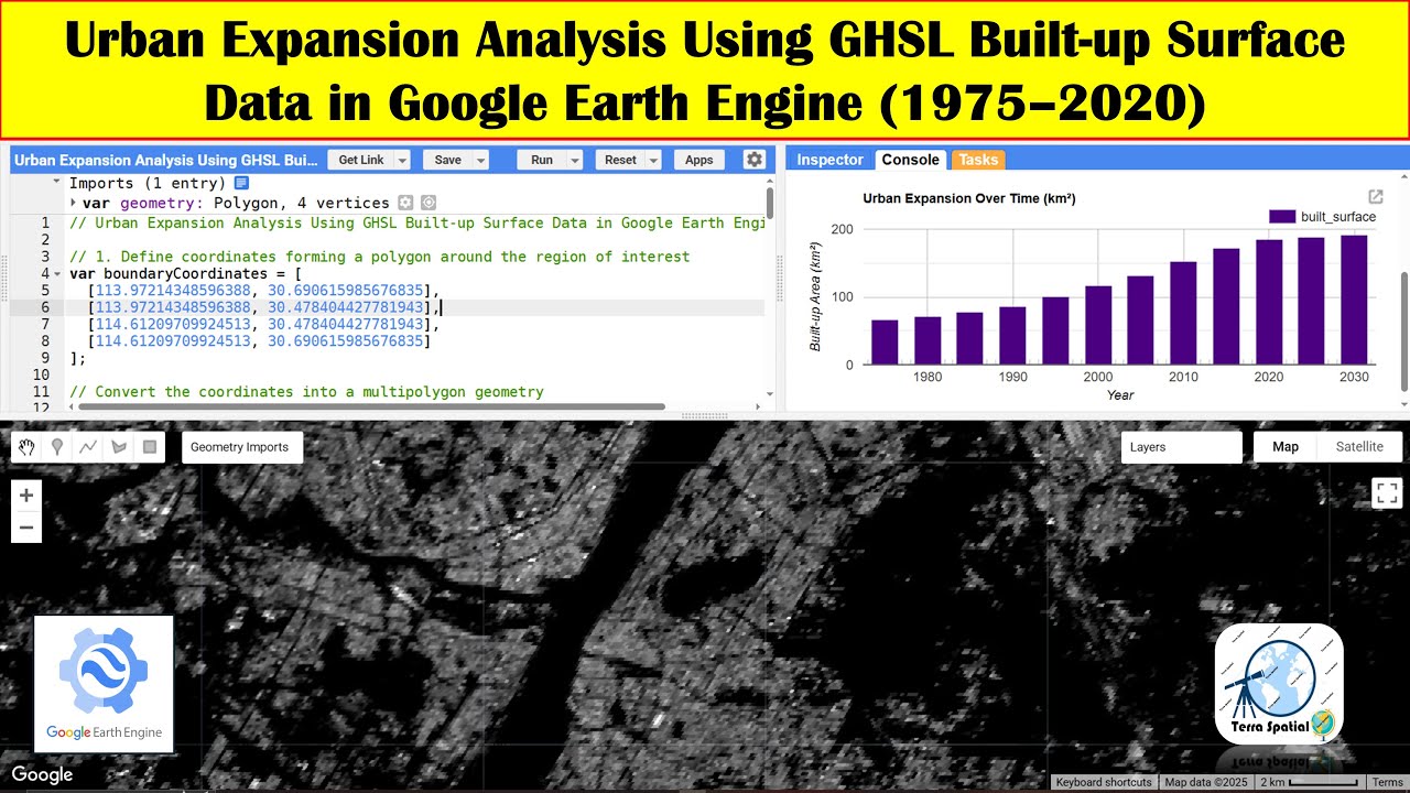
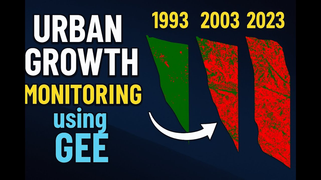
In this tutorial, you'll learn how to monitor and analyze urban growth using Google Earth Engine (GEE). We’ll explore how satellite imagery can reveal changes in built-up areas over time and show you step-by-step how to visualize, classify, and interpret urban expansion.
🌆 What You'll Learn:
✔️ Accessing multi-temporal satellite imagery
✔️ Using indices like NDBI for built-up area detection
Whether you're a beginner or an experienced user, this video will help you understand how to use GEE for urban monitoring in an easy and practical way!
🔗 Watch till the end and don’t forget to check the code in the description below.
👍 Like | 💬 Comment | 🔔 Subscribe for more tutorials on remote sensing and GIS!
link code:
https://code.earthengine.google.com/6...
#UrbanGrowth #GoogleEarthEngine #RemoteSensing #UrbanMonitoring #GIS #CityExpansion #SatelliteData #GEE #BuiltUpArea #NDBI
Повторяем попытку...
Доступные форматы для скачивания:
Скачать видео
-
Информация по загрузке: