🚨 Met Office FOG WARNING | 8°C Divide | UK Weather Update 18/1
Автор: Atlantic Weather UK
Загружено: 2026-01-17
Просмотров: 18
Описание:
MET OFFICE FOG WARNINGS remain in force for eastern counties until at least 11:00 GMT Sunday. Proper thick fog affecting East Anglia, East Midlands, Lincolnshire, Cambridgeshire and Kent. A14, M11 and country lanes experiencing hazardous conditions with 30-40 metre visibility in worst-affected areas. Non-essential travel should be avoided where possible.
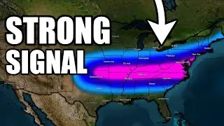
Contrasting weather systems creating Britain's divided forecast. Continental blocking high pressure over Germany/Poland delivering cold, stagnant, foggy conditions to the East. Atlantic low pressure systems bringing mild but wet south-westerly airflow to Wales, South West England and Western Scotland. Temperature differential of 6-8°C across the UK this morning alone.
Comprehensive regional breakdown:
🔹 Yorkshire down to Kent: Dense fog early, lifting to grey low cloud, 4-6°C highs, dry but miserable
🔹 Wales & West Country: Heavy showers, bright intervals between downpours, 8-10°C, Snowdonia 20-25mm rain
🔹 Central England: Overcast, cool, possible drizzle, 6-7°C, improving slightly afternoon
🔹 Scotland: West showery/blustery, east cold/drier, both struggling to 5-6°C
🔹 London & Home Counties: Overcast, damp, 10-11°C (above seasonal average)
Tonight's ice risk: Scotland and Northern England seeing rapid temperature drop after 18:00. Freezing conditions on untreated roads, residential streets, bridges by 21:00-22:00. Elderly and vulnerable should stay indoors and keep heating on.
📺 Daily professional weather forecasts | 👍 Subscribe now
🇬🇧 England, Scotland, Wales, Northern Ireland
#UKWeather #WeatherForecast #MetOffice #FogWarning #BritishWeather #WeatherToday #IceWarning #WeatherAlert #TravelDisruption #UKWeatherUpdate
Повторяем попытку...
Доступные форматы для скачивания:
Скачать видео
-
Информация по загрузке:


![How much Carolina snow is REALLY forecast? [Ep. 568]](https://image.4k-video.ru/id-video/2G4RT3vgG_o)