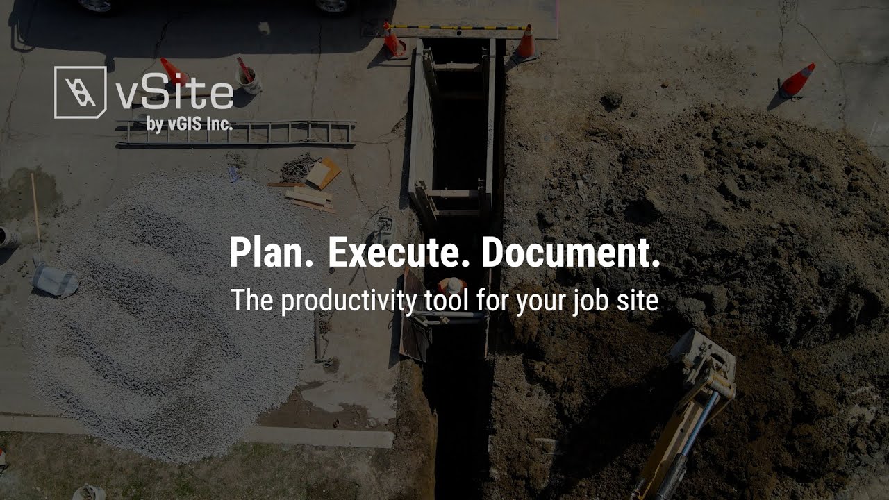
vGIS App - Augmented reality, reality capture and infrastructure
Автор: vGIS Inc.
Загружено: 2020-06-10
Просмотров: 24145
Описание:
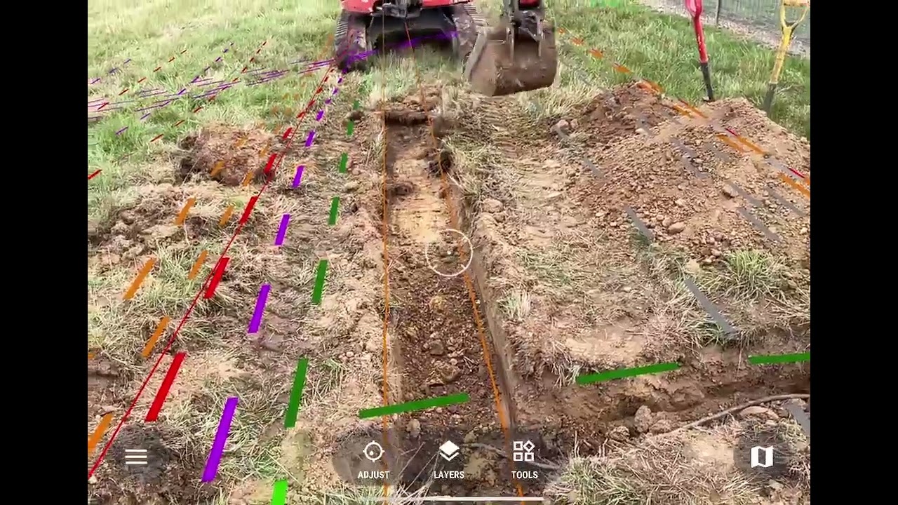
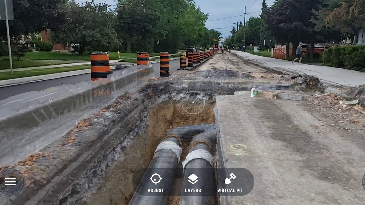
A preview of the upcoming vGIS (www.vGIS.io) functionality – high-accuracy reality mesh /point-cloud data positioned with sub-10cm accuracy. Working with the industry partners, vGIS is bringing the reality mesh and point-clouddata into AR. Reality capture is done using the vGIS app and/or variety of methods offered by vGIS’s partners, and it often requires nothing more than a camera phone to complete. An excavation crew may capture the exposed infrastructure a few times, which takes just a couple of minutes to complete. That data can be accessed later – after the hole is filled and paved over. It is a powerful way to collect photographic 3D evidence, document infrastructure details and provide additional information for remote collaboration.
The process is fully automated and doesn’t require manual 3D model preparations. Users simply access company 3D archives, which are built automatically.
The reality mesh is combined with GIS and BIM information in real-time by the vGIS engine, so in a single unified view, the User sees the reality mesh, GIS and BIM information all at once. The possibilities for damage prevention and productivity improvements are endless.
vGIS Utilities (https://www.vgis.io) is the most advanced augmented reality solution for spatial data (BIM, GIS, reality mesh and point-cloud) visualizations. vGIS was designed to create a more productive, enjoyable and safe working environment. The system connects to Esri ArcGIS, Bentley iTwin, Autodesk BIM 360, and other sources to seamlessly convert and aggregate data into powerful, accurate and stable 3D visuals. vGIS Utilities is deployed at over 100 sites across the world to bring real-life benefits to its users.
Time stamps:
0:00 - 0:27 Viewing underground pipes in AR
0:27 - 1:46 GPS auto-corrections in vGIS AR
Повторяем попытку...
Доступные форматы для скачивания:
Скачать видео
-
Информация по загрузке: