Скачать
Google Earth Engine tutorial 1: Filtering and Displaying Least Cloudy Sentinel-2 Image
Автор: Open Source Remote Sensing & GIS
Загружено: 2020-05-21
Просмотров: 4542
Описание:
OSRSGIS
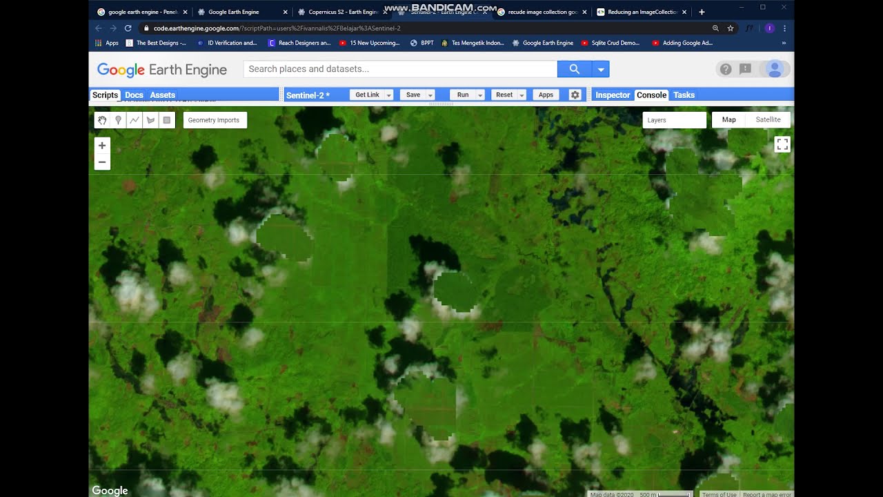
Filtering image collections in Google Earth Engine is a fundamental process in selecting satellite images over any area of interest. This tutorial shows you a simple example of how you can search and filter Sentinel-2 images by location and cloud cover for display.
By: Kwame Awuah
Не удается загрузить Youtube-плеер. Проверьте блокировку Youtube в вашей сети.
Повторяем попытку...
Повторяем попытку...

Доступные форматы для скачивания:
Скачать видео
-
Информация по загрузке:


![[GEE Basic #5] Creating mosaics, composites and Clipping images in Google Earth Engine](https://imager.clipsaver.ru/QcFNORUe3FY/max.jpg)