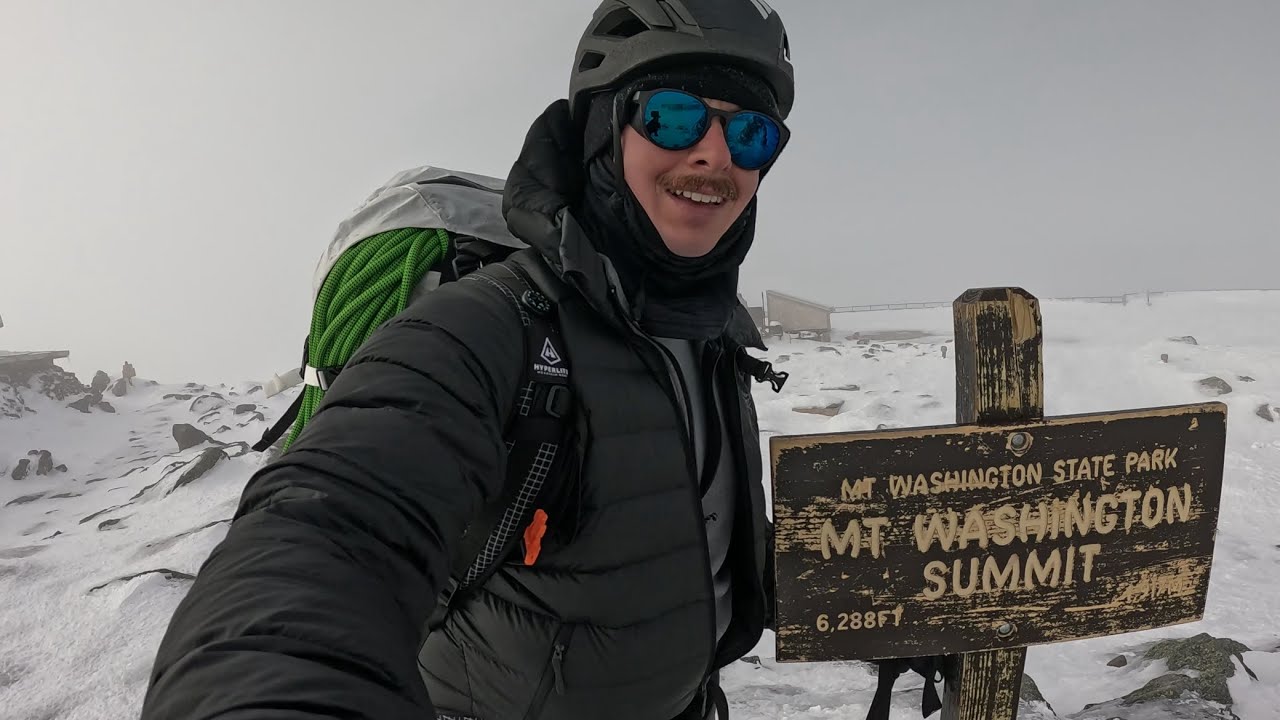
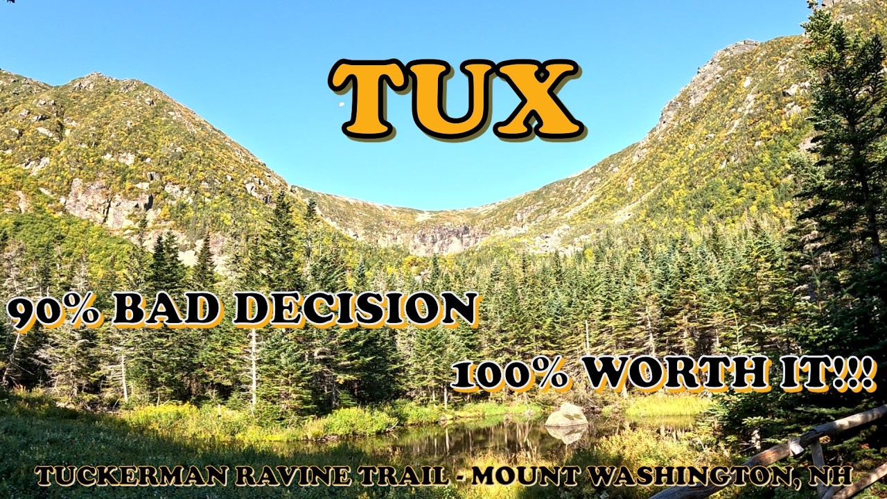
TUCKERMAN RAVINE TRAIL Mount Washington New Hampshire Climbing Guide of Highest New England Mountain
Автор: Mission Wicked Awesome
Загружено: 2026-03-05
Просмотров: 198
Описание:
The Tallest Mountain in New England is Mount Washington in New Hampshire.
IT IS ALSO ONE OF THE DEADLIEST MOUNTAINS IN THE WORLD!!!
Sitting geographically at the junction of 3 North American weather factors: Canadian cold, Atlantic Ocean and Continental US, weather changes in minutes. With a low-altitude Alpine Zone and tree line, this mountain held the record for fastest wind on earth at 231mph for over 60 years! Often underestimated by many weekend, suburban, casual, inexperienced, or day hikers due to easier summit access via auto road, train and trails - as well as proximity to major cities... hikers often find themselves in trouble on this mountain.
New Hampshire offers a hiker safety course online... completion of this course helps support funding for mountain rescue efforts and should you need rescue - covers your cost liability.
https://www.nhfishandgame.com/HikeSaf...
GREAT Mt Washington weather info:
• The Nightmare Geography Glitch Hiding in N...
Mt Washington at its worst:
• Arc'teryx Presents: 109° Below
Find your limits and raise them:
• New bionics let us run, climb and dance | ...
• New bionics let us run, climb and dance | ...
After a summer spent searching for answers on a virus that shredded my nervous system - causing waves of numbness in arms, legs and face for 15 minutes to 4 hours at a time, climbing for my 8th summit was not in the plans. BUT my dear friend Lisa had her mind set on climbing a 4000' mountain (a distinction of New England mountains - remember, climbing in the Northeast starts around sea level).
Two years prior, while waiting for a weather window, my ankle was wrenched in the dark on the sidewalk of my apartment with a new owner who was too cheap to pay for outside lights - preventing my 8th summit to surpass my father and threatening The Maine Project.
With numbness symptoms easing in mid-September, and Lisa in New England visiting Corey who was here working, I was asked if the weather was perfect, I would join. With MANY CONTINGENCIES... (weather, turning around & stagecoach down among them) I agreed. This video shows our climb and the terrain of Tuckerman Ravine Trail - it can be used as a resource (like the videos going up the auto road) to evaluate if it is a climb you want to attempt.
THIS CLIMB WAS DONE IN PERFECT WEATHER and DOES NOT show the difficulty of the terrain in wind, rain, sleet, freezing rain or snow - all are common YEAR-ROUND on Mount Washington. Also... Lisa is an ICU Nurse - despite my health challenge for this climb - the right person was along.
If a picture is worth 1000 words...what's a video worth?
*KNOW WHAT TO EXPECT ON THE TRAIL*
see the Terrain, Trailheads, Views, and Intersecting Trails... NATURE!!!
LIKE or SUBSCRIBE - I'd like for you to do either, I'd LOVE for you to do both!
I hope my efforts make your watching experience AND your next hike... Wicked Awesome!
FRIENDLY REMINDER: no matter the difficulty, hiking has risks... HAVE A PLAN...
the best times are had when planned properly.
Alternate routes are less abundant on this mountain...
your hiking plan SHOULD INCLUDE turning around if necessary and enough time to descend, as well as at least 2 descent options!!! It is important to know how you are getting down.
Injuries can happen, let others know your planned route and timeframe...
cell service is spotty on Mount Washington.
Remember: know your limits so you can push them,
and DEFINITELY REMEMBER: what goes up must come down which includes you...
AND if you enjoy the tour, your guide does accept likes, subscriptions and comments...
(an option of leaving a tip: ie a link for actual tips through patreon is likely coming soonish).
Be Safe!
Live your purpose, change your world...
Share your knowledge, change the world...
FB: Mission Wicked Awesome
Insta: mission_wicked_awesome
missionwickedawesome.com
[email protected]
#whitemountains #tuckermanravine #newhampshire #mountwashington #mountains #forests #hikingadventures
#trailguide #nationalforest #newhampshirehiking #POVhiking #HikingVideos #GoProHiking #NaturePOV
#OutdoorAdventure #TrailLife #NatureLovers #ExploreNature #virtualhiking
Timecodes
0:00 - Intro
1:36 - Pinkham Notch Base Camp
3:55 - Trailhead to Crystal Cascade
8:25 - The "Easy Part" to Huntington Ravine Trailhead
12:40 - up to Hermit Lake
19:00 - Hermit Lake Reprieve
21:47 - Lake to Headwall
28:00 - up the Headwall
32:45 - Green Lichen Granite
39:30 - Lot Edge to the Summit
40:30 - At the Summit
42:00 - Montage Finale
Music from Bensound.com
Maps: OpenStreetMap & AllTrails & USGS map
Camera: GoPro HERO 12 Black
Повторяем попытку...
Доступные форматы для скачивания:
Скачать видео
-
Информация по загрузке: