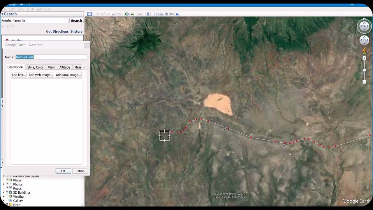
Pipeline Network Design Part-1: Drawing Pipelines & Surface Data (Points) in Google Earth
Автор: Subhash chand Mahich
Загружено: 2024-11-13
Просмотров: 1227
Описание:
Pipeline Network Design Part-1: Drawing Pipelines & Surface Data (Points) in Google Earth.
Welcome to Part 1 of the Pipeline Network Design series! In this video, we'll dive into drawing a pipeline alignment along a road and adding surface data points in Google Earth. Learn how to position pipeline routes and align surface points 10 meters parallel to the pipeline using Google Earth and Civil 3D. This foundational tutorial is perfect for engineers and planners working with pressure networks, gravity mains, and distribution pipelines. Stay tuned for the next part, where we’ll assign elevations to our pipeline using QGIS and a GPS visualization tool.
#PipelineDesign
#CivilEngineering
#InfrastructurePlanning
#PipelineNetwork
#QGISTutorial
#Civil3DTutorial
#WaterGEMS
#GoogleEarthMapping
#EngineeringDesign
#PipelineAlignment
#GISforEngineering
#ElevationData
#PipelineMapping
#EngineeringTutorials
#SurfaceData
Pipeline Network Design
Pressure Network Design
Gravity Main Pipeline
Distribution Network
Google Earth Pipeline Mapping
QGIS Pipeline Tutorial
Civil 3D Pipeline Alignment
WaterGEMS Pipeline Design
Surface Data Pipeline
Pipeline Alignment Tutorial
Pipeline Network Engineering
GIS for Pipeline Design
Infrastructure Planning
Pipeline Surface Points
Civil Engineering Tutorials
Elevation Profile in QGIS
Pipeline Mapping
Повторяем попытку...
Доступные форматы для скачивания:
Скачать видео
-
Информация по загрузке:


