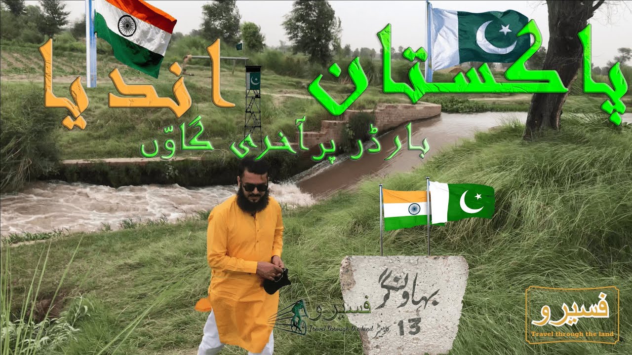
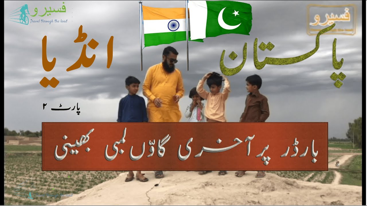
Last village of Pakistan India Border | Lambi Bhaini| Part 1 | Faseero | Eastern Saddiqia Canal
Автор: Faseero
Загружено: 2021-07-04
Просмотров: 15006
Описание:
The India–Pakistan Border, known locally as the International Border (IB), is an international border running between Pakistan and India. The border runs from the Line of Control (LoC), which separates Indian-administered Kashmir from Pakistani-administered Kashmir in the north, to Sir Creek in Rann of Kutch between the Indian state of Gujarat and the Sindh province of Pakistan in the south.[1]
Drafted and created based upon the Radcliffe line in 1947, the border, which divides Pakistan and India from each other, traverses a variety of terrains ranging from major urban areas to inhospitable deserts.[2] Since the independence of India and Pakistan (see British India), the border has been a site of numerous conflicts and wars between each country, and is one of the most contested borders in the world.[2] The border's total length is 2320km 3,323 km (2,065 mi),[2] according to the figures given by the PBS; it is also one of the most dangerous borders in the world, based on an article written in the Foreign Policy in 2011.[3] It can be seen from space at night due to the 150,000 flood lights installed by India on about 50,000 poles.
The border between the two nations is an internationally recognised frontier from Gujarat/Sindh only with exemption to the Line of Control that is not internationally accepted. The disputed region of Kashmir got divided through the Indo-Pakistani War of 1947 into the regions of Pakistan-administered Kashmir and Indian-administered Kashmir. The UN-mediated ceasefire line of 1949 served as the de facto border between the two regions, which was revised to a Line of Control after the Indo-PakistaniWar of 1971
Bahawalnagar
Bahawalnagar (Punjabi, Urdu: بہاولنگر), is the capital city of Bahawalnagar District situated in the south east region in the Punjab province of Pakistan. The city of Bahawalnagar is the headquarter of the district and tehsil as well.[3] It is the 54th largest city of Pakistan by population according to the 2017 census.. Old name of Bahawalnagar was Rojanwali/Ubbha. It was named Bahawalnagar in 1904 after Bahawal Khan V, the ruler of the Bahawalpur state comprising the present districts of Bahawalpur, Bahawalnagar and Rahim Yar Khan.[4] It is 192 miles south of Lahore and about 120 miles east of Bahwalpur. River Sutlej passes on the northern side at a distance of about 6 miles
The border between Indian-administered Kashmir and the Pakistani
province of Punjab is officially called the "Working Boundary" by Pakistan.
India regards it as the international border.
Bahawalnagar originally known as Rojhanwali[6] was a small settlement consisting of few huts and shacks. This village Rojhanwali is still in existence at a distance of about 1.5 miles north of the Railway Station. In the year 1895, a railway station was established and was named as Rojhanwali Railway Station. It was a junction between Bahawalnagar and Bhatinda at distance of 113 miles, now linking branch lines Amrooka and Fort Abbas. Before partition it was very busy junction. Trains used to run from Karachi to Delhi and vice versa via Bahawalnagar. Passenger trains also used to run from Bahawalnagar to Fazilka, Ferozpur. There was a loco shed and two institutes meant for recreation.
In 1904 when Nawab Mohammad Bahawal Khan Abbasi IV,[7] who originally ruled over Bahawalpur State visited Rojhanwali the people asked that with His permission they want to rename the city on the name of Nawab, The Nawab allowed them with pleasure and since then the city is named as Bahawalnagar. With the advent of railways, 40–50 shops with a population of 100 dwelling units developed at existing railway bazar. Though this site was not fit for flourishing as the topographical features were not favorable and drinking water was unfit for health. With the introduction of canal system, it has become fertile area. The real achievement was Fordwah Canal which brought almost the entire district under the command of irrigation system. The town developed as colony town south of railway station.
Sections of the India–Pakistan border from north to south:
Line of Control (LoC): De facto boundary between Indian-administered Kashmir and Pakistani-administered Kashmir. Its current form was demarcated after the 1972 Simla Agreement.
Working Boundary: Separates Punjab, Pakistan from Indian-administered Jammu and Kashmir. It is referred to as a working boundary by Pakistan because it is subject to a one-way dispute; Pakistani Punjab is internationally recognized as part of Pakistan by both parties while Jammu and Kashmir is a disputed territory (claimed by Pakistan, controlled by India).[7][6]
International Boundary (IB): The demarcated line between the Republic of India and the Islamic Republic of Pakistan, recognized by both sides internationally. The boundary was drawn by Sir Cyril Radcliffe during the Partition of India by the British Empire in 1947.
#pakindiaborder #vlog #faseero
Повторяем попытку...
Доступные форматы для скачивания:
Скачать видео
-
Информация по загрузке:


![India's Reality: Is This the India of 2026🇮🇳 ] Hardships And Happiness: Story Of Rural India](https://imager.clipsaver.ru/J1sHKlb7w9Q/max.jpg)