4x4 Trail: Cathedral Valley Loop - Capitol Reef NP - Part 1 (Complete Trail)
Автор: MJ's Adventures
Загружено: 2022-04-28
Просмотров: 875
Описание:
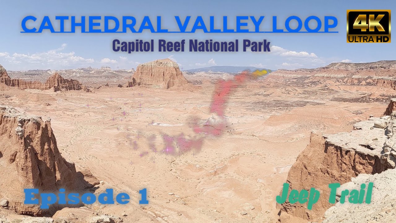
This episode starts at the Fremont River crossing to Lower South Desert Overlook
This driving loop takes about 6-8 hours to complete. Most visitors to Cathedral Valley drive the 57.6 miles (92.7 km) loop clockwise, beginning on the Hartnet Road located 11.7 miles (18.8 km) east of the visitor center on Highway 24, and continuing on that for 27.8 miles (44.7 km) to Hartnet Junction. Turn right (north) onto Cathedral Road and drive 29.9 miles (48.0 km) back to Highway 24 will complete the loop. There are many side trips and hiking opportunities along the way.
The south end of the Hartnet Road near Highway 24 requires fording the Fremont River; there is no bridge over the river. Do not attempt to cross the river during floods or other periods of high water. Ask at the visitor center about river ford conditions or call 435-425-3791. The ford has a hard-packed, rocky bottom and water levels are normally a foot or less deep. The access road to the River Ford crosses private land. Please honor the posted no trespassing signs along the road near the ford by not parking off-road or camping in the vicinity.
Bentonite Hills
The Bentonite Hills among the Hartnet Road and the Painted Desert on the Cathedral (also known as the Caineville Wash) Road appear as softly-contoured, banded hills in varying hues of brown, red, purple, gray, and green.
The hills are composed of the Brushy Basin shale member of the Morrison Formation. This layer was formed during Jurassic times when mud, silt, fine sand, and volcanic ash were deposited in swamps and lakes. Bentonite clay (altered volcanic ash) absorbs water and becomes very slick and gummy when wet, making vehicle or foot travel difficult or impossible.
South Desert
South Desert is a long, narrow valley that runs parallel to the strike of the Waterpocket Fold monocline. The valley extends 20 miles (32.2 km) from the Upper South Desert Overlook southeast to Hwy 24. From Lower South Desert Overlook (located midway through the valley) viewers can see rock layers ranging from the gray, ledgy Morrison atop the cliffs to the east to the white Navajo Sandstone Slickrock and domes high on top of the Fold. In the near distance, Jailhouse Rock, composed of Entrada Sandstone, rises 500 feet (152 m) from the valley floor.
Повторяем попытку...
Доступные форматы для скачивания:
Скачать видео
-
Информация по загрузке: