Nazca Tree Geoglyph – El Árbol from Above | Google Earth View of Peru’s Ancient Lines
Автор: Michael LaPalme
Загружено: 2025-04-18
Просмотров: 8
Описание:
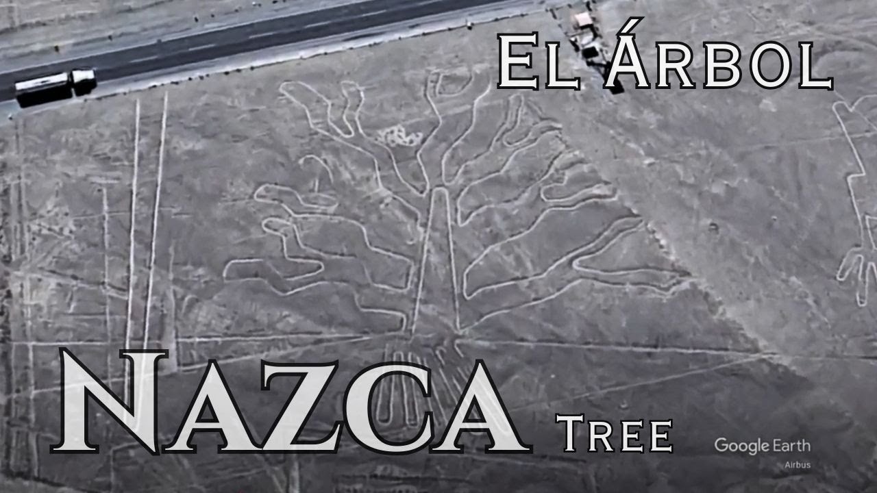
Using Google Earth to explore the desert plains near Nazca, Peru, I zoomed in on one of the most recognizable and accessible geoglyphs — the Nazca Tree, or El Árbol.
Unlike many of the Nazca Lines, this geoglyph is clearly visible from ground level at the Nazca Lines observation tower on the Pan-American Highway. The Tree geoglyph stands out for its complex branching design, which spreads out like a natural fractal across the earth—its symbolic meaning still debated by scholars today.
Created over 1,500 years ago by the Nazca civilization, this geoglyph is part of a vast network of desert drawings only fully appreciated from above. The Nazca used simple tools and surveying techniques to scrape away the darker top layer of soil, revealing the light-colored ground beneath and forming large-scale images of animals, shapes, and nature.
The Nazca Tree is located next to other well-known figures, including the Hands (Manos) geoglyph, making this a central area for tourism and research. Some interpret the tree as a symbol of fertility, life, or a connection between earth and the divine—part of broader theories that link the Nazca Lines to ritual pathways, astronomy, or water worship.
Повторяем попытку...
Доступные форматы для скачивания:
Скачать видео
-
Информация по загрузке:


