Traversata Piz Umbrail-Punta di Rims ( passo dello Stelvio)
Автор: Andamento lento ( Slow pace )
Загружено: 2022-10-15
Просмотров: 983
Описание:
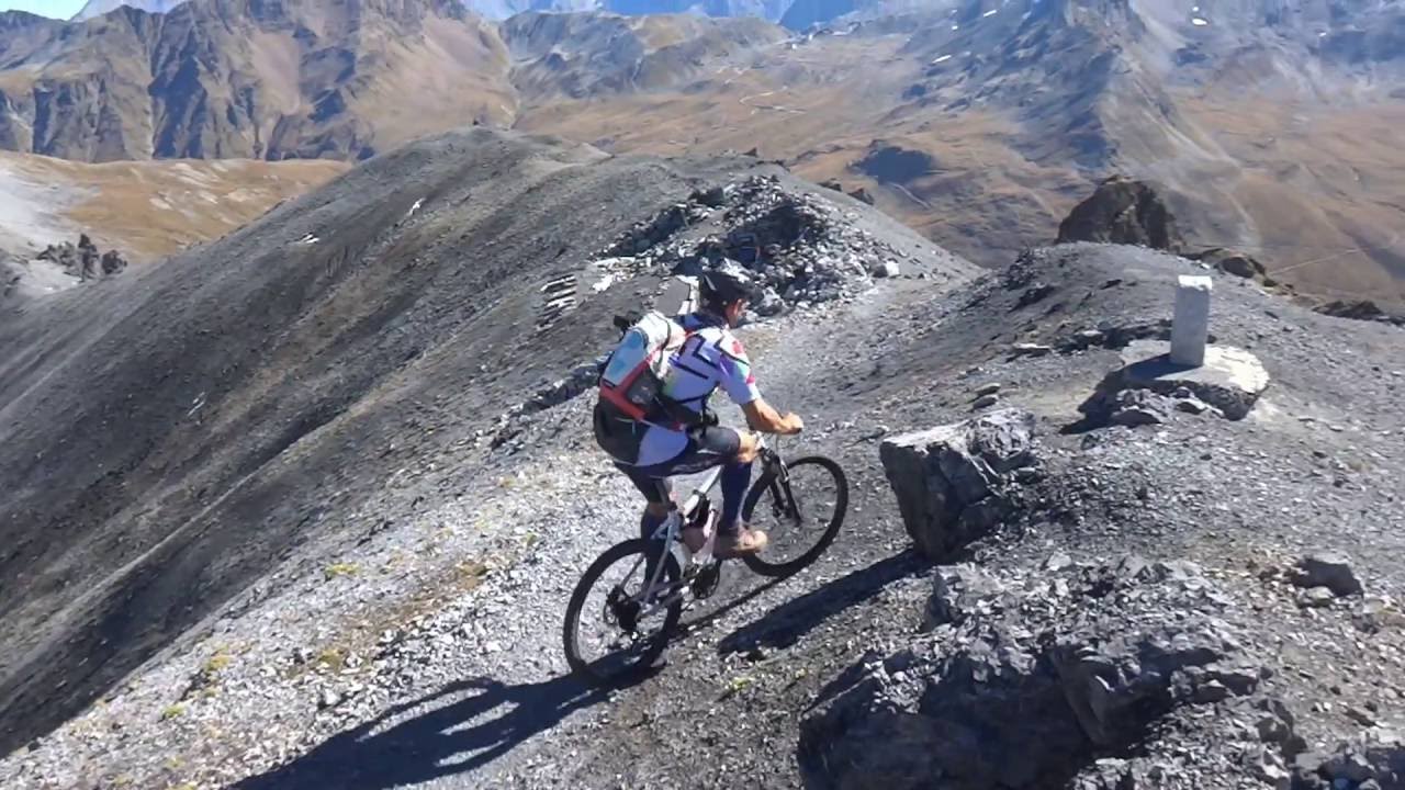
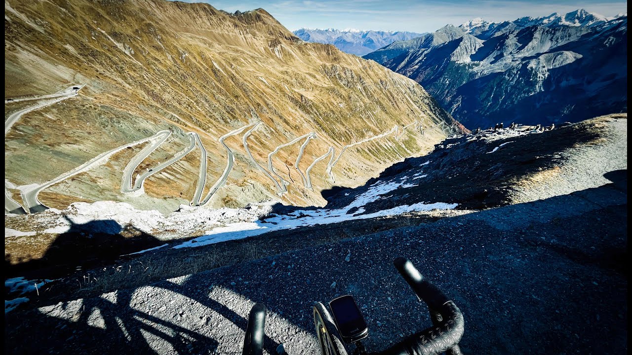
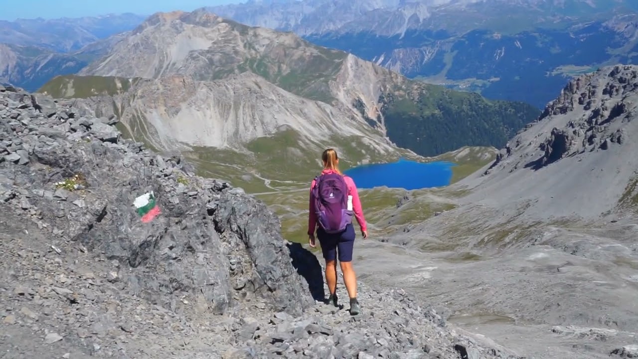
Si parte dalla IV Cantoniera dello Stelvio e seguendo la strada carrozzabile ci si porta in prossimità della dogana svizzera. Da qui inizia il sentiero che con segnavia bianco-rosso-verdi sale lungo un ampio dosso prativo chiamato di Astras dove si incontrano resti di postazioni fortificate. Si continua salendo qualche tornante fino ad un bivio; la traccia di sinistra segue il sentiero storico-militare 1914-18 mentre la traccia più marcata a destra sale sul territorio elvetico. Prendendo il sentiero di sinistra si sale dapprima sale in mezzo a dei torrioni rocciosi e quindi si arriva ad un breve tratto attrezzato con una catena comunque poco impegnativo e così dopo qualche tornante, si raggiunge la panoramica cima del Pizzo Umbrail (3.033 m). Ci si incammina verso la punta di Rims sul sentiero di cresta caratterizzato da diversi saliscendi ma con dislivelli relativi ( poca esposizione) sino a raggiungerla (2947 m). Rientriamo in territorio italiano seguendo il sentiero che scende verso sinistra e raggiungiamo in breve tempo la Forcola di Rims. Poco sotto c’è il rudere di un’ex caserma. Dalla bocchetta si scende verso sinistra lungo una ripida zona prativa e quando il sentiero si addolcisce andiamo a percorrere tutta la base della cresta finora percorsa rientrando così alla IV Cantoniera, andando a chiudere l'anello.
It starts from the IV Cantoniera dello Stelvio and following the carriage road you will reach the Swiss customs. From here begins the path that, with a white-red-green trail sign, climbs along a large meadow hump called Astras where there are the remains of fortified posts. Continue climbing a few hairpin bends up to a crossroads; the left track follows the historical-military path 1914-18 while the more marked track on the right climbs over the Swiss territory. Taking the path on the left, you first climb up in the middle of rocky towers and then you arrive at a short stretch equipped with a chain that is not very demanding and so after a few hairpin bends, you reach the panoramic peak of Pizzo Umbrail (3,033 m). Walk towards the tip of Rims on the ridge path characterized by various ups and downs but with relative differences in height (little exposure) until you reach it (2947 m). We return to Italian territory following the path that descends to the left and we quickly reach the Forcola di Rims. Just below is the ruins of a former barracks. From the pass, go down to the left along a steep grassy area and when the path softens we go along the entire base of the ridge traveled so far, thus returning to the IV Cantoniera, closing the ring.
MATERIALECopyright Info ©
Be aware all music belongs to the original artists.
I am in no position to give anyone permission to use this.
Please ask the artists. Thanks
Повторяем попытку...
Доступные форматы для скачивания:
Скачать видео
-
Информация по загрузке: