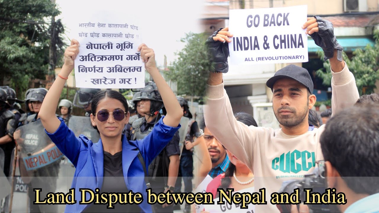
IN front Of Indian Embassy in Kathmandu|
Автор: MrPhul
Загружено: 2025-08-23
Просмотров: 1555
Описание:
The land dispute between Nepal and India primarily revolves around two key areas: the Kalapani-Lipulekh-Limpiyadhura region and the Susta area. These disputes are rooted in different interpretations of historical treaties, particularly the 1816 Treaty of Sugauli, which established the border between the then Kingdom of Nepal and British India.
Kalapani-Lipulekh-Limpiyadhura Dispute
Background: The 1816 Treaty of Sugauli designated the Kali River as the western boundary of Nepal. The core of the dispute is the origin of the river.
Nepal's Position: Nepal claims that the Kali River originates at Limpiyadhura, which is located to the west of Kalapani and Lipulekh. Based on this, Nepal asserts that Kalapani, Lipulekh, and Limpiyadhura, located east of this point, are its integral territories. In 2020, Nepal issued a new political map that included these areas.
India's Position: India maintains that the river begins further downstream, and as such, the territories of Kalapani and Lipulekh are part of its Uttarakhand state. India has had a military presence in the Kalapani area since the 1962 Sino-Indian War. India also states that its territorial claims are based on historical facts and evidence, and that any unilateral enlargement of territorial claims is "untenable."
Strategic Significance: Lipulekh Pass is a strategically important mountain pass that serves as a trade route and a pilgrimage route to Kailash Mansarovar. India has been building and upgrading a road to the pass, which has intensified Nepal's objections, particularly when India and China have agreed to reopen trade through the pass.
Susta Area Dispute
Background: The Susta dispute is located in the southern part of Nepal, along the Gandak River (known as Narayani in Nepal). The Treaty of Sugauli also established the Gandak River as the boundary.
The Cause: The dispute arises from the Gandak River's changing course over the years. Over time, the river has shifted its path, causing Susta village, which was originally on the western side of the river (and thus Nepali territory), to move to the eastern side.
Conflicting Claims: Nepal argues that the boundary should be fixed according to the river's original course at the time of the treaty signing in 1816. India, on the other hand, claims the land on the eastern side of the river, where the village now sits, as its own.
Efforts at Resolution
Both countries have, at various times, stated their commitment to resolving these issues through dialogue and diplomacy. However, no final resolution has been reached. The disputes often flare up when new developments, such as road construction or bilateral trade agreements, occur in the contested areas.
Повторяем попытку...
Доступные форматы для скачивания:
Скачать видео
-
Информация по загрузке: