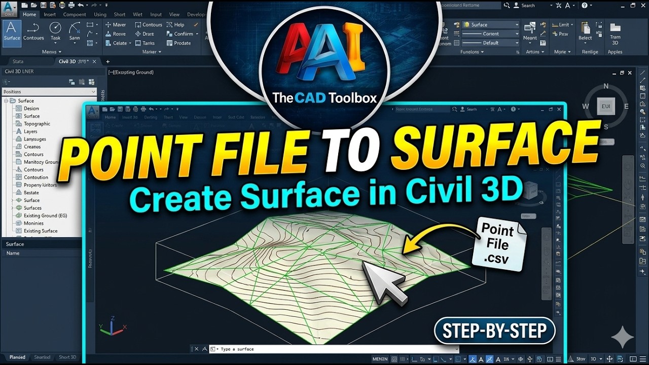
Create Surface from Point File in Civil 3D |Civil 3D Ground Surface from Point Data
Автор: The CAD Toolbox
Загружено: 2026-02-09
Просмотров: 33
Описание:
In this tutorial, you’ll learn how to create a surface from a point file in Civil 3D step by step.
This video shows the complete workflow to convert survey point data into an Existing Ground (EG) surface, including proper point selection and surface building techniques.
🔹 Topics covered in this video:
Importing survey point files into Civil 3D
Organizing points using point groups
Creating a TIN surface from points
Updating and rebuilding surfaces
Common surface creation mistakes and tips
This tutorial is ideal for civil engineers, surveyors, and students who want accurate and clean surfaces for design work in Civil 3D.
🔧 Subscribe to @thecadtoolbox for more Civil 3D, AutoCAD, and practical CAD workflow tutorials.
💬 Comment below if you want the next video on surface boundaries, break lines, or contour editing.
#Civil3D
#SurfaceCreation
#SurveyPoints
#TINSurface
#CivilEngineering
#Surveying
#AutoCADCivil3D
#TheCADToolbox
Повторяем попытку...

Доступные форматы для скачивания:
Скачать видео
-
Информация по загрузке: