Скачать
Oriented imagery: Putting imagery into perspective
Автор: Esri Australia
Загружено: 2025-07-27
Просмотров: 1051
Описание:
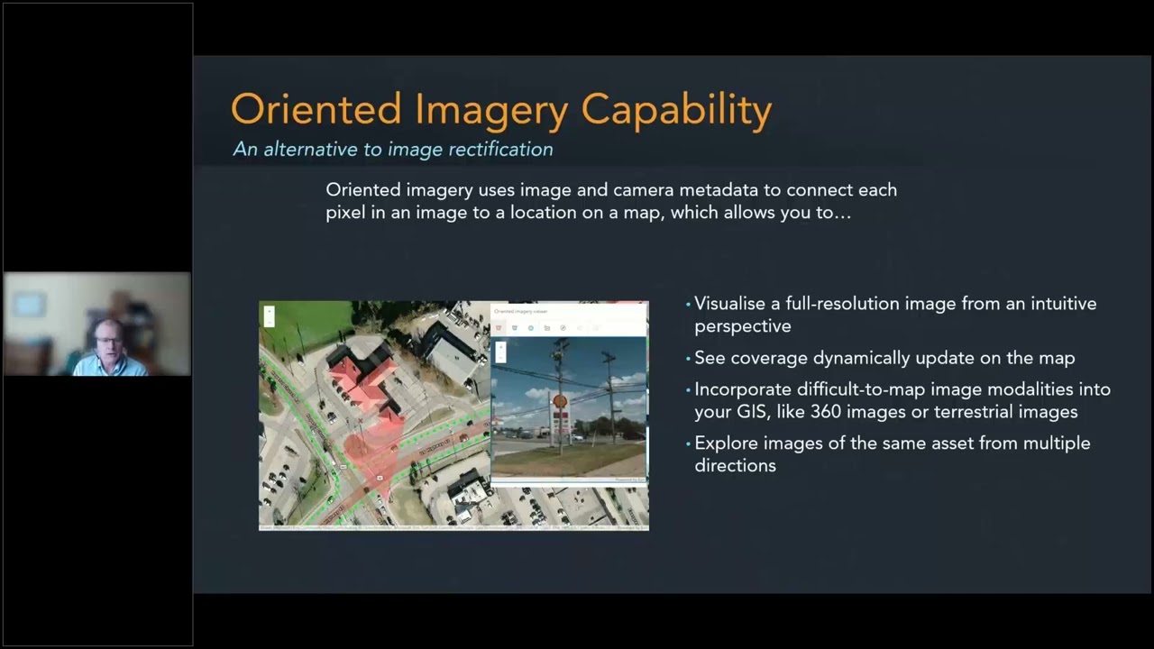
Oriented imagery in ArcGIS is a powerful capability that helps you work with photos taken from different angles, not just straight-down:
This includes drone imagery taken at an angle, close-range inspection images, street-level photos from mobile devices, and 360-degree images.
These types of images don’t always work with traditional mapping tools because of how they’re taken or the data they include. Oriented imagery makes it easier to use these photos in your maps, as long as they have key details like where the camera was, which way it was pointing, and what it could see.
Не удается загрузить Youtube-плеер. Проверьте блокировку Youtube в вашей сети.
Повторяем попытку...
Повторяем попытку...
Доступные форматы для скачивания:
Скачать видео
-
Информация по загрузке: