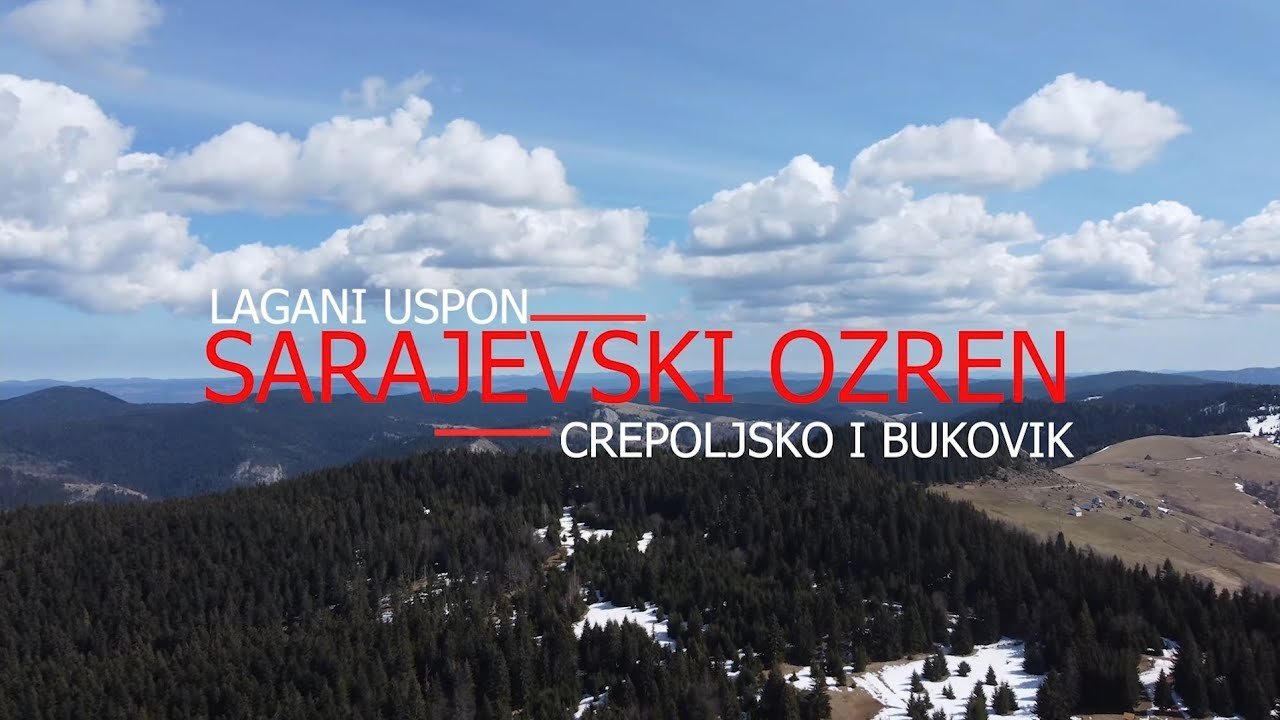
Sarajevo's Ozren hiking route (Uževica - Močioci - Barice), July 2023
Автор: Jasminae
Загружено: 2023-07-24
Просмотров: 227
Описание:
Sarajevski Ozren nalazi se sjeveroistočno od Sarajeva i obuhvata vrhove Bukovik (1534 m nv) i Crepoljsko (1524 m nv). U ovom predjelu dominiraju cvjetni planinski pašnjaci, zimzelena i mješovita šuma i karakteristična je visoka biološka raznolikost. Cijelo područje je bogato vodotocima i izvorima vode.
Jedna od početnih tački koja vodi prema Sarajevskom Ozrenu jeste selo Nahorevo (700 m nv), do kojeg se može doći i minibusom Sutjeska - Nahorevo (cca 6 km od Sarajeva), gdje je polazna tačka za hodanje bus stanica preko puta prodavnice u Nahorevu.
Ruta prikazana u videu ide od Uževice (1120 m nv) preko Sedam vrela (1250 m nv), sela Močioci i nekropole sa stećcima (1260 m nv), nastavlja se preko područja Crepoljskog i Pjeskovite ravni (1370 m nv) i završava na Baricama (906 m nv).
Lijepe usputne lokacije za vidjeti na ovoj ruti:
Sedam vrela je izvor Nahorevskog potoka, a s vremenom je nekoliko tih vrela zatrpano siparom Bijele stijene ispod koje se nalaze.
Nekropola sa stećcima i nišanima Grčko groblje/Svatovsko groblje (Greblje) je dio sela Donji Močioci, i sadrži nadgrobnike iz dužeg perioda historije BiH. Proglašena je za nacionalni spomenik Bosne i Hercegovine.
Selo Močioci i potok Lučica.
Dužinom rute ima nekoliko izvora vode i niz planinskih kućica na dionici poslije Crepoljskog. Ruta je duga 15-17 km.
ENGLISH
Sarajevo's Ozren is located northeast of Sarajevo and includes the Bukovik (1534 m above sea level [asl]) and Crepoljsko (1524 m asl) peaks. This area is covered with flowery meadows and patches of coniferous and mixed forests, and it has high biodiversity. The entire area has many water streams and natural water springs.
One of the starting points leading to the area of Sarajevo's Ozren is the village of Nahorevo (700 m asl), which can also be reached by public transport (minibus Sutjeska - Nahorevo) (approx. 6 km from Sarajevo). The starting point for walking is the final bus stop across from a local grocery shop in Nahorevo.
From the final bus stop, the village road marked and recently completely asphalted, leads to Uževica (1120 m asl) (approx. 4 km).
At Uževica, at the plateau with trail posts, a marked trail to the right leads towards the Seven springs. The Seven springs (1250 m asl) are the source of the Nahorevski stream, and over time, several of those springs have been covered by the sediment of the White rock under which they are located.
From the Seven springs, there is a right turn onto a marked trail, where patches of deciduous and coniferous trees alternate with flowery meadows.
From the meadows, go down to the country road that leads to Močioci village and a necropolis tombs (stećci) (1260 m asl). The necropolis with Greek/Svatovsko Cemetery in the village of Donji Močioci contains 61 tombstones from a longer period of the history of BiH and was declared a national monument of BiH.
From the necropolis, the route continues along the country road through Močioci village in the direction of Crepoljsko, goes across the Lučica stream and up the meadows, from which Gornji Močioci and Bukovik are visible, until the exit to the country road from which Crepoljsko peak (1524 m asl) is visible.
The country road then continues in the direction of Barice/Čavljak. The area is covered with meadows and patches of mostly coniferous forest. The marked trail continues along the Sandy plain (1370 m asl) and it ends at Barice or Čavljak.
From Barice (950 m asl), the asphalted road leads to the bus stop near the "Friendship Forest" Park at Grdonj (906 m asl), where the minibus for Mrkovići village arrives.
Along the route, there are several water sources and a number of mountain huts between Crepoljsko and Barice.
The route is 15-17 km long.
REFERENCES
Braco Babić, Drago Bozja. Planinarsko-turistički vodić po planinama oko Sarajeva. 2006, Sarajevo.
https://bs.wikipedia.org/wiki/Nekropo...
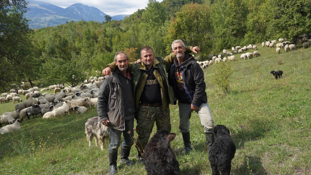
Suvada Topčagić appears in the video.
THANKS to Ahmed i Amila Voloder, Dreammedia Mostar, Lamija Topčagić, Dorothee Baumann-Topčagić, Suvada i Hasan Topčagić for making this possible.
Filmed (with DJI Zenmuse X3) and edited by Jasmina Topčagić.
Music: SergePavkinMusic https://pixabay.com/music/main-title-...
Повторяем попытку...

Доступные форматы для скачивания:
Скачать видео
-
Информация по загрузке: