NEW FOREST WALK at WHITTEN POND (NEW FOREST NATIONAL PARK) (4K)
Автор: Dave Ford (Dave's Countryside Walks)
Загружено: 2023-02-03
Просмотров: 3164
Описание:
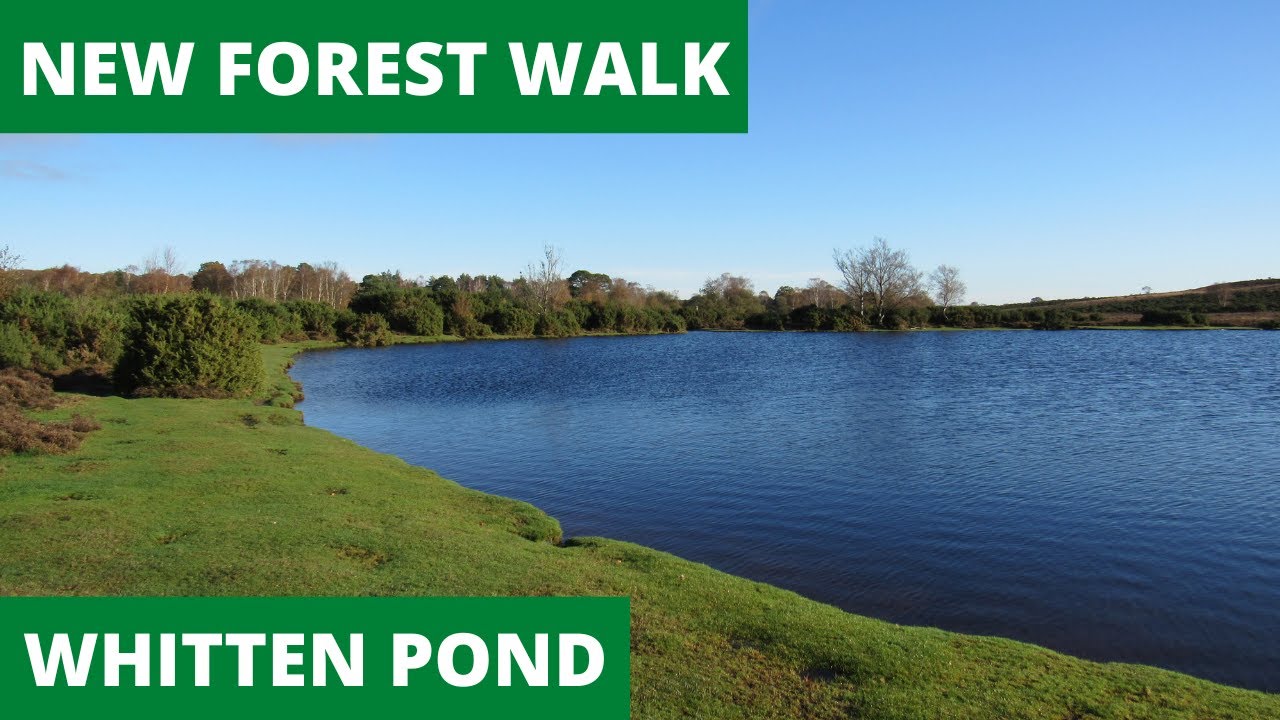
In this episode of my series “ New Forest Walks” , I take a walk to the South of the village of Burley – starting at Whitten Pond. Once again I am accompanied by my Whippet, Logan.
After parking my car at the Forestry Commission (free) car park at Burbush, I start my 6 mile “circular -ish” route by heading for the magical Whitten Pond – one of the largest natural ponds in the New Forest.
I then head West along a track to try and find the remains of an old Radar Transmitter Building (it was part of the Radar station complex at Sopley 3.5 miles away to the South West), that was demolished in 1977 …... I found a few remains!
My route took me further West to the edge of the new Forest boundary but I was unable to find the Lugden Bronze age barrow as work was being done in the area by Forestry Commission staff.
After initially heading South, I turn Eastwards towards a wooded area known as “Devil's Den”. Along the way I spotted a cute little Field Mouse!
At the South Western edge of the Holmsley Inclosure, I head North towards the site of what was once Holmsley Lodge (the building has been demolished now).
I then take a quick detour along Holmsley ridge to explore the old gravel pits that hare now very pretty ponds.
My homeward journey takes me along the old disused railway track – that used to run from Brockenhurst to Ringwood – back to my car.
I finish my walk by driving a short distance to the Old Holmsley station Tea Rooms for some light refreshments.
** I am still not sure what the foundations were in the clearing in Devil's Den (East of Cross Ways). The "New Forest Remembers Untold Stories of WW2" website makes mention of a "possible WW2 military site" at the location (420155 Easting / 100112 Northing). The old RAF Holmsley South airfield was located not too far away to the South East so it may have had something to with that?
Map courtesy of Google Maps.
Aerial pictures courtesy of Google Maps
OS Maps. Media License.
Historic Maps NLS Maps 'Reproduced with the permission of the National Library of Scotland' https://maps.nls.uk/index.html
Information Sources: Wikipedia, Historic England & British History Online.
Music by Original Spruce (Copyright owner). Permission for me to use this track has been given to me by the copyright owner. 2022. Tracks (in order of appearance in the video): 1) Eko Eko, 2) Nicely Stone, 3) Martin Down, 4) Pembrokeshire ,5) Open The G, 6) Nicely Stone ,7) Marching The Moors & 8) No Time For Lillies. To download these tracks & other music by Original Spruce go to: https://spruce1.bandcamp.com
For further videos in the series, please go to: / @daveford
My Facebook page is: / davescountrysidewalks
I use a GOPRO HERO 7, 8 or 10 Black Action Camera (sometimes with a Gimbal) & a Rode microphone (either a “Shotgun” or a Rode Wireless Go) together with a Canon Powershot SX530 HS.
Повторяем попытку...
Доступные форматы для скачивания:
Скачать видео
-
Информация по загрузке:


![WALKS IN DORSET at TOLLER PORCORUM & TOLLER FRATRUM [4K]](https://imager.clipsaver.ru/zWpqoQxGdSs/max.jpg)