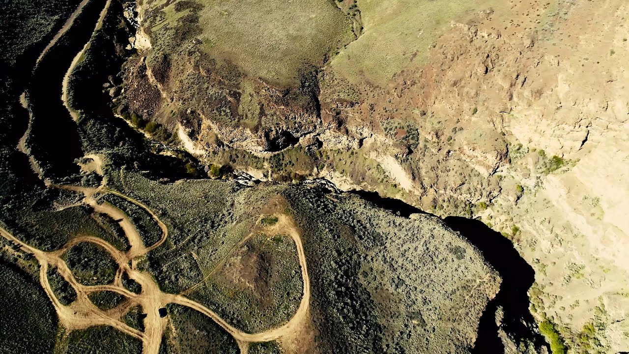
Meandering Moses Coulee
Автор: James Eagle Eyes Olson
Загружено: 2019-04-22
Просмотров: 1578
Описание:
THIS EASTER STORY HAS IT ALL AND ALL PUNS ARE INTENDED. WANDERING THE PALISADES, MID- MOSES COULEE ON EASTER SUNDAY. A CROSS, A CATHEDRAL, A PIPE ORGAN, WATER, STONE TABLETS, WILD FLOWERS AND, NOT ONE BUT THREE DEVIL’S GRADE. FOR MY EASTER SUNDAY, MOTHER NATURE, GOD AND JESUS WERE ONE AND THE SUN SPARKED MY SENSE OF HUMOR TOO.
Moses Coulee is a canyon in the Waterville plateau region of Douglas County, Washington. Moses Coulee is the second-largest and westernmost canyon of the Channeled Scablands, located about 30 kilometers (19 mi) to the west of the larger Grand Coulee. This water channel is now dry, but during glacial periods, large outburst floods with discharges greater than 600,000 m3/s (21,000,000 cu ft/s) carved the channel.[1] While it's clear that mega floods from Glacial Lake Missoula passed through and contributed to the erosion of Moses Coulee, the origins of the coulee are less clear. Some researchers propose that floods from glacial Lake Missoula formed Moses Coulee,[2] while others suggest that subglacial floods from the Okanogan Lobe incised the canyon.[3] The mouth of Moses Coulee discharges into the Columbia River. Three Devil's grade in Moses Coulee, Washington. The upper basalt is Roza Member, while the lower canyon exposes Frenchmen Springs Member basalt.
Two National Natural Landmarks were established in 1986 for features, notable as the best examples of their kind, in and around Moses Coulee. The Great Gravel Bar of Moses Coulee, on the western edge of Moses Coulee where US Highway 2 crosses the coulee, is described as "the largest and best example of a pendant river bar formed by catastrophic glacial outburst floods that swept across the Columbia Plateau prior to the last Pleistocene glaciation." Withrow Moraine and Jameson Lake Drumlin Field "contains the best examples of drumlins and the most illustrative segment of the only Pleistocene terminal moraine in the Columbia Plateau bio physiographic province. ... They are also the only such glacial features in the world to show a clear geological relationship to catastrophic flooding."
Повторяем попытку...
Доступные форматы для скачивания:
Скачать видео
-
Информация по загрузке: