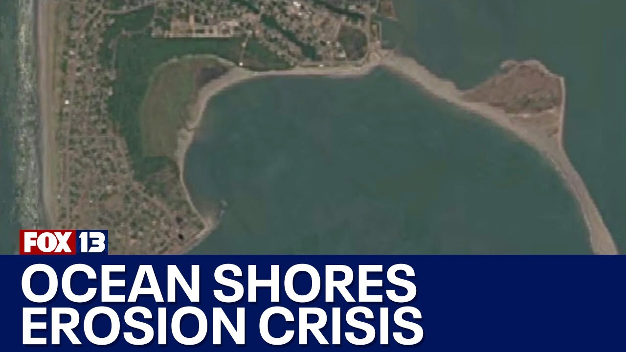
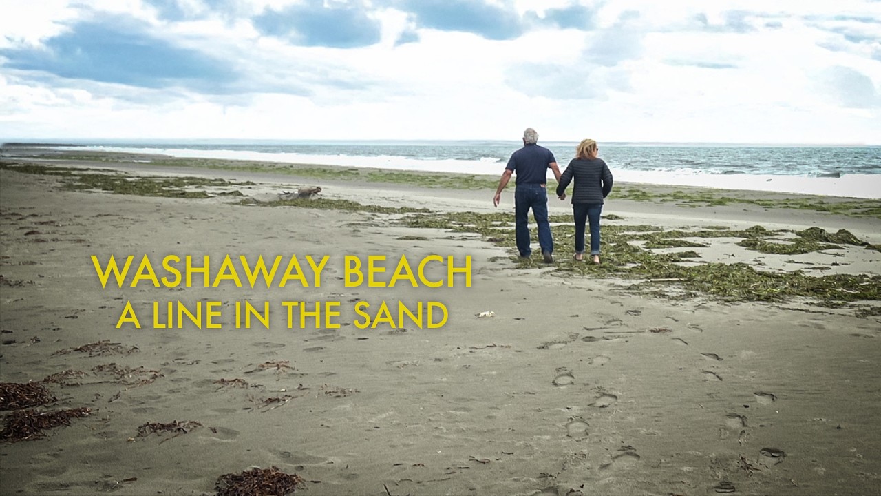
Washaway Beach: A Line in the Sand
Автор: TVW
Загружено: 2025-01-10
Просмотров: 23750
Описание:
North Cove, Washington, is a small coastal town battling the most extreme erosion on the West Coast. It's been losing 100 feet of beach a year on average for a century, as house after house toppled into the ocean. But recently, the area has made a stunning comeback that caught the world’s attention. What started as a grassroots, last ditch effort to save "Washaway Beach" has transformed into a partnership with state and local agencies that could be a model for coastal erosion control around the world.
-----------------
It’s a beach town where home prices drop the closer you get to the ocean.
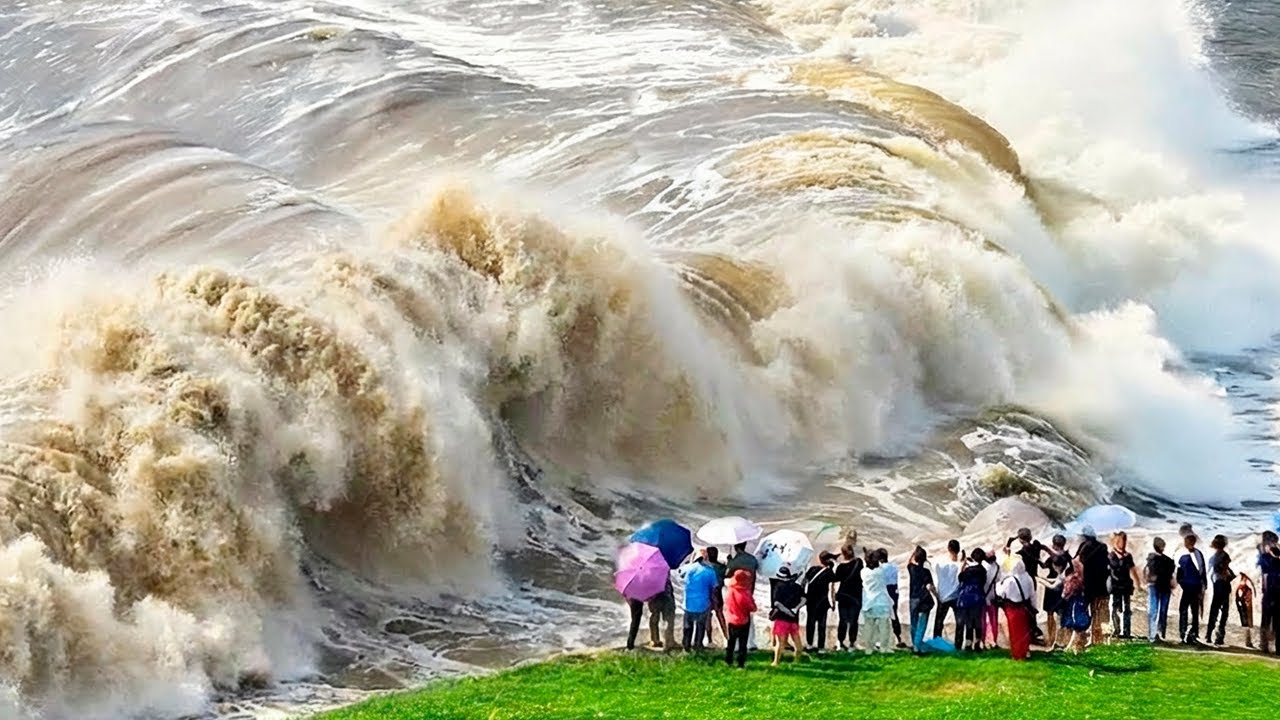
Where waves can change the landscape in a matter of hours
Where homes, streets, the land itself - just disappear. (George Kaminsky) “There's been losses every year, you know, since, since the early 1920s.” What if there’s a way to reverse the erosion?
What if there’s a way to save Washaway Beach? North Cove sits at the junction of The Pacific Ocean and Willapa Bay on the West coast of Washington. It’s known for some of the most aggressive erosion anywhere on the West Coast over the last
100 years. The shoreline moved inland by about 2000 feet between 1989 and 2013. The ocean has continued to eat away at the edge of this coastal cranberry farming community. Winter storms and king tides- can cut through more than 100 feet of beach a year, The waves cut through the sand, cut through the soil bank, the roads, and the neighborhoods.
But a new approach using a timeless method copied from mother nature is showing real
promise in the fight to save the sand, the houses, the cranberries, and the highway. at
Washaway Beach.
THE SHOALWATER BAY INDIAN TRIBE HAS LIVED IN THE REGION FOR COUNTLESS
GENERATIONS. THE FIRST EUROPEAN SETTLERS PUT DOWN ROOTS IN THE LATE 1800’S .
NORTH COVE SITS AT THE NORTH ENTRANCE TO WILLAPA BAY, ON WASHINGTON’S
PACIFIC COAST a few dozen MILES NORTH OF WHERE THE COLUMBIA RIVER
MEETS THE SEA.
NORTH COVE WAS FOUNDED IN THE 1880’S WHEN WASHINGTON WAS STILL A
TERRITORY - AND SOON HAD A RESCUE STATION RUN BY THE FORERUNNER TO THE
COAST GUARD (THE U.S. LIFESAVING SERVICE) AND ONE THE REGION’S FIRST
LIGHTHOUSES….…TO GUIDE SHIPS THROUGH THE NOTORIOUSLY DANGEROUS WATERS
NEAR WASHINGTON’S PACIFIC COASTLINE- KNOWN AS THE COLUMBIA BAR.
OVER TIME THE COMMUNITY GREW - DEVELOPING A LOCAL FISHING ECONOMY A
CANNERY, AND A THRIVING CRANBERRY INDUSTRY.
WITH POWERFUL NEARSHORE CURRENTS AND STRONG WINTER TIDES - THE REGION
IS KNOWN FOR SHIFTING SANDS AND SEASONAL EROSION, BUT HISTORICALLY
BEACH SANDS WERE REPLENISHED EACH SUMMER. THAT CHANGED AROUND THE TURN OF THE 20TH CENTURY- THE REBUILDING CYCLE WAS INTERRUPTED BUT THE EROSION NEVER STOPPED. THE REASONS ARE COMPLEX- AND MAY INVOLVE SEVERAL FACTORS WHICH
ALTERED THE OCEAN CURRENTS AND INTERRUPTED THE SEDIMENT STREAM THAT
HISTORICALLY FED BEACHES. BY THE MID-20TH CENTURY THE LAND THAT CONSTITUTES NORTH COVE WAS A
FRACTION OF ITS ORIGINAL SIZE.
(George Kaminsky) “It was about two miles out there, You can kind of
see darker water off in the distance, almost in the horizon. You can see some breaking waves
out there. That’s about where the shoreline would have been just 100 years ago and it’s been
just marching this way ever since.” THE TOWN’S NAME
REFERS TO A GEOGRAPHIC FEATURE THAT NO LONGER EXISTS.
THE LIGHTHOUSE AND OTHER EARLY STRUCTURES WERE BUILT ON CAPE
SHOALWATER- A CURVED STRIP OF LAND THAT STRETCHED A COUPLE
OF MILES OUT TO SEA- AND FORMED A COVE, OVER TIME THE PACIFIC GROUND THE CAPE DOWN TO NOTHING. THE LIGHTHOUSE FELL IN 1940. . . THE HOTEL, THE SCHOOL, THE POST
OFFICE, AND THE HOUSES WERE ALL SWEPT AWAY.
THE ONLY REMNANT OF THE ORIGINAL TOWN IS A CEMETERY WHICH WAS
RELOCATED FURTHER INLAND.
The residents have been fighting to save North Cove for a century, as the ocean pushes
further inland every year. One property owner built an expensive boulder wall to
save their beach house as the surrounding properties disappeared. Many abandoned their houses and their hopes of saving them at Washaway Beach. Around 150 homes have reportedly been destroyed by the waves since the 1950’s. BUT IN THE LAST SEVERAL YEARS - A NEW APPROACH HAS NOT ONLY SLOWED THE
SAND LOSS IN NORTH COVE — PARTS OF WASHAWAY BEACH ARE ACTUALLY
GROWING BACK.
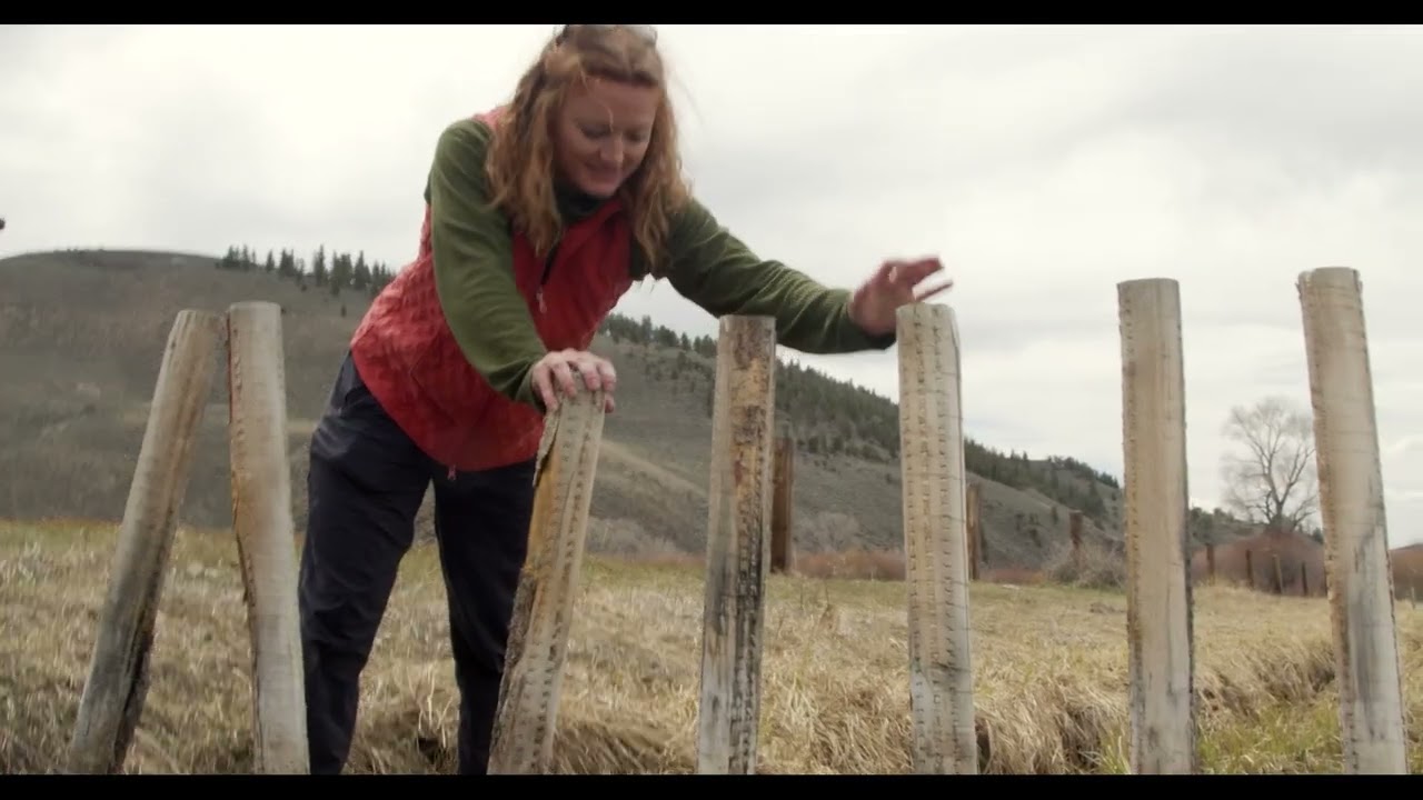
A combination of rocks, logs, dune grass and determination is showing promise
where so many other strategies have failed. It’s also raising hopes that it might just be
possible to save a beach many thought was doomed for certain. …IT’S CALLED A DYNAMIC REVETMENT. Essentially it’s made up of layers of loose stones which can move when absorbing the force of strong waves. . This long sloped rockpile is POSITIONED TO TAKE SOME OF THE PUNCH OUT OF BIG WINTER WAVES, protecting the sand and dirt at the upper boundary of the beach. AND
because there are gaps and spaces between the stones- a dynamic revetment can TRAP
SOME OF THE SAND SUSPENDED IN THE SALTWATER.
Повторяем попытку...
Доступные форматы для скачивания:
Скачать видео
-
Информация по загрузке: