Mount Noble Lookout Tower - Qualla Boundary, NC
Автор: Zachary Robbins
Загружено: 2017-12-24
Просмотров: 1220
Описание:
A relatively short but steep hike to the Mount Noble Lookout Tower in the Qualla Boundary of the Eastern Band of Cherokee Indians. The Fire Tower Trail is part of the excellent Fire Mountain Trail System, just above downtown Cherokee. The first third of the hike passes by multiple mountain biking trails, but I saw no one. The trail climbs ~1,600 feet in ~2.5 miles, a moderately steep and consistent gradient. There aren't any views on the trail, but the trail itself was in very good condition.
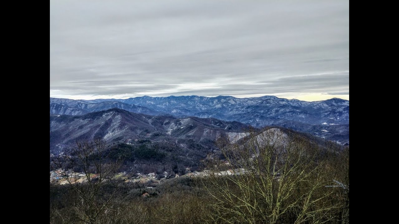
The lookout tower on Mount Noble is actually on a southern subpeak of the mountain at 3,840 feet. The steel Aermotor tower, built in 1957, is 60 feet tall. Even though the tower is in shoddy aesthetic condition, the windowless cab has tremendous 360-degree views. You just have to watch your step, half of the floor boards are missing. Newton Bald rises just above the true summit of Mount Noble, with Clingmans Dome further to the left. The dominant pyramid of Cheoah Bald rises high above Fontana Lake due southwest. The clouds were rolling in, but I think I could see Wesser Bald, Copper Ridge Bald, and Trimont Ridge. The Cowee-Alarka Mountains complex impressively rises above the Soco Valley due south, with the towers on Cowee Bald easy to see. The western peaks of the Great Balsam Mountains are behind the bald but I could not specifically point out peaks.
Easily the most impressive view was southeast across the valley of the Plott Balsam Mountains. You can pick out almost every notable peak in the range from the tower. Just east of the Plott Balsams are the southern Great Smoky Mountains that connect along the Heintooga Ridge and the Balsam Mountain transverse chain. The towers on Barnett Knob are visible high above Cherokee, with pointy Bunches Bald on the right. Balsam Mountain is the massive dark ridge due east, with Mt. Sterling Ridge behind on the right. I could also see the northeastern 6K Smokies, but I wasn't sure of each peak. However, I guessed a few and probably got them wrong. This was a surprisingly awesome lookout tower, hopefully it can get some cab repairs to make it safer for the average hiker to enjoy.
Hike was 5.2 miles in 2 hours and 30 minutes.
Hike location
https://goo.gl/maps/XF9MRydw4xQHig8e8
Hike report
https://www.hikingupward.com/NCSP/Mou...
Повторяем попытку...
Доступные форматы для скачивания:
Скачать видео
-
Информация по загрузке: