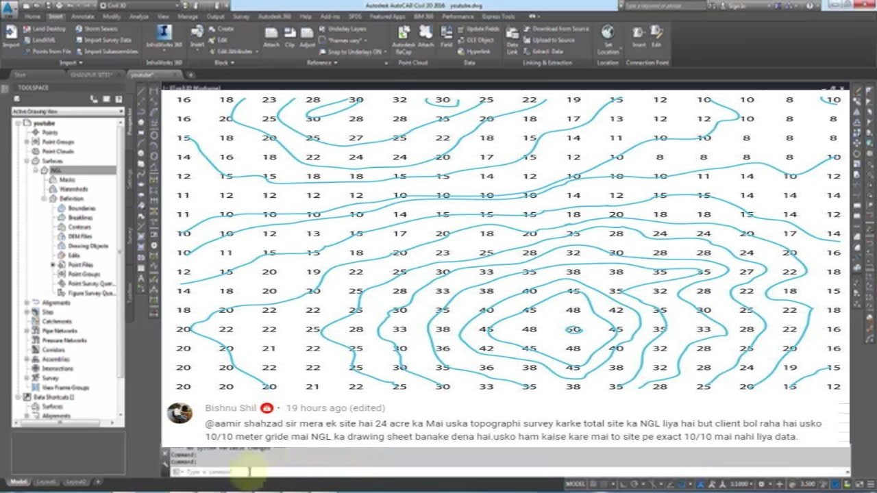
Assume Topography Survey data draw in Grid on Drawing & Export in Excel & AutoCAD File in Civil 3d
Автор: aamir shahzad
Загружено: 2020-08-07
Просмотров: 22641
Описание:
This is 89th of Q&A and in this video, I answer one question which I received on youtube comments and the question is how to draw topo survey data in Grid 10 in 10 meters squire. For the answer to this question, I used AutoCAD Civil 3d and I use excel and AutoCAD file which I received by email
1st I Create a surface from topo points then make grid points using Civil 3d
For complete training of civil 3d click on the link given bellow
• Complete training of Civil 3d in Urdu/Hindi
For watching all Q&A videos click on the link given bellow
• Question & Answar
For visiting My Dailymotion channel click on the link given bellow
https://www.dailymotion.com/aamirshah...
For visit, my Website click on the link given bellow
https://aamirshahzad216.com/
For visit, my FaceBook Page click on the link given bellow
/ aamirshahzad216-105377167600580
For visit, my Blog click on the link given bellow
http://aamir2016.blogspot.com/
~-~~-~~~-~~-~
Please watch: "How to Prevent Memory Loss in Sokkia Total Station SET 250RX सोक्किया में स्मृति हानि को कैसे रोकें"
• How to Prevent Memory Loss in Sokkia Total...
~-~~-~~~-~~-~
Повторяем попытку...
Доступные форматы для скачивания:
Скачать видео
-
Информация по загрузке:


![Как сжимаются изображения? [46 МБ ↘↘ 4,07 МБ] JPEG в деталях](https://image.4k-video.ru/id-video/Kv1Hiv3ox8I)

